Area Overview for SA42 0XY
Photos of SA42 0XY
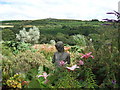
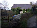
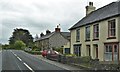
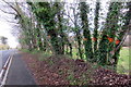

27 photos from this area
Area Information
Key information about the SA42 0XY including its size, population, and administrative classification.
- Area Type
- Postcode
- Area Size
- 39.6 hectares
- Population
- 1608
- Population Density
- 16 people/km²
House Prices in SA42 0XY
10
Properties
£249,250
Average Sold Price
£128,000
Lowest Price
£435,000
Highest Price
Showing 10 properties
| Address | Type | Beds | Baths | Last Sale Price | Last Sale Date | |
|---|---|---|---|---|---|---|
| Haulwen, A 487 Bwlchmawr To Junction C 3159, Dinas Cross, SA42 0XY | Detached | 3 | - | £435,000 | Oct 2022 | |
| 2, Brynawel, A 487 Bwlchmawr To Junction C 3159, Dinas Cross, SA42 0XY | Semi-detached | 3 | 2 | £285,000 | Jun 2022 | |
| 1, Brynawel, A 487 Bwlchmawr To Junction C 3159, Dinas Cross, SA42 0XY | house | 3 | - | £128,000 | Feb 2018 | |
| Parc Newydd, A 487 Bwlchmawr To Junction C 3159, Dinas Cross, SA42 0XY | Semi-detached | 2 | - | £149,000 | Nov 2016 | |
| Trem Y Glyn, A 487 Bwlchmawr To Junction C 3159, Dinas Cross, SA42 0XY | Bungalow | 2 | 1 | - | - | |
| Cilrhedyn, A 487 Bwlchmawr To Junction C 3159, Dinas Cross, SA42 0XY | Detached | - | - | - | - | |
| Banc Y Ffynnon, A 487 Bwlchmawr To Junction C 3159, Dinas Cross, SA42 0XY | Detached | - | - | - | - | |
| Flat 2, Clyn, A 487 Bwlchmawr To Junction C 3159, Dinas Cross, SA42 0XY | Flat | - | - | - | - | |
| Flat 1, Clyn, A 487 Bwlchmawr To Junction C 3159, Dinas Cross, SA42 0XY | Flat | - | - | - | - | |
| Vehicle Repair Workshop, Greenacres, A 487 Bwlchmawr To Junction C 3159, Dinas Cross, SA42 0XY | warehouse | - | - | - | - |
Energy Efficiency in SA42 0XY
Amenities
Schools
| Rank | School | Type | Entry gender | Ages |
|---|
Explore more schools in this area
Go to Schools tabDemographics
Household Size
Two person
most common
Accommodation Type
Houses
most common
Tenure
77
majority
Ethnic Group
White
most common
Religion
N/A
most common
Household Composition
N/A
most common
Age
47
median
Adults (30-64 years)
most common
Household Deprivation
N/A
with no deprivation
NS-SEC
31
in Lower managerial occupations
Explore more demographic insights in this area
Go to Demographics tabPlanning
Planning Constraints
- Flood RiskPremium
- Ramsar Wetland SitesPremium
- Area of Outstanding Natural BeautyPremium
- Protected Nature ReservePremium
- Protected WoodlandPremium
- Crime RiskPremium