Area Overview for SA42 0UW
Photos of SA42 0UW
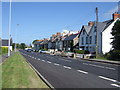
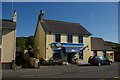

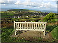
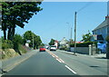
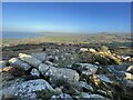

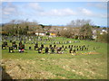
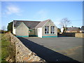
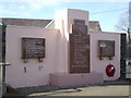

37 photos from this area
Area Information
Key information about the SA42 0UW including its size, population, and administrative classification.
- Area Type
- Postcode
- Area Size
- 9.3 hectares
- Population
- 1608
- Population Density
- 16 people/km²
House Prices in SA42 0UW
13
Properties
£447,500
Average Sold Price
£280,000
Lowest Price
£525,000
Highest Price
Showing 13 properties
| Address | Type | Beds | Baths | Last Sale Price | Last Sale Date | |
|---|---|---|---|---|---|---|
| Nant Y Mynydd, A 487 Dinas To Junction Fedir Brenin, Dinas Cross, SA42 0UW | Retail | 3 | 1 | £500,000 | Oct 2022 | |
| Dolwar, A 487 Dinas To Junction Fedir Brenin, Dinas Cross, SA42 0UW | Detached | 4 | 2 | £525,000 | Apr 2022 | |
| Pengwern, A 487 Dinas To Junction Fedir Brenin, Dinas Cross, SA42 0UW | Retail | 4 | 2 | £485,000 | Mar 2022 | |
| Thorneloe, A 487 Dinas To Junction Fedir Brenin, Dinas Cross, SA42 0UW | Detached | - | - | £280,000 | May 2007 | |
| Llygad Yr Haul, A 487 Dinas To Junction Fedir Brenin, Dinas Cross, SA42 0UW | Detached | 4 | 3 | - | - | |
| Flat Freemasons Arms, Spencer Buildings, A 487 Dinas To Junction Fedir Brenin, Dinas Cross, SA42 0UW | Terraced | 3 | 1 | - | - | |
| 2, Spencer Buildings, A 487 Dinas To Junction Fedir Brenin, Dinas Cross, SA42 0UW | Terraced | 2 | 2 | - | - | |
| Spencer Cottage, A 487 Dinas To Junction Fedir Brenin, Dinas Cross, SA42 0UW | house | - | - | - | - | |
| Ty Clyd, A 487 Dinas To Junction Fedir Brenin, Dinas Cross, SA42 0UW | Detached | - | - | - | - | |
| 4, Flat, Spencer Buildings, A 487 Dinas To Junction Fedir Brenin, Dinas Cross, SA42 0UW | Flat | - | - | - | - |
Page 1 of 2
Energy Efficiency in SA42 0UW
Amenities
Schools
| Rank | School | Type | Entry gender | Ages |
|---|
Explore more schools in this area
Go to Schools tabDemographics
Household Size
Two person
most common
Accommodation Type
Houses
most common
Tenure
77
majority
Ethnic Group
White
most common
Religion
N/A
most common
Household Composition
N/A
most common
Age
47
median
Adults (30-64 years)
most common
Household Deprivation
N/A
with no deprivation
NS-SEC
31
in Lower managerial occupations
Explore more demographic insights in this area
Go to Demographics tabPlanning
Planning Constraints
- Flood RiskPremium
- Ramsar Wetland SitesPremium
- Area of Outstanding Natural BeautyPremium
- Protected Nature ReservePremium
- Protected WoodlandPremium
- Crime RiskPremium