Area Overview for SA42 0UE
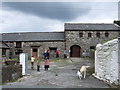
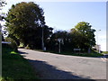
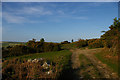
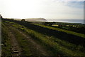
Photos of SA42 0UE


Area Information
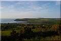
Living in SA42 0UE offers a quiet existence within a rural residential cluster. This postcode covers a specific neighbourhood spanning 4.2 hectares in Pembrokeshire, Wales. You will find a community of just 1,058 people, creating a low-density environment where houses predominate. The median age of 47 suggests a mature population, while the density of 60 people per square kilometre indicates spacious living conditions. Daily life here revolves around a tight-knit group of residents rather than a bustling urban population. The area functions as a small, self-contained community where neighbours know one another. You can expect a peaceful everyday routine without the noise or congestion typical of larger towns. This setting is ideal for those seeking a slower pace of life away from the city centre. The distinct character of this small cluster defines your daily experience. You are living in a location where the focus remains on home and local surroundings. The scale of the area ensures that privacy remains a central feature of life here.
- Area Type
- Postcode
- Area Size
- 4.2 hectares
- Population
- 1058
- Population Density
- 60 people/km²
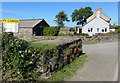
The property market in SA42 0UE is characterised by a high proportion of owner-occupied homes. Seventy-three percent of residents own their property, which means the local housing stock is largely composed of owner-occupied houses. You will find very few rental properties listed within this specific cluster. This ownership rate suggests that homes in SA42 0UE are typically bought and lived in by the people who purchase them. The accommodation type is exclusively houses, so you will not come across flats or shared housing arrangements. Buying here means joining a community where stability is the norm rather than the exception. The market operates on a small scale, given the total population of just over 1,000 people in the 4.2-hectare area. Competition may be lower than in city districts, but inventory will also be limited. If you are looking at homes in SA42 0UE, expect to engage with a market that values permanence over turnarover. Your investment would sit within a section of Wales where ownership has remained the dominant model for decades.
House Prices in SA42 0UE
Showing 3 properties
| Address | Type | Beds | Baths | Last Sale Price | Last Sale Date | |
|---|---|---|---|---|---|---|
| Retreat Cottage, Gelli Olau, Fishguard Road, Newport, SA42 0UE | hotel | - | - | - | - | |
| The Old Rectory, Gelli Olau, Fishguard Road, Newport, SA42 0UE | hotel | - | - | - | - | |
| Gelli Olau, Fishguard Road, Newport, SA42 0UE | Detached | - | - | - | - |
Energy Efficiency in SA42 0UE
Your lifestyle in SA42 0UE depends heavily on travel to the nearby town of Fishguard for amenities. Within practical reach, you have access to four retail outlets, including Spar, Co-op High, and another Spar. These shops are located within a short trip and cover essential daily needs. The area also benefits from excellent rail transport links. Two railway stations serve residents: Fishguard Harbour Railway Station and Fishguard & Goodwick Railway Station. These stations provide connections across the region and beyond. A ferry terminal further expands your mobility, offering access to Ireland and surrounding ports via the Fishguard Ferry Terminal. This combination of rail and sea transport makes SA42 0UE a gateway for international travel. Dining options, leisure centres, and larger department stores are found in Fishguard itself, requiring a short car journey or taxi ride. You do not find supermarkets, cinemas, or major parks directly inside the 1,058-person cluster. Your weekend activities and social life will likely centre around the town centre rather than the immediate rural cluster.
Amenities
Schools
Families considering schools near SA42 0UE have one primary local option listed in the immediate vicinity. Ysgol Bro Ingli serves as the other school for this area. It operates as a non-acute secondary institution, though specific exam code or detailed Ofsted ratings are not provided in the current records. The presence of only this one facility indicates a reliance on the broader educational catchment of Cardigan or Newport for many children residing in the postcode. You cannot expect a choice of multiple schools directly within the immediate boundaries of the 1,058 residents. The single school listing suggests a rural pattern where students travel to maintain local education. Living in SA42 0UE requires planning for school runs on a community-wide scale rather than within street limits. The limited educational infrastructure nearest you means families must look beyond the immediate neighbourhood for primary or secondary placement options.
| Rank | School | Type | Entry gender | Ages |
|---|
Explore more schools in this area
Go to Schools tabDemographics
The community in SA42 0UE presents a clear demographic picture dominated by older residents. A median age of 47 years places this area firmly among the older parts of Wales. The most common age group comprises elderly people aged 65 and over. This skew towards an older population defines the social fabric of the postcode. Home ownership stands at a high level of 73%, indicating that most residents live in their own properties. This statistic reflects a stable community where people have settled long-term rather than renting transiently. Houses make up the entire accommodation type, meaning you will not find flats or blocks of purpose-built apartments. The predominant ethnic group is White, which aligns with the broader rural demographic of Pembrokeshire. With three-quarters of households owned outright or with a mortgage, the area feels established. You are dealing with a community built on property stability and long-term residency. The lack of younger families or student housing reinforces the quiet, mature atmosphere of the neighbourhood.
Household Size
Accommodation Type
Tenure
Ethnic Group
Religion
Household Composition
Age
Household Deprivation
NS-SEC
Explore more demographic insights in this area
Go to Demographics tabPlanning
Planning Constraints
- Flood RiskPremium
- Ramsar Wetland SitesPremium
- Area of Outstanding Natural BeautyPremium
- Protected Nature ReservePremium
- Protected WoodlandPremium
- Crime RiskPremium