Area Overview for SA42 0RS
Photos of SA42 0RS
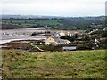
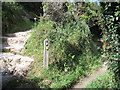
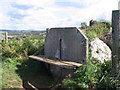
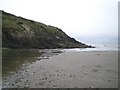
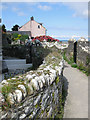
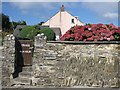
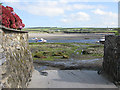
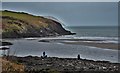
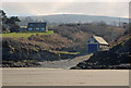
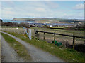
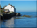
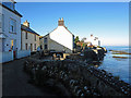
100 photos from this area
Area Information
Key information about the SA42 0RS including its size, population, and administrative classification.
- Area Type
- Postcode
- Area Size
- 4.9 hectares
- Population
- 1058
- Population Density
- 60 people/km²
House Prices in SA42 0RS
33
Properties
£370,000
Average Sold Price
£125,000
Lowest Price
£930,000
Highest Price
Showing 33 properties
| Address | Type | Beds | Baths | Last Sale Price | Last Sale Date | |
|---|---|---|---|---|---|---|
| Brenwyn, 30 Maes Y Cnwce, Newport, SA42 0RS | Bungalow | 3 | 2 | £560,000 | Mar 2025 | |
| Tonnau, 11 Maes Y Cnwce, Newport, SA42 0RS | Bungalow | 2 | 2 | £503,000 | Jun 2024 | |
| Dwndwr, 10 Maes Y Cnwce, Newport, SA42 0RS | Bungalow | 2 | 1 | £430,000 | Nov 2023 | |
| Penybryn, 34 Maes Y Cnwce, Newport, SA42 0RS | Bungalow | 3 | 2 | £375,000 | Mar 2023 | |
| Driftwood, 36 Maes Y Cnwce, Newport, SA42 0RS | Bungalow | 3 | 2 | £490,000 | Jan 2023 | |
| TREM Y MORFA, 33 MAES Y CNWCE, Newport, SA42 0RS | Detached | - | - | £520,000 | Oct 2021 | |
| 2 Maes Y Cnwce, Newport, SA42 0RS | Bungalow | - | - | £325,000 | Apr 2021 | |
| Maes Y Dderwen, Maes Y Cnwce, Newport, SA42 0RS | Detached | 5 | 4 | £930,000 | Apr 2017 | |
| Lanwg, 20 Maes Y Cnwce, Newport, SA42 0RS | Bungalow | - | - | £400,000 | Nov 2015 | |
| Morerin, 16 Maes Y Cnwce, Newport, SA42 0RS | Bungalow | 3 | - | £320,000 | Mar 2015 |
Page 1 of 4
Energy Efficiency in SA42 0RS
Amenities
Schools
| Rank | School | Type | Entry gender | Ages |
|---|
Explore more schools in this area
Go to Schools tabDemographics
Household Size
Two person
most common
Accommodation Type
Houses
most common
Tenure
73
majority
Ethnic Group
White
most common
Religion
N/A
most common
Household Composition
N/A
most common
Age
47
median
Elderly (65+ years)
most common
Household Deprivation
N/A
with no deprivation
NS-SEC
40
in Lower managerial occupations
Explore more demographic insights in this area
Go to Demographics tabPlanning
Planning Constraints
- Flood RiskPremium
- Ramsar Wetland SitesPremium
- Area of Outstanding Natural BeautyPremium
- Protected Nature ReservePremium
- Protected WoodlandPremium
- Crime RiskPremium