Area Overview for SA41 3UB
Photos of SA41 3UB
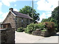
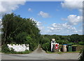
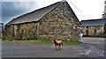

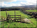
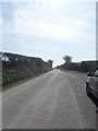
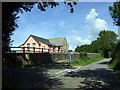
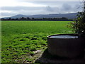
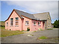
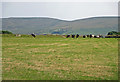
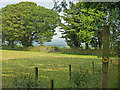
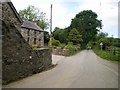
15 photos from this area
Area Information
Key information about the SA41 3UB including its size, population, and administrative classification.
- Area Type
- Postcode
- Area Size
- 1.3 km²
- Population
- 2058
- Population Density
- 26 people/km²
House Prices in SA41 3UB
11
Properties
£515,000
Average Sold Price
£270,000
Lowest Price
£760,000
Highest Price
Showing 11 properties
| Address | Type | Beds | Baths | Last Sale Price | Last Sale Date | |
|---|---|---|---|---|---|---|
| Brynawel, U 3159 Via Fynnonwen, Brynberian, Crymych, SA41 3UB | Detached | 3 | 1 | £760,000 | Sep 2021 | |
| Plasyparke, U 3159 Via Fynnonwen, Brynberian, Crymych, SA41 3UB | house | - | - | £270,000 | Sep 2021 | |
| Parcau, 0 , Brynberian, Crymych, SA41 3UB | Farm | 2 | 1 | - | - | |
| Plas Preseli, 0 , Brynberian, Crymych, SA41 3UB | Detached | 3 | 2 | - | - | |
| Castell Y Glonc, U 3159 Via Fynnonwen, Brynberian, Crymych, SA41 3UB | Detached | 3 | 2 | - | - | |
| Maesybeddau, U 3159 Via Fynnonwen, Brynberian, Crymych, SA41 3UB | house | - | - | - | - | |
| Pantymansail, U 3159 Via Fynnonwen, Brynberian, Crymych, SA41 3UB | house | 3 | 1 | - | - | |
| Erw Beili, U 3159 Via Fynnonwen, Brynberian, Crymych, SA41 3UB | Detached | 3 | 2 | - | - | |
| Ffynnonwen, U 3159 Via Fynnonwen, Brynberian, Crymych, SA41 3UB | Detached | - | - | - | - | |
| Rhosfach, U 3159 Via Fynnonwen, Brynberian, Crymych, SA41 3UB | house | - | - | - | - |
Page 1 of 2
Energy Efficiency in SA41 3UB
Amenities
Schools
| Rank | School | Type | Entry gender | Ages |
|---|
Explore more schools in this area
Go to Schools tabDemographics
Household Size
Two person
most common
Accommodation Type
Houses
most common
Tenure
78
majority
Ethnic Group
White
most common
Religion
N/A
most common
Household Composition
N/A
most common
Age
47
median
Adults (30-64 years)
most common
Household Deprivation
N/A
with no deprivation
NS-SEC
33
in Lower managerial occupations
Explore more demographic insights in this area
Go to Demographics tabPlanning
Planning Constraints
- Flood RiskPremium
- Ramsar Wetland SitesPremium
- Area of Outstanding Natural BeautyPremium
- Protected Nature ReservePremium
- Protected WoodlandPremium
- Crime RiskPremium