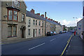
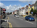
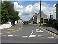
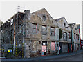
Area Overview for Milford Haven Community
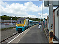
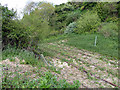
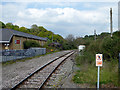
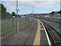
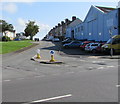
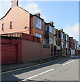
Photos of Milford Haven Community


Area Information
Milford Haven Community is a civil parish situated within Wales, covering an area of 15.8 km². You will find a population of 5,915 residents spread across this relatively compact space, resulting in a density of 375 people per square kilometre. This figure indicates a moderate level of crowding where neighbours may be close without the area feeling entirely saturated. Living in Milford Haven Community offers a distinct rural character typical of the region, yet the population size ensures that local services remain accessible. The parish status provides a layer of local governance that often contributes to a stable community environment. Daily life here balances the quiet of a small settlement with the practicalities of a community that has grown to support nearly six thousand individuals. Prospective buyers looking for homes in Milford Haven Community should note that the land area is finite, which keeps the development spread out rather than compact. This layout influences travel times and the general pace of life. The area represents a specific-point location where modern infrastructure meets traditional settlement patterns, providing a clear picture for anyone considering this spot for their next residence.
- Area Type
- Parish
- Area Size
- 15.8 km²
- Population
- 5915
- Population Density
- 375 people/km²
Demographics
The age profile of Milford Haven Community tells a clear story about the nature of its residents. The median age stands at 70 years, which is significantly higher than the national average for many parts of the UK. This means the community is home to a predominantly older demographic, likely comprising retirees or those living into later life. While specific data on the most common age range is not further broken down beyond the total age category, the high median age suggests a lack of young families driving the current population makeup. Over 59% of residents own their homes outright, a substantial majority compared to national trends in some other areas. This high level of home ownership indicates a settled population with strong local roots rather than a transient workforce. The household composition data provided covers the total population, but the age median implies that many households may consist of single occupants or couples who have children grown. Religious and ethnic diversity data are noted as total figures in the provided records, meaning the community likely maintains a specific demographic character reflective of its location in Wales. This demographic reality means you will be living alongside a cohort that shares similar life stages and priorities.
Household Size
Accommodation Type
Tenure
Ethnic Group
Religion
Household Composition
Age
Household Deprivation
NS-SEC
Explore more demographic insights in this area
Go to Demographics tabPlanning
Planning Constraints
- Flood RiskPremium
- Ramsar Wetland SitesPremium
- Area of Outstanding Natural BeautyPremium
- Protected Nature ReservePremium
- Protected WoodlandPremium
- Crime RiskPremium