Area Overview for Mathry Community
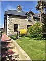
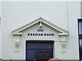
Photos of Mathry Community
Area Information
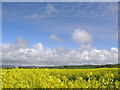
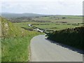
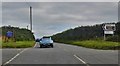
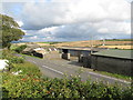
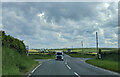
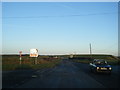
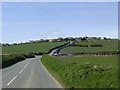
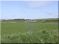
Living in Mathry Community means residing within a civil parish that spans 29.7 km² of rural Wales. This location offers a distinct lifestyle defined by its rural setting and significant natural features. The area is largely characterised by open countryside rather than dense urban sprawl, making it suitable for those seeking space and quiet. You will find that daily life here centres around the pace of the countryside, with a strong emphasis on ownership and stability. The community possesses a long-established character, reflected in nearly thirty per cent of the land being under a one-hour flood risk threshold, though specific flooding events do not cover the majority of the parish. While specific population counts are not detailed in the current records, the median age of seventy signals a settlement dominated by older residents. This demographic profile suggests a community where long-term residents have settled for life, rather than a transient population. Homes in Mathry Community reflect this stability, with property ownership being the norm. You should expect a neighbourhood where neighbours have likely lived in their properties for decades, creating a close-knit but perhaps less diverse community than found in larger towns. Your daily commute to urban centres may require planning, given the rural nature of the 29.7 km² area.
- Area Type
- Parish
- Area Size
- 29.7 km²
- Population
- Not available
- Population Density
- Not available
Demographics
The demographic landscape of Mathry Community is heavily weighted towards older age groups. With a median age of seventy, this is a retirement-focused or later-life settlement where children have typically moved away. The most common age range covers adults, indicating that the area is not a destination for young families or students. Home ownership stands at eighty-one per cent, which is a significantly high figure compared to the UK average. This statistic confirms that the vast majority of households own their residences outright or with a mortgage, rather than renting. The high rate of ownership correlates with the age profile, suggesting residents value stability and have spent their life building equity in this specific locality. Unlike many parts of England where deprivation data is tracked, criminal risk statistics are unavailable for this Welsh parish. However, the sheer scale of home ownership implies a community with financial resilience. The household composition is diverse in sleeping arrangements but forms around established family units or couples in later life. You will not find the multigenerational dynamics common in urban cores here; instead, the housing stock likely consists of bungalows or single-storey conversions suitable for mobility. The ethnic and religious makeup is traditional, reflecting the cultural fabric of the Welsh valleys and rural communities.
Household Size
Accommodation Type
Tenure
Ethnic Group
Religion
Household Composition
Age
Household Deprivation
NS-SEC
Explore more demographic insights in this area
Go to Demographics tabPlanning
Planning Constraints
- Flood RiskPremium
- Ramsar Wetland SitesPremium
- Area of Outstanding Natural BeautyPremium
- Protected Nature ReservePremium
- Protected WoodlandPremium
- Crime RiskPremium