Area Overview for Llanstadwell Community
Photos of Llanstadwell Community
Area Information
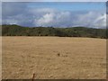
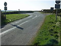
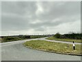
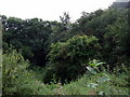
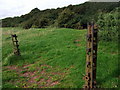
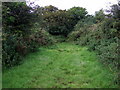
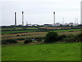
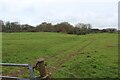
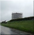
Living in Llanstadwell Community means settling into a small rural setting defined by a distinct, isolated character. This civil parish covers an area of 10.5 km², creating an environment where local life moves at a slower pace than in denser urban centres. The landscape here is not absolutely free of planning constraints, as the area contains protected nature reserves and protected woodland. These designations introduce specific considerations for anyone considering the future development or character of the neighbourhood. Consequently, the physical boundaries of the parish are marked by a mix of open space and natural features that require careful attention. You will find that daily life here is shaped by the inherent limitations of a small parish with no data suggesting active large-scale commercial development. The absence of significant planning pressure in zones like Ramsar sites or Areas of Outstanding Natural Beauty suggests a stable, non-expanding physical footprint. However, the presence of protected woodlands and nature reserves means that the immediate surroundings retain a strong emphasis on conservation. Residents here navigate a landscape where environmental protection plays a visible role in local identity. When you research homes in Llanstadwell Community, you must accept that the area remains a quiet, green parish rather than a growing town hub. The town centre of Llanstadwell is effectively a non-entity in terms of statistics, leaving you to look outward for services. This reality defines the practical experience of living in this specific 10.5 km² zone.
- Area Type
- Parish
- Area Size
- 10.5 km²
- Population
- Not available
- Population Density
- Not available
Demographics
The community of Llanstadwell Community presents a clear demographic profile that points towards a retired or late-middle-aged population. The median age within the parish sits at 70 years, indicating that the demographic heart of Llanstadwell belongs to older residents. While specific age breakdowns for sub-ranges are not detailed beyond the total age category, this high median age strongly suggests a retirement-focused lifestyle. For a homebuyer, this means the local amenities and street life are likely geared towards an older clientele rather than families with young children. Home ownership acts as a dominant feature of this community, with 68% of households in Llanstadwell buying their homes outright. This figure signifies a area where stability is common and the rental market plays a secondary role. You will encounter little turnover typical of investment-heavy rental zones; instead, the housing stock reflects long-term tenure. The household composition data confirms that the predominant group consists of older residents, reinforcing the picture of a quiet, established neighbourhood. Diversity regarding ethnicity and religious affiliation is not quantified in the available details for this specific parish, leaving the precise cultural makeup undefined by headline figures. Nevertheless, the 70-year median age and 68% ownership rate create a very specific social environment. Living in Llanstadwell Community means joining a demographic where life has moved past the typical peaks of early career and early parenting.
Household Size
Accommodation Type
Tenure
Ethnic Group
Religion
Household Composition
Age
Household Deprivation
NS-SEC
Explore more demographic insights in this area
Go to Demographics tabPlanning
Planning Constraints
- Flood RiskPremium
- Ramsar Wetland SitesPremium
- Area of Outstanding Natural BeautyPremium
- Protected Nature ReservePremium
- Protected WoodlandPremium
- Crime RiskPremium