Area Overview for The Havens Community
Photos of The Havens Community


Area Information
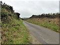
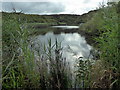
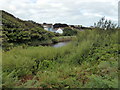
The Havens Community spans 20.6 square kilometres and sits firmly established as a distinct residential area in Wales. Living in The Havens Community offers a settled environment defined by its mature demographic profile. You will find that daily life here revolves around stability and long-term residency rather than the transient nature of new developments. The area covers sufficient ground to feel spacious while maintaining the intimacy of a neighbourhood where services and local amenities are within easy reach. This unitary electoral division represents a place where people have put down roots. The housing stock reflects decades of accumulation rather than recent rapid expansion. Residents here navigate a landscape designed for those who plan to stay for the long haul. The physical footprint of the area provides a buffer that separates homes from heavy industrial zones, creating a zone suitable for families and retirees alike. When you consider homes in The Havens Community, you are looking at a microcosm of Welsh settlement that prioritises space and quiet over high-density urban development. The character of the place is defined by this consistent population base.
- Area Type
- Parish
- Area Size
- 20.6 km²
- Population
- Not available
- Population Density
- Not available
Demographics
The community in The Havens Community displays a clear demographic skew towards older residents. The median age stands at 70 years, indicating that the area is dominated by retirees or older adults who have remained settled for a significant period. You will encounter very few young families or single professionals compared to the broader national average. This age profile shapes the local demand for housing, healthcare, and leisure facilities in ways that differ from younger-dominated districts. Home ownership in The Havens Community reaches 79 per cent. This figure highlights a district where property is primarily owned by its inhabitants rather than rented out. The high ownership rate suggests financial security among residents and a lack of seasonal or student tenancy markets. Accommodation types and household composition follow naturally from this ownership structure, as long-term owners often occupy single-family homes or adapted properties suitable for aging in place. The population is relatively homogeneous regarding age, with the most common age grouping falling within the retirement bracket. This stability means the local economy and social services are tailored to the needs of an older population.
Household Size
Accommodation Type
Tenure
Ethnic Group
Religion
Household Composition
Age
Household Deprivation
NS-SEC
Explore more demographic insights in this area
Go to Demographics tabPlanning
Planning Constraints
- Flood RiskPremium
- Ramsar Wetland SitesPremium
- Area of Outstanding Natural BeautyPremium
- Protected Nature ReservePremium
- Protected WoodlandPremium
- Crime RiskPremium