Area Overview for St. David's Community
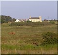
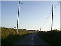
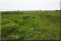
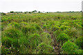
Photos of St. David's Community

Area Information
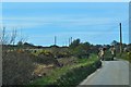
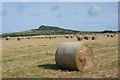
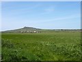
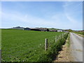
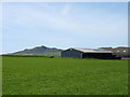
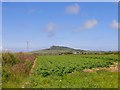
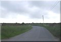
St. David's Community stands as a civil parish covering 46.5 km², a distinct rural settlement within Wales. This area functions as a traditional parish with a quiet daily rhythm defined by its expansive size and low-density living. You are stepping into a setting where property choices reflect a strong sense of local identity and established community ties rather than rapid urban development. The landscape offers open spaces and a rural character that defines the experience of living in St. David's Community. Current figures indicate a population predominantly shaped by specific life stages, as the median age here reaches 70 years. This demographic reality creates a neighbourhood that caters to retirees and established residents who have chosen to stay or settle in this part of Wales. The environment here does not mimic the pace of major cities; instead, life revolves around local convenience and established routines. When considering homes in St. David's Community, you are looking at a location set apart by its geography and its specific social composition. The parish provides a settled atmosphere where the primary draw is the stability of the area itself rather than flashy amenities or high-energy lifestyles.
- Area Type
- Parish
- Area Size
- 46.5 km²
- Population
- Not available
- Population Density
- Not available
Demographics
The community character in St. David's Community is defined by a clear age profile where the median age sits at 70 years. This statistic confirms that the majority of residents belong to the older age demographic, creating a neighbourhood tailored to those approaching or in retirement. Families with young children are less common here compared to towns with a younger population, meaning the social fabric focuses on the needs and lifestyles of mature homeowners. Home ownership is exceptionally strong, with 71% of households owning their properties outright. This high level of ownership suggests long-term residents who have likely lived in their homes for decades. The remaining 29% of households consist of renters or those with different tenure arrangements. Data on household composition, predominant ethnic groups, and religious affiliation is currently unavailable for this specific parish, but the high ownership rate clearly indicates a stable, established population rather than a transient one. For you considering living in St. David's Community, this demographic landscape means you are joining a group of permanent residents who value the settled nature of parish life.
Household Size
Accommodation Type
Tenure
Ethnic Group
Religion
Household Composition
Age
Household Deprivation
NS-SEC
Explore more demographic insights in this area
Go to Demographics tabPlanning
Planning Constraints
- Flood RiskPremium
- Ramsar Wetland SitesPremium
- Area of Outstanding Natural BeautyPremium
- Protected Nature ReservePremium
- Crime RiskPremium