Area Overview for Pembroke Community
Photos of Pembroke Community


Area Information
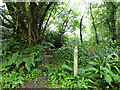
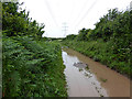
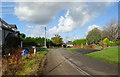
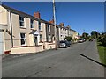
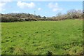
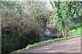
Pembroke Community is a civil parish situated in Wales, covering a total area of 11.9 square kilometres. Living in this parish offers a defined rural landscape where the community operates at a local level. The setting provides a distinct environment for those seeking a specific place to call home rather than a dense urban centre. You will find that daily life here revolves around the character of a traditional parish with clear boundaries and neighbours who are likely to know one another. The landscape is open and expansive, which contrasts sharply with the congestion found in larger towns. Your daily commute likely involves navigating established routes rather than dealing with significant traffic bottlenecks. The area maintains a stable identity, avoiding the rapid changes seen in faster-growing regions. This makes Pembroke Community a predictable choice for buyers who value consistency and a known environment. You do not need to worry about sudden demographic shifts or unexplained changes to your neighbourhood. The parish structure ensures that local governance remains focused on specific, manageable areas.
- Area Type
- Parish
- Area Size
- 11.9 km²
- Population
- Not available
- Population Density
- Not available
Demographics
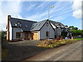
The people living in Pembroke Community have a distinct age profile compared to the national average. The median age here stands at 70 years, indicating that the population is predominantly elderly. This demographic reality shapes the character of the parish and the services it supports. Most residents fall into the older age bracket, which suggests a calm, settled community rather than a bustling hub of young families. Home ownership is a dominant feature of life in this area, with 60% of all households owning their property outright. This high rate suggests stability and long-term residency, as residents are less likely to move frequently. You will find that many homes are multi-generational or occupied by retirees who wish to remain in their established homes. The lack of specific data on ethnicity or religion prevents assumptions about diversity, so you should understand that the community leans heavily toward traditional demographics. Household composition and accommodation types follow similar patterns to the ownership figures, reinforcing the image of a mature residential zone. When you consider the people in Pembroke Community, you are looking at a generation that has likely lived in the same houses for decades. This creates an atmosphere of continuity where local traditions persist unchanged over time.
Household Size
Accommodation Type
Tenure
Ethnic Group
Religion
Household Composition
Age
Household Deprivation
NS-SEC
Explore more demographic insights in this area
Go to Demographics tabPlanning
Planning Constraints
- Flood RiskPremium
- Ramsar Wetland SitesPremium
- Area of Outstanding Natural BeautyPremium
- Protected Nature ReservePremium
- Protected WoodlandPremium
- Crime RiskPremium