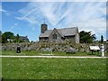
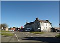
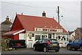
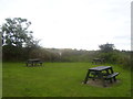
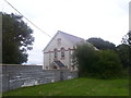
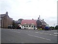
Area Overview for Maenclochog Community
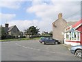
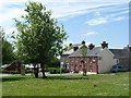
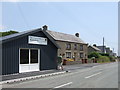
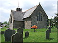
Photos of Maenclochog Community


Area Information
Maenclochog Community represents a distinct civil parish situated in Wales, covering an area of 31.3 square kilometres. This jurisdiction offers a defined local identity for those considering moving to the region. The landscape and local structure support a consistent way of life for current residents. Living in Maenclochog Community means engaging with a specific administrative area that maintains clear boundaries. You can find homes here within this established parish framework. The environment is characterised by its local governance and geographical extent. You reside in a space that balances rural setting with parish-level organisation. The size of the community provides enough space for development while maintaining its character as a single entity. Daily life unfolds within these 31.3 square kilometres, which forms the core of the residential experience. This parish status ensures that local services and planning follow specific Welsh regulations. Understanding the scale of Maenclochog Community helps you gauge the distance to major towns or services. The area functions as a self-contained unit for many of its inhabitants. When you think about settling down, the civil parish structure offers a sense of order. The area size dictates the spread of properties and public access points. You live within a jurisdiction that has tangible limits and defined responsibilities. Whether you are buying a property or renting, the location falls under this specific community banner. The parish of Maenclochog Community provides a stable backdrop for your home search.
- Area Type
- Parish
- Area Size
- 31.3 km²
- Population
- Not available
- Population Density
- Not available
Demographics
The population of Maenclochog Community is defined by an older demographic profile. You will find that the median age across the area stands at 70 years. This figure indicates that the typical resident is among the senior demographic cohort. Age distribution data shows that the total population skews significantly towards older adults. Consequently, you are more likely to encounter retired家庭成员 than young families or working professionals in their prime career years. The community reflects a settlement where retirement living or long-term residence by older generations dominates the social fabric. Home ownership rates within Maenclochog Community reach a notable 83 per cent of the total population. This high level of ownership suggests that most people living here have purchased their properties over time. You will find far fewer private rental properties compared to owner-occupied stocks in this parish. The household composition data confirms this trend towards permanent residence. Accommodation types across the parish align with this pattern of long-term settlement rather than transient housing markets. While specific data on ethnic diversity and religious affiliation exists in the government records, the primary demographic identity centres on age and tenure. The community does not display the younger, more transient population profiles found in urban centres. You should expect a neighbourliness built around similar life stages. The 70-year median age influences local services and community activities. This demographic reality shapes how living in Maenclochog Community unfolds for any new arrival.
Household Size
Accommodation Type
Tenure
Ethnic Group
Religion
Household Composition
Age
Household Deprivation
NS-SEC
Explore more demographic insights in this area
Go to Demographics tabPlanning
Planning Constraints
- Flood RiskPremium
- Ramsar Wetland SitesPremium
- Area of Outstanding Natural BeautyPremium
- Protected Nature ReservePremium
- Protected WoodlandPremium
- Crime RiskPremium