Area Overview for Kilgetty/Begelly Community
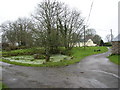
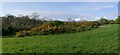
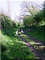
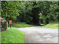
Photos of Kilgetty/Begelly Community


Area Information
Living in Kilgetty/Begelly Community means settling into a civil parish defined by two villages nestled between Narberth and Saundersfoot. The area covers 19.5 km², offering a mix of rural open countryside and modest local amenities. You will find shops such as a Co-op, a pharmacy, and takeaways within walking or driving distance. Pubs like The White Horse and Begelly Arms provide warm hospitality for residents and visitors alike. The character of the neighbourhood is clean, inviting, and welcoming, supported by a strong sense of shared local history. Heavy industry shaped the village's origins. Mining workings existed in Begelly as early as 1581, and a railway opened in 1834 to transport coal to Saundersfoot. Kilgetty railway station opened in 1866, around which the village developed. Today, Folly Farm Adventure Park and Zoo stand as key attractions in Begelly. Nearby features include Oakwood Theme Park, the Miners Walk, and the Stepaside Ironworks Circular Walk. Visitor guides and historical resources highlight the industrial past revealed along these trails. Daily life here is accessible via specific transport links. Kilgetty railway station provides rail access, while bus services 352 and 382 connect you to Tenby and Haverfordwest. The village stretches along the A478 main road, facilitating travel to nearby market towns. You live in an area with rich heritage, where the Child family owned the Begelly estate until 1919. The Jubilee Park Nature Trail offers birdwatching and hiking opportunities. This rural village area retains its open spaces while maintaining essential connectivity for work and leisure.
- Area Type
- Parish
- Area Size
- 19.5 km²
- Population
- Not available
- Population Density
- Not available
Demographics
The community in Kilgetty/Begelly Community reflects a settled, mature population. The median age is 70 years, indicating a resident base skewed significantly towards older adults. While specific age range breakdowns are not detailed beyond the median figure, the demographic profile suggests a location popular for retirement or long-term rural living rather than young family migration. Traditional household structures likely dominate given the median age, though household composition data for the total population does not provide further breakdowns. Home ownership stands at 78%, a notably high figure for the region. This statistic confirms that the area is primarily an owner-occupied zone rather than a hub for rental properties or student housing. Such high ownership rates typically signal established roots and financial stability within the local community. The remaining 22% consists of renters or those not owning their homes. Ethnic and religious diversity data are recorded as totals in the available records, without specifying predominant groups. A comforting 78% home ownership rate shapes the social fabric of Kilgetty/Begelly Community. Residents often describe the area as clean and inviting, with a rich history evident in the preserved mining and railway heritage. The area size of 19.5 km² supports this residential focus, blending village life with open countryside. You are living in a neighbourhood where ownership is the norm, fostering a sense of permanence. This contrasts with rapidly developing urban edges where renting often dominates the landscape. The demographic reality here involves a stable, likely ageing population enjoying the benefits of rural living.
Household Size
Accommodation Type
Tenure
Ethnic Group
Religion
Household Composition
Age
Household Deprivation
NS-SEC
Explore more demographic insights in this area
Go to Demographics tabPlanning
Planning Constraints
- Flood RiskPremium
- Ramsar Wetland SitesPremium
- Area of Outstanding Natural BeautyPremium
- Protected Nature ReservePremium
- Protected WoodlandPremium
- Crime RiskPremium