Area Overview for Wentlooge Community
Photos of Wentlooge Community

Area Information
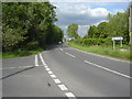
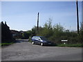
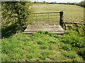
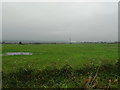
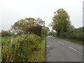
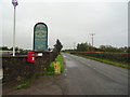
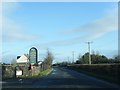
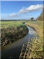
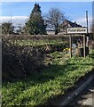
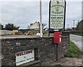
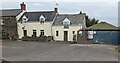
Living in Wentlooge Community means residing within a civil parish in the southwest of Newport, South Wales. This parish encompasses the distinct hamlets of Peterstone Wentlooge and St Brides Wentlooge, situated within the Marshfield ward. The area covers a total size of 24.3 km² and sits on the flat, reclaimed Wentloog Levels. These low-lying lands are protected by a sea wall and criss-crossed by drainage ditches known locally as reens. The location is defined by its natural boundaries, including Percoed Reen to the northwest, the Ebbw River to the northeast, and the Bristol Channel to the southeast. To the southwest, the South Wales Main Line railway runs alongside the community. You are entering an area with deep historical roots. The name derives from Gwynllŵg, named after the 5th-6th century ruler Gwynllyw, who remains the patron saint of Newport. Historically, the land was part of the ancient Wentloog Hundred in Monmouthshire. Today, the landscape reflects a working heritage driven by farming on tenanted saltmarsh, such as the 90 acres at Greenmoor Farm. St Brides Wentlooge retains a rural character, having been home to notable figures like actor Lyn Harding. While the landscape is reclaimed, it retains the memory of its marshy past and remains one of the few places where you can experience coastal plains inland from the Bristol Channel. The area offers a setting where modern life intersects with protected saltmarsh environments and significant transport links.
- Area Type
- Parish
- Area Size
- 24.3 km²
- Population
- Not available
- Population Density
- Not available
Demographics
The community of Wentlooge Community is defined by an older population profile. The median age stands at 70 years, placing it well above the national average for the United Kingdom. This demographic structure indicates that the area attracts retirees rather than young working families. Consequently, you will find a village atmosphere suited to a slower pace of life. The household composition reflects this, with a significant number of single-person households and adult couples living without dependent children. Total household figures align with this older demographic reality. Home ownership in Wentlooge Community is exceptionally high, with 85% of residents owning their homes outright or with a mortgage. This figure creates a very stable community with low tenant turnover. Such high ownership rates often correlate with the area's appeal to retirees who have moved away from higher-cost urban centres. Accommodation types mirror this stability, featuring predominantly traditional detached and semi-detached housing rather than purpose-built high-density flats. The area lacks the transient feel common in university towns or city centres. While specific data on ethnic diversity and religious affiliation is not detailed in current statistics, the historic background suggests a predominantly White British population, though the parish management documents a total population count without specific breakdowns. The high level of home ownership means you are likely to live amongst established neighbours who have been in the area for decades. This stability can make integrating into the community straightforward, as relationships often span generations. The area does not suffer from significant deprivation, allowing residents to enjoy a quality of life defined by property autonomy and local leisure.
Household Size
Accommodation Type
Tenure
Ethnic Group
Religion
Household Composition
Age
Household Deprivation
NS-SEC
Explore more demographic insights in this area
Go to Demographics tabPlanning
Planning Constraints
- Flood RiskPremium
- Ramsar Wetland SitesPremium
- Area of Outstanding Natural BeautyPremium
- Protected Nature ReservePremium
- Protected WoodlandPremium
- Crime RiskPremium