Area Overview for Tredegar Park Community
Photos of Tredegar Park Community

Area Information
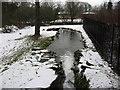
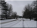
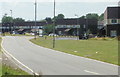
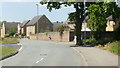
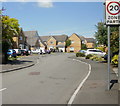
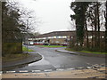
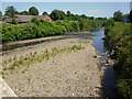
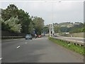
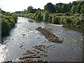
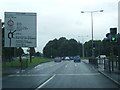
Tredegar Park Community is a civil parish in Wales covering an area of 1.8 km². You will find this location distinct from other settlements due to its specific planning constraints and age profile. The area exists as a small but defined parish, meaning local governance operates at a parish council level. Daily life here revolves around a resident community with a clear sense of place. Anyone considering homes in Tredegar Park Community must understand that the land is limited, which influences property density and availability. The village centre likely focuses on local services available within this small footprint. This community sits within a broader landscape that includes specific protected features. You will encounter protected woodland covering a small portion of the land. Flood risk is low, providing reassurance for those concerned about environmental safety. The space allows for a quiet residential experience but limits the potential for rapid expansion. Living in Tredegar Park Community offers a known environment where planning rules are strictly applied due to the protected status of the woodland. The small size of the parish means facilities are immediate, yet the protected nature reserves constrain new developments. This balance creates a stable setting for families and retirees alike. The area attracts buyers who value established community boundaries over rapid growth. The parish status ensures that local history and character remain central to the identity of Tredegar Park Community. Your connection to the wider region will depend on transport links outside the parish borders. The combination of safe flood zones and specific woodland protections defines the physical reality of this location.
- Area Type
- Parish
- Area Size
- 1.8 km²
- Population
- Not available
- Population Density
- Not available
Demographics
The community in Tredegar Park Community is defined by an older population. Statistically, the median age reaches 70, marking a significant shift away from younger family demographics. Most residents belong to the age range classified as total, indicating a broad spread across standard adult categories. You will notice a neighbourhood dominated by settled individuals rather than young professionals or students. This demographic profile shapes the local services, from healthcare accessibility to leisure activities suitable for seniors. Home ownership stands at 46 percent, meaning roughly half the households rent their homes. This figure indicates a balanced market where neither ownership nor renting overwhelmingly dominates the housing landscape. Accommodation types reflect this mix, with a steady number of tenants alongside owner-occupiers. The household composition suggests traditional family units coexist with single-person households typical of retirement living. Regarding diversity, the predominant ethnic group comprises the total population, showing a homogenous community structure common in many Welsh parishes. Deprivation levels and specific religion statistics are not available in the current data for Tredegar Park Community. However, the high median age suggests a retired population often found in areas with established rural histories. Your quality of life here depends on how well local amenities meet the needs of an older demographic. Shopping and transport must be accessible for those with mobility concerns. The 46 percent ownership rate implies some homes are available for purchase, but availability may be tighter in a retirement-oriented area. Understanding these numbers helps you gauge the social fabric of Tredegar Park Community accurately.
Household Size
Accommodation Type
Tenure
Ethnic Group
Religion
Household Composition
Age
Household Deprivation
NS-SEC
Explore more demographic insights in this area
Go to Demographics tabPlanning
Planning Constraints
- Flood RiskPremium
- Ramsar Wetland SitesPremium
- Area of Outstanding Natural BeautyPremium
- Protected Nature ReservePremium
- Protected WoodlandPremium
- Crime RiskPremium