Area Overview for NP9 5XL
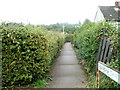
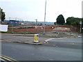
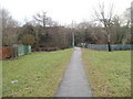
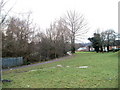
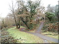
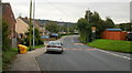
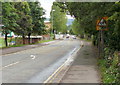
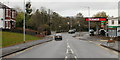
Photos of NP9 5XL


Area Information
Living in NP9 5XL offers a clear sense of place within the Newport postcode cluster. This specific residential cluster forms a tightly knit part of the wider South Wales landscape, accommodating a population of 1,688 people. With a density of 761 people per square kilometre, the area strikes a balance between civic engagement and residential comfort. You will find yourself amongst a group of neighbours who value stability and community presence. The area is defined by its residential nature, removing the noise and chaos often found in larger commercial zones of Newport. Daily life revolves around a predictable routine where local interactions matter. You work beside the people who shop at the same Tesco or wait for the train at Pye Corner. This postcode serves as a quiet backdrop to the energy of the city, allowing you to engage with Newport without being consumed by it. It is a location where modern connectivity meets established housing stock.
- Area Type
- Postcode
- Area Size
- Not available
- Population
- 1688
- Population Density
- 761 people/km²
The property market in NP9 5XL is characterised by a strong preference for traditional family living. As indicated by the accommodation data, houses form the dominant housing stock in this postcode. This fact shapes the available inventory for buyers looking for space and garden access. With 56% of residents being homeowners, the area leans heavily towards owner-occupied living rather than a high-rental market. You are likely to buy a property that has been maintained for generations or renovated by a current owner who values their home. This contrasts sharply with postgraduate student towns where rental demand skews towards smaller flats. The specific nature of NP9 5XL means buyers expect a degree of permanence and stability in their investment. Future residents can anticipate a market where properties are held long-term, reducing the turnover rate you observe in volatile rental districts. If you seek a solid investment in a residential cluster, this market offers the stability of house ownership rather than the flux of high-turnover renting.
House Prices in NP9 5XL
No properties found in this postcode.
Energy Efficiency in NP9 5XL
Your lifestyle in NP9 5XL benefits from well-established amenities within practical reach. Five key retail venues serve the daily shopping needs of residents, including the large Tesco Newport, the Spar convenience store, and the Morrisons Daily. This variety means you can handle budget groceries at home or sample fresh options at the larger supermarket. Transport links are equally convenient, with access to five rail connections enabled by stations including Newport Railway Station, Pye Corner Railway Station, and Rogerstone Railway Station. These stations act as the arteries connecting you to the wider Welsh network. You do not need to travel far to reach Newport Ferry Terminal, which stands as the single ferry amenity nearby for those needing coastal or cross-channel access. Local amenities are sufficient to cover basic needs, yet the rail links ensure you can commute into the wider city centre whenever required. The presence of these specific venues and stations defines the rhythm of daily life for residents of this postcode.
Amenities
Schools
Families in NP9 5XL have access to two key educational institutions listed as nearby options. Most residents rely on Don Close Nursery for the earliest years of their children's education. This facility serves as an important starting point for local families before they progress to other stages of schooling. Further on in the education journey, Newport High School stands as the primary secondary option for residents in the immediate vicinity. The school type classification for both Don Close Nursery and Newport High School is recorded as "other," which signifies their specific role within the local educational framework for this postcode. While the data does not provide specific Ofsted ratings, the presence of these two named institutions confirms that educational provision is active in the catchment area. You must plan school runs around the locations of Don Close Nursery and Newport High School. The mix of nursery and secondary schooling coverage suggests a continuum of support, though parents living here may travel further for comprehensive education if their children require different specialisms.
| Rank | School | Type | Entry gender | Ages |
|---|
Explore more schools in this area
Go to Schools tabDemographics
The community of NP9 5XL displays a distinct demographic profile suited to mature households. The median age stands at 47 years, indicating a resident base that has moved beyond young adulthood. You will encounter primarily adults aged between 30 and 64 years living in this postcode. This age range suggests a population often associated with stable careers and established family units rather than students or young professionals just entering the market. Home ownership dominates the local housing landscape, with 56% of residents owning their properties outright or with a mortgage. This high ownership rate correlates with the primary accommodation type: houses. The prevalence of houses over flats creates an environment ideal for those seeking space and traditional British living standards. The predominant ethnic group is White, reflecting the broader national trend in this part of Wales. Demographically, the area lacks significant youth clusters, meaning you are joining a settled community where the local shops serve long-term residents rather than transient populations.
Household Size
Accommodation Type
Tenure
Ethnic Group
Religion
Household Composition
Age
Household Deprivation
NS-SEC
Explore more demographic insights in this area
Go to Demographics tabPlanning
Planning Constraints
- Flood RiskPremium
- Ramsar Wetland SitesPremium
- Area of Outstanding Natural BeautyPremium
- Protected Nature ReservePremium
- Protected WoodlandPremium
- Crime RiskPremium