Area Overview for NP9 4YF
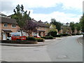
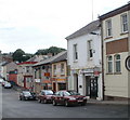
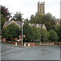
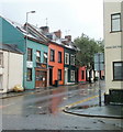
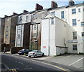
Photos of NP9 4YF


Area Information
Living in NP9 4YF means residing in a specific postcode area covering a small residential cluster within Wales. The population here totals 1,519 people, creating an intimate local environment where neighbours are likely known by name. This area represents a concentrated community rather than a sprawling development, offering residents a sense of closeness that larger urban districts often dilute. You will find a locality defined by its manageable scale and its position within the wider Newport region. The footprint of this postcode is compact, resulting in a neighbourhood where daily necessities are relatively close at hand. For someone considering homes in NP9 4YF, the setting provides a quiet retreat while remaining connected to broader transport networks. The demographic profile shows a mature population, suggesting a stable environment free from the transient energy of student housing zones. Daily life revolves around established routines, with local amenities like Tesco Clytha and Newport Railway Station acting as primary hubs. The area lacks the density of city centres but avoids the isolation of rural villages. Instead, it occupies a functional middle ground where residents walk to key services or take brief drives to Newport. This balance makes the location suitable for those who value privacy without complete remoteness.
- Area Type
- Postcode
- Area Size
- Not available
- Population
- Not available
- Population Density
- Not available
The property market in NP9 4YF is characterised by a stock almost entirely composed of houses. The data confirms that the accommodation type is exclusively houses, which dictates the layout and exterior style of the homes you will find. With a home ownership rate of 63 per cent, the area leans heavily towards owner-occupiers rather than a rental-dominated zone. This suggests that prices may be more stable compared to areas where landlord turnover drives market volatility. You are looking at a market where buyers purchase homes intended for long-term family living rather than short-term investments. Given the small population of 1,519, the total number of available properties is limited. This scarcity can be both an advantage and a constraint depending on your specific needs. The lack of apartments means there are no shared residential blocks, eliminating considerations regarding building fees or communal spaces often found in flats. Buyers in this sector should expect to compete for established family homes within this tight postcode boundary. The high level of owner occupation implies that many houses on the market have been in the same family for generations, often resulting in well-maintained interiors and gardens that have matured over time. For those seeking a traditional Welsh home, this area offers a consistent and straightforward housing stock without the variety found in mixed-use developments.
House Prices in NP9 4YF
No properties found in this postcode.
Energy Efficiency in NP9 4YF
Your lifestyle in NP9 4YF is defined by proximity to essential services and leisure points. There are five notable retail locations available, including Tesco Clytha, Tesco Newport, and Asda Stow. These supermarkets provide easy access to groceries and household essentials, reducing the need for extended car journeys. For transport, five rail stations serve the area, with Newport Railway Station acting as the primary hub for regional travel. If you prefer water travel, the Newport Ferry Terminal provides ferry connections for coastal exploration. The area supports a balanced daily routine where work and shopping fit within a short drive. You can visit the main Newport Retail and Transport hubs with confidence that the journey is manageable. The presence of multiple Tesco and Asda stores means you rarely need to look further for fresh food or large purchases. Living in NP9 4YF grants you access to these amenities while maintaining a low-key residential setting. There are no parks, leisure centres, or dining restaurants explicitly listed in the immediate data, suggesting reliance on nearby Newport for those specific activities. The character of the lifestyle is functional and efficient, removing the friction of long commutes to the city centre. Residents who value convenience alongside quiet living will find this cluster of properties to be a practical base for their week.
Amenities
Schools
Families looking at schools near NP9 4YF have one primary educational option listed in the immediate vicinity. The nearest facility is Queen's Hill PRU, which operates as a Special School. This institution provides specialist education for students with specific learning needs rather than serving the general school population for compulsory education. The presence of a special school indicates a commitment to inclusive education within the local authority area. While this does not offer a standard primary or secondary comprehensive school option within the walkable distance, it shows a range of educational support is available close by. If you are a parent reliant on the nearest options in NP9 4YF, you must consider that a standard key-stage school is not explicitly listed in the provided data for this specific cluster. Residents likely rely on secondary schools in nearby Newport or primary schools in adjacent postcodes to catch up places that for their children, as the data only highlights the PRU. The mix of school types near NP9 4YF is therefore limited, focusing on specialist provision rather than the typical plurality of primary and secondary options found in larger urban zones. This reflects the small population size and the classification of the area as a residential cluster rather than a multi-academy hub. Parents must verify the catchment areas of neighbouring mainstream schools, as the local provision is specialised rather than general.
| Rank | School | Type | Entry gender | Ages |
|---|
Explore more schools in this area
Go to Schools tabDemographics
The community in NP9 4YF is defined by a mature population structure. The median age is 47 years, with the most common age range falling between 30 and 64 years. This indicates a neighbourhood populated primarily by families and individuals in the middle stages of their lives rather than young professionals or retired residents. You will find a resident base that has likely put down deep roots in this part of Wales. The predominant ethnic group is White, reflecting the typical demographic composition of many Welsh town and country locales. Home ownership stands at 63 per cent within this postcode, indicating that a significant majority of households are owner-occupied rather than tenants. This high rate suggests a stable community where families stay for the long term, contributing to a reliable environment. All accommodation in NP9 4YF consists of houses, meaning you will not find apartments or flats in this specific cluster. The absence of high-density living supports the quieter character of the area, with detached or semi-detached properties likely forming the bulk of the stock. With a population of only 1,519, the community functions like a small village despite being technically part of a larger postcode area. The demographic data points to a settled, family-oriented locality where change happens gradually.
Household Size
Accommodation Type
Tenure
Ethnic Group
Religion
Household Composition
Age
Household Deprivation
NS-SEC
Explore more demographic insights in this area
Go to Demographics tabPlanning
Planning Constraints
- Flood RiskPremium
- Ramsar Wetland SitesPremium
- Area of Outstanding Natural BeautyPremium
- Protected Nature ReservePremium
- Protected WoodlandPremium
- Crime RiskPremium