Area Overview for NP9 3XF
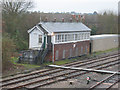
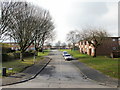
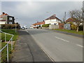
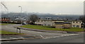
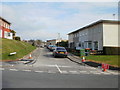
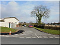
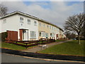
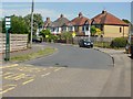
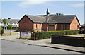
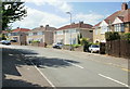
Photos of NP9 3XF


Area Information
Living in NP9 3XF places you within a specific postcode cluster in Wales with a population of 1,656 residents. This small residential area offers a contained community environment distinct from the larger surrounding towns. The setting is characterised by a concentration of homes in a limited geographical spread, creating an intimate neighbourhood feel rather than a sprawling urban footprint. You are looking at a locality defined by its compact nature, where daily life revolves around the close proximity of your home to local services and neighbours. The area functions as a quiet residential hub, away from the high-pressure pace of major city centres. Despite its modest size, the postcode covers enough ground to support a functional community with established amenities nearby. Residents here benefit from being part of a defined pocket of Wales that maintains its own identity within the broader region. The combination of housing types and limited population creates a stable environment where local dynamics are easy to monitor. You gain access to practical transport links and essential shops without needing to travel long distances for basic requirements. This postcode represents a practical choice for those seeking a settled lifestyle with lower density than larger urban developments. The specific boundaries of NP9 3XF ensure that noise levels and footfall remain manageable. Its location allows for a balanced commute to Newport while retaining a sense of local privacy. The area does not cater to high-density housing; instead, it focuses on providing space for the households identified within its limits.
- Area Type
- Postcode
- Area Size
- Not available
- Population
- 1656
- Population Density
- 4613 people/km²
The property market in NP9 3XF is defined by a clear preference for houses over flats or apartments. This housing stock predominance indicates a development history focused on family-oriented or independent living rather than density. With 44% home ownership, the area demonstrates a significant portion of owners either fully paying off investments or managing mortgages. This ownership rate suggests a stable market where buyers look for long-term holding periods rather than short-term rental flips. The limited population of 1,656 creates a niche market dynamic. Supply is likely restricted compared to larger districts, meaning competition hinges on the quality and condition of individual houses rather than sheer volume. Buyers seeking homes in this postcode should prepare for a targeted search of existing stock. The area does not cater to large-scale new-build projects; instead, it relies on the current housing inventory. Prospective purchasers looking at NP9 3XF will find a market less volatile than national city averages. The proportion of owner-occupiers typically leads to slower vacancy rates and steadier price retention. This section of the market appeals to individuals who value privacy and larger gardens over urban convenience features. The dominance of houses supports buyers who require specific layouts not available in apartment blocks. Understanding this inventory mix early prevents mismatches in buyer expectations regarding property types.
House Prices in NP9 3XF
No properties found in this postcode.
Energy Efficiency in NP9 3XF
Daily life in NP9 3XF benefits from immediate access to essential retail and transport infrastructure. Within practical reach, you can shop at Lidl Newport, Tesco Newport, and Spar, ensuring daily necessities are always available. This concentration of three major retailers covers most household purchasing needs without requiring long commutes. Public transport options are extensive with five nearby railway stations. Newport Railway Station, Pye Corner Railway Station, and Rogerstone Railway Station facilitate direct train connections to major cities. A ferry terminal is also accessible at Newport Ferry Terminal, adding maritime transport options to your travel network. This density of transport links makes commuting flexible and reduces dependency on private vehicles. The area's lifestyle relies on convenience. Residents do not need to travel far to find food, clothing, or household goods. The proximity of these amenities supports a balanced routine where leisure and essential errands happen efficiently. The character of NP9 3XF is defined by this accessibility; you start your day with easy transport connections and end it with convenient shopping nearby. Such practical advantages contribute to a low-stress environment for managing household logistics.
Amenities
Schools
Families approaching NP9 3XF find two primary教育机构 within practical reach, both classified under the 'other' category for school type. Gaer Junior School and Gaer Infant School sit near the postcode boundary, forming a core part of the local education landscape. These institutions serve the early years through lower secondary stages, though specific Ofsted ratings are not listed in the current dataset. The presence of both infant and junior sections in close proximity suggests a structured educational journey managed within the same immediate vicinity. This arrangement simplifies logistics for parents accessing education for children at different stages. The dual-school setup indicates that the area supports a continuous educational pathway without requiring significant travel to larger complexes elsewhere. Residents relying on these facilities benefit from established routines and local integration. Gaer Junior School and Gaer Infant School provide the necessary foundation for primary education in the district. The 'other' classification may denote specific specialisms or administrative categories unique to the local authority. Parents looking at NP9 3XF should verify current performance metrics through official channels, as the provided data confirms the names and types but omits detailed inspection grades. The availability of these schools supports the demographic tendency toward settling families in stable neighbourhoods.
| Rank | School | Type | Entry gender | Ages |
|---|
Explore more schools in this area
Go to Schools tabDemographics
The community demographic profile in NP9 3XF reflects an established residential population with a distinct age structure. The median age stands at 47 years, indicating a mature resident base rather than a youthful influx. Adults aged between 30 and 64 years represent the most common age range within the area. This distribution suggests the neighbourhood attracts families and long-term residents who have consolidated their lives locally. Home ownership figures show that 44% of residents own their homes outright or with a mortgage. This level of investment signifies a degree of permanence and financial stability among those living in the cluster. The remaining households likely consist of private or social renters who have chosen this specific location. Accommodation types are predominantly houses, which aligns with the older demographic seeking single-story or detached properties suited to later life stages. Ethnic makeup in the area is predominantly White, reflecting a homogeneous community structure typical of many Welsh postcodes. This demographic consistency often correlates with shared cultural expectations and community cohesion. The population statistics reveal a stable society where changes in occupancy happen gradually. You should expect a neighbourhood where long-standing residents interact regularly with new neighbours, fostering a predictable social environment. The high proportion of adults in the workforce or approaching retirement age shapes local demand for services and leisure facilities.
Household Size
Accommodation Type
Tenure
Ethnic Group
Religion
Household Composition
Age
Household Deprivation
NS-SEC
Explore more demographic insights in this area
Go to Demographics tabPlanning
Planning Constraints
- Flood RiskPremium
- Ramsar Wetland SitesPremium
- Area of Outstanding Natural BeautyPremium
- Protected Nature ReservePremium
- Protected WoodlandPremium
- Crime RiskPremium