Area Overview for NP9 0WT
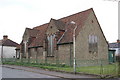
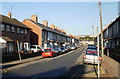
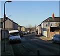
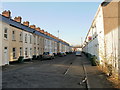
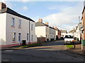
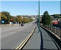
Photos of NP9 0WT


Area Information
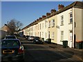
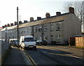
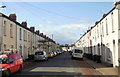
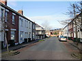
Living in NP9 0WT offers a quiet residential experience within a specific cluster of homes in Wales. This postcode covers a small group of properties with a total population of 1,695 people. You will find a community that is less about dense urban energy and more about settled neighbourhood living. The area provides a distinct break from the busy city centre while remaining accessible to key local hubs. Daily life here revolves around a manageable scale where residents know their surroundings well. The environment is defined by its domestic character rather than commercial vibrancy. You can expect a peaceful atmosphere suited to those who value stability and low noise levels. The location strikes a balance between seclusion and convenience without the chaos of larger districts. This locality serves as a practical base for those working nearby or relying on excellent public transport links. Connectivity to Newport and other transport hubs is a central feature of daily routines here. The area does not boast massive shopping centres or large parks within its immediate borders, but the nearby network supports a well-rounded existence. Homes in NP9 0WT appeal to buyers seeking a calm backdrop for country life with modern infrastructure. The distinctiveness of the area comes from its size and the focus on housing rather than commercial development. You are living in a precise pocket of Wales where every street contributes to the overall tranquility of the community.
- Area Type
- Postcode
- Area Size
- Not available
- Population
- 1695
- Population Density
- 6978 people/km²
The property market in NP9 0WT is characterised by a high rate of home ownership which defines the area. With 49% of residents owning their homes, this postcode stands out as a stable pocket of real estate rather than a transient rental hub. Most homes in NP9 0WT are houses, creating a landscape dominated by private detached or semi-detached properties rather than flats or high-rise apartments. This housing stock appeals to buyers who prioritise space, gardens, and independence over urban density. The predominance of houses suggests that the area has been developed for families or individuals seeking to settle down in a quiet environment. You will not find the smaller, apartment-style living options typically found in city centres here. The market reflects a shift towards long-term tenure where owners invest in their individual properties rather than the local authority or landlords managing the stock. This structure benefits residents who value control over their living space and the ability to customise their homes without consent issues. The housing landscape in this specific residential cluster remains consistent with the preference for traditional family homes found across many parts of Wales.
House Prices in NP9 0WT
No properties found in this postcode.
Energy Efficiency in NP9 0WT
Daily life in NP9 0WT benefits from a well-established network of amenities within practical reach. You have easy access to five retail locations, including a Spar, Morrisons Somerton, and a Co-op Somerton. These shops provide essential groceries and daily necessities without requiring long drives to the city. Transport links are equally convenient with five rail stations nearby, including Newport Railway Station, Pye Corner Railway Station, and Rogerstone Railway Station. You can commute to Newport quickly or explore other parts of the region by train. One ferry terminal, the Newport Ferry Terminal, is also within reach, offering additional travel options for longer journeys. While you may not find large leisure parks or theatres directly inside the postcode boundaries, the surrounding area supports a busy commercial life just steps away from your front door. The combination of supermarkets, train stations, and ferry access creates a lifestyle that balances convenience with simplicity. Living in NP9 0WT means you can walk to shops and catch a train without leaving the county.
Amenities
Schools
Families considering NP9 0WT have access to two primary educational institutions located nearby. The nearest schools are St Andrew's Junior School and St Andrew's Infant School. Both institutions are classified as 'other' types rather than community, voluntary aided, or foundation schools, which indicates a specific funding or governance structure common in certain Welsh areas. St Andrew's Junior School handles children in later primary years, while St Andrew's Infant School educates younger pupils. This split arrangement ensures continuous care for children as they grow, meaning you do not need to navigate the transition to secondary education within this immediate locality. The presence of both infant and junior sections right here supports young families who value convenience and shorter commutes. While specific Ofsted ratings or inspection dates are not included in the current data, the availability of these two schools provides a solid educational foundation for residents. Parents in this postcode enjoy the benefit of having dedicated educational facilities on their doorstep.
| Rank | School | Type | Entry gender | Ages |
|---|
Explore more schools in this area
Go to Schools tabDemographics
The community inNP9 0WT is defined by a mature population with a median age of 47 years. Adults between the ages of 30 and 64 represent the most common age range in this neighbourhood. This demographic profile suggests an area populated by established households rather than young families or retirees. Nearly half of the residents, accounting for 49% of the total population, own their homes outright. The remaining residents likely live in rented properties or shared arrangements, contributing to a mixed but stable household structure. Houses form the predominant accommodation type, reinforcing the character of a traditional suburban settlement. The area reflects a clear preference for private property ownership among long-term residents. Most inhabitants in this postcode fall into the white ethnic group, creating a culturally familiar neighbourhood dynamic. This steady demographic makeup indicates a low rate of turnover and a sense of rootedness within the local streets. Living in NP9 0WT means joining a community where generations have formed deep connections with the land and each other.
Household Size
Accommodation Type
Tenure
Ethnic Group
Religion
Household Composition
Age
Household Deprivation
NS-SEC
Explore more demographic insights in this area
Go to Demographics tabPlanning
Planning Constraints
- Flood RiskPremium
- Ramsar Wetland SitesPremium
- Area of Outstanding Natural BeautyPremium
- Protected Nature ReservePremium
- Protected WoodlandPremium
- Crime RiskPremium