Area Overview for NP26 3AG
Photos of NP26 3AG
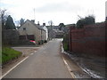
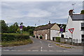
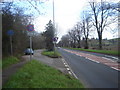
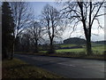
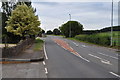
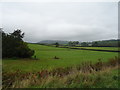

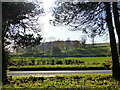
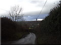
31 photos from this area
Area Information
Key information about the NP26 3AG including its size, population, and administrative classification.
- Area Type
- Postcode
- Area Size
- 10.0 hectares
- Population
- 1107
- Population Density
- 71 people/km²
House Prices in NP26 3AG
36
Properties
£341,481
Average Sold Price
£82,250
Lowest Price
£585,000
Highest Price
Showing 36 properties
| Address | Type | Beds | Baths | Last Sale Price | Last Sale Date | |
|---|---|---|---|---|---|---|
| Sintra, 7 Seymour Avenue, Parc Seymour, Newport, NP26 3AG | Detached | 4 | 2 | £465,000 | Apr 2025 | |
| 13 Seymour Avenue, Parc Seymour, Newport, NP26 3AG | Semi-detached | 3 | 1 | £360,000 | Dec 2022 | |
| 6 Seymour Avenue, Parc Seymour, Newport, NP26 3AG | Bungalow | - | - | £495,000 | Mar 2022 | |
| The Birches, 30 Seymour Avenue, Parc Seymour, Newport, NP26 3AG | Detached | 5 | 3 | £585,000 | Mar 2022 | |
| 34 Seymour Avenue, Parc Seymour, Newport, NP26 3AG | Detached | 4 | 3 | £520,000 | Feb 2022 | |
| Red Ceders, 27 Seymour Avenue, Parc Seymour, Newport, NP26 3AG | Bungalow | 4 | 2 | £470,000 | Aug 2021 | |
| 3 Seymour Avenue, Parc Seymour, Newport, NP26 3AG | Bungalow | 4 | 2 | £408,000 | Nov 2016 | |
| Bermudez, 9 Seymour Avenue, Parc Seymour, Newport, NP26 3AG | Bungalow | 2 | 2 | £250,000 | Jun 2016 | |
| Kerinyagga, 23 Seymour Avenue, Parc Seymour, Newport, NP26 3AG | Detached | - | - | £350,000 | Mar 2014 | |
| Fairacres, 12 Seymour Avenue, Parc Seymour, Newport, NP26 3AG | Detached | - | - | £202,000 | May 2006 |
Page 1 of 4
Energy Efficiency in NP26 3AG
Amenities
Schools
| Rank | School | Type | Entry gender | Ages |
|---|
Explore more schools in this area
Go to Schools tabDemographics
Household Size
Two person
most common
Accommodation Type
Houses
most common
Tenure
88
majority
Ethnic Group
White
most common
Religion
N/A
most common
Household Composition
N/A
most common
Age
47
median
Adults (30-64 years)
most common
Household Deprivation
N/A
with no deprivation
NS-SEC
48
in Lower managerial occupations
Explore more demographic insights in this area
Go to Demographics tabPlanning
Planning Constraints
- Flood RiskPremium
- Ramsar Wetland SitesPremium
- Area of Outstanding Natural BeautyPremium
- Protected Nature ReservePremium
- Protected WoodlandPremium
- Crime RiskPremium