Area Overview for NP20 7RA
Photos of NP20 7RA

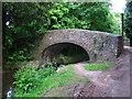
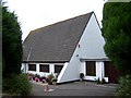
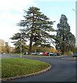
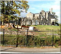
100 photos from this area
Area Information
Key information about the NP20 7RA including its size, population, and administrative classification.
- Area Type
- Postcode
- Area Size
- 1.7 hectares
- Population
- 1205
- Population Density
- 753 people/km²
House Prices in NP20 7RA
59
Properties
£121,405
Average Sold Price
£23,250
Lowest Price
£200,000
Highest Price
Showing 59 properties
| Address | Type | Beds | Baths | Last Sale Price | Last Sale Date | |
|---|---|---|---|---|---|---|
| 115 Mill Heath, Bettws, Newport, NP20 7RA | Semi-detached | 3 | 1 | £192,500 | Mar 2025 | |
| 85 Mill Heath, Bettws, Newport, NP20 7RA | Semi-detached | 3 | 1 | £200,000 | Dec 2024 | |
| 97 Mill Heath, Bettws, Newport, NP20 7RA | Terraced | 2 | 1 | £160,000 | May 2024 | |
| 31 Mill Heath, Bettws, Newport, NP20 7RA | Semi-detached | 3 | 1 | £197,000 | Mar 2024 | |
| 95 Mill Heath, Bettws, Newport, NP20 7RA | Terraced | 2 | 1 | £167,000 | Jun 2023 | |
| 41 Mill Heath, Bettws, Newport, NP20 7RA | house | - | - | £170,000 | Feb 2023 | |
| 53 Mill Heath, Bettws, Newport, NP20 7RA | Semi-detached | 3 | 1 | £175,000 | Jun 2022 | |
| 63 Mill Heath, Bettws, Newport, NP20 7RA | house | - | - | £190,000 | Sep 2021 | |
| 11 Mill Heath, Bettws, Newport, NP20 7RA | house | - | - | £170,550 | Aug 2021 | |
| 81 Mill Heath, Bettws, Newport, NP20 7RA | house | 3 | 1 | £148,000 | Jan 2020 |
Page 1 of 6
Energy Efficiency in NP20 7RA
Amenities
Schools
| Rank | School | Type | Entry gender | Ages |
|---|
Explore more schools in this area
Go to Schools tabDemographics
Household Size
Family (3-5 people)
most common
Accommodation Type
Houses
most common
Tenure
70
majority
Ethnic Group
White
most common
Religion
N/A
most common
Household Composition
N/A
most common
Age
47
median
Adults (30-64 years)
most common
Household Deprivation
N/A
with no deprivation
NS-SEC
22
in Lower managerial occupations
Explore more demographic insights in this area
Go to Demographics tabPlanning
Planning Constraints
- Flood RiskPremium
- Ramsar Wetland SitesPremium
- Area of Outstanding Natural BeautyPremium
- Protected Nature ReservePremium
- Protected WoodlandPremium
- Crime RiskPremium