Area Overview for NP20 5PF
Photos of NP20 5PF

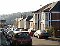
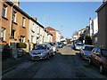
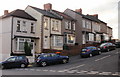
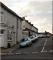
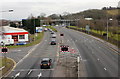
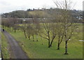
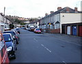
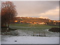
100 photos from this area
Area Information
Key information about the NP20 5PF including its size, population, and administrative classification.
- Area Type
- Postcode
- Area Size
- 8508 m²
- Population
- 1412
- Population Density
- 6818 people/km²
House Prices in NP20 5PF
36
Properties
£94,210
Average Sold Price
£23,500
Lowest Price
£182,000
Highest Price
Showing 36 properties
| Address | Type | Beds | Baths | Last Sale Price | Last Sale Date | |
|---|---|---|---|---|---|---|
| 111 Goodrich Crescent, Newport, NP20 5PF | house | - | - | £165,000 | Aug 2025 | |
| 85 Goodrich Crescent, Newport, NP20 5PF | Terraced | 3 | 1 | £157,000 | Aug 2025 | |
| 107 Goodrich Crescent, Newport, NP20 5PF | house | - | - | £133,000 | May 2025 | |
| 99 Goodrich Crescent, Newport, NP20 5PF | house | - | - | £130,000 | May 2023 | |
| 81 Goodrich Crescent, Newport, NP20 5PF | house | - | - | £182,000 | Oct 2022 | |
| 121 Goodrich Crescent, Newport, NP20 5PF | house | - | - | £110,000 | Aug 2022 | |
| 127 Goodrich Crescent, Newport, NP20 5PF | Terraced | 2 | 1 | £142,000 | Mar 2022 | |
| 131 Goodrich Crescent, Newport, NP20 5PF | Terraced | 2 | 1 | £112,000 | Mar 2021 | |
| 129 Goodrich Crescent, Newport, NP20 5PF | house | - | - | £131,500 | Jun 2019 | |
| 133 Goodrich Crescent, Newport, NP20 5PF | house | - | - | £103,000 | Mar 2019 |
Page 1 of 4
Energy Efficiency in NP20 5PF
Amenities
Schools
| Rank | School | Type | Entry gender | Ages |
|---|
Explore more schools in this area
Go to Schools tabDemographics
Household Size
Two person
most common
Accommodation Type
Houses
most common
Tenure
72
majority
Ethnic Group
White
most common
Religion
N/A
most common
Household Composition
N/A
most common
Age
47
median
Adults (30-64 years)
most common
Household Deprivation
N/A
with no deprivation
NS-SEC
30
in Lower managerial occupations
Explore more demographic insights in this area
Go to Demographics tabPlanning
Planning Constraints
- Flood RiskPremium
- Ramsar Wetland SitesPremium
- Area of Outstanding Natural BeautyPremium
- Protected Nature ReservePremium
- Crime RiskPremium