Area Overview for NP20 5LZ
Photos of NP20 5LZ

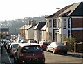
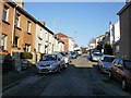
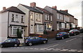
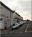
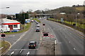
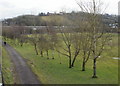
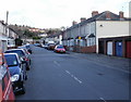
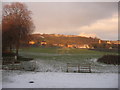
100 photos from this area
Area Information
Key information about the NP20 5LZ including its size, population, and administrative classification.
- Area Type
- Postcode
- Area Size
- 8649 m²
- Population
- 1096
- Population Density
- 2802 people/km²
House Prices in NP20 5LZ
40
Properties
£116,728
Average Sold Price
£65,000
Lowest Price
£181,000
Highest Price
Showing 40 properties
| Address | Type | Beds | Baths | Last Sale Price | Last Sale Date | |
|---|---|---|---|---|---|---|
| 59 Redland Street, Newport, NP20 5LZ | Terraced | 3 | 1 | £160,000 | Dec 2024 | |
| 31 Redland Street, Newport, NP20 5LZ | house | - | - | £100,000 | Aug 2022 | |
| 62 Redland Street, Newport, NP20 5LZ | Terraced | 2 | 1 | £138,250 | Aug 2022 | |
| 74 Redland Street, Newport, NP20 5LZ | house | - | - | £137,000 | Jul 2022 | |
| 36 Redland Street, Newport, NP20 5LZ | house | 2 | 1 | £144,000 | Apr 2022 | |
| 70 Redland Street, Newport, NP20 5LZ | house | - | - | £110,000 | Apr 2022 | |
| 49 Redland Street, Newport, NP20 5LZ | house | 3 | 1 | £181,000 | Aug 2021 | |
| 46 Redland Street, Newport, NP20 5LZ | Terraced | 2 | 2 | £120,000 | Jun 2021 | |
| 35 Redland Street, Newport, NP20 5LZ | Terraced | 3 | 1 | £116,000 | May 2020 | |
| 63 Redland Street, Newport, NP20 5LZ | Terraced | 5 | 2 | £175,000 | Dec 2019 |
Page 1 of 4
Energy Efficiency in NP20 5LZ
Amenities
Schools
| Rank | School | Type | Entry gender | Ages |
|---|
Explore more schools in this area
Go to Schools tabDemographics
Household Size
Two person
most common
Accommodation Type
Houses
most common
Tenure
76
majority
Ethnic Group
White
most common
Religion
N/A
most common
Household Composition
N/A
most common
Age
47
median
Adults (30-64 years)
most common
Household Deprivation
N/A
with no deprivation
NS-SEC
28
in Lower managerial occupations
Explore more demographic insights in this area
Go to Demographics tabPlanning
Planning Constraints
- Flood RiskPremium
- Ramsar Wetland SitesPremium
- Area of Outstanding Natural BeautyPremium
- Protected Nature ReservePremium
- Protected WoodlandPremium
- Crime RiskPremium