Area Overview for NP20 5HD
Photos of NP20 5HD


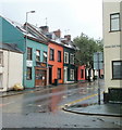
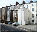
100 photos from this area
Area Information
Key information about the NP20 5HD including its size, population, and administrative classification.
- Area Type
- Postcode
- Area Size
- 8307 m²
- Population
- Not available
- Population Density
- Not available
House Prices in NP20 5HD
23
Properties
£235,900
Average Sold Price
£80,000
Lowest Price
£380,000
Highest Price
Showing 23 properties
| Address | Type | Beds | Baths | Last Sale Price | Last Sale Date | |
|---|---|---|---|---|---|---|
| 7 St Marks Crescent, Newport, NP20 5HD | Terraced | 5 | 2 | £340,000 | Sep 2023 | |
| 16 St Marks Crescent, Newport, NP20 5HD | house | - | - | £282,500 | Feb 2021 | |
| 3 St Marks Crescent, Newport, NP20 5HD | house | - | - | £380,000 | Feb 2021 | |
| 14 St Marks Crescent, Newport, NP20 5HD | Detached | 4 | 2 | £375,000 | Feb 2020 | |
| 1 St Marks Crescent, Newport, NP20 5HD | house | 1 | - | £295,000 | Dec 2019 | |
| 15 St Marks Crescent, Newport, NP20 5HD | Flat | 2 | 1 | £154,000 | Sep 2019 | |
| 13 St Marks Crescent, Newport, NP20 5HD | house | - | - | £230,000 | May 2016 | |
| 2 St Marks Crescent, Newport, NP20 5HD | house | - | - | £242,000 | Nov 2015 | |
| 19 St Marks Crescent, Newport, NP20 5HD | house | - | - | £220,000 | Dec 2014 | |
| 4 St Marks Crescent, Newport, NP20 5HD | house | - | - | £241,000 | Nov 2014 |
Page 1 of 3
Energy Efficiency in NP20 5HD
Amenities
Schools
| Rank | School | Type | Entry gender | Ages |
|---|
Explore more schools in this area
Go to Schools tabDemographics
Household Size
One person
most common
Accommodation Type
Houses
most common
Tenure
63
majority
Ethnic Group
White
most common
Religion
N/A
most common
Household Composition
N/A
most common
Age
47
median
Adults (30-64 years)
most common
Household Deprivation
N/A
with no deprivation
NS-SEC
41
in Lower managerial occupations
Explore more demographic insights in this area
Go to Demographics tabPlanning
Planning Constraints
- Flood RiskPremium
- Ramsar Wetland SitesPremium
- Area of Outstanding Natural BeautyPremium
- Protected Nature ReservePremium
- Protected WoodlandPremium
- Crime RiskPremium