Area Overview for NP20 4TU
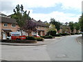
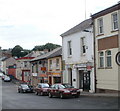
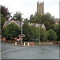
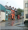
Photos of NP20 4TU


Area Information
NP20 4TU is a specific postcode covering a small residential cluster within Wales. This compact area spans only 1,277 square metres and houses 1,519 people. Living in NP20 4TU means residing in a dense environment where space is at a premium. The population density reaches 1,189,164 people per square kilometre, which creates a highly concentrated living experience for the community. Residents enjoy the benefits of a tight-knit neighbourhood while maintaining significant proximity to wider Newport facilities. This postcode serves as a distinct point on the map for those seeking homes in an established part of town. Daily life here is defined by the close quarters and the active presence of neighbours within this small footprint.
- Area Type
- Postcode
- Area Size
- 1277 m²
- Population
- Not available
- Population Density
- Not available
The property market in NP20 4TU is characterised by a significant owner-occupier presence. With 63% of the population owning their homes, the area functions primarily as an established residential zone rather than a transient rental market. The predominant accommodation type consists of houses, which aligns with the preference for traditional family living spaces found throughout Newport. This concentration of owner-occupied properties often implies a neighbourhood with long-term residents who have invested heavily in their local streets. Buyers looking at NP20 4TU should expect a stock composed mainly of detached or semi-detached dwellings. The small total area of 1,277 square metres limits the overall volume of housing available within this specific postcode boundary. Consequently, purchasing a home in NP20 4TU typically involves finding properties within a broader NP20 search radius, as the specific gatecode covers only a limited cluster of residences.
House Prices in NP20 4TU
Showing 1 properties
| Address | Type | Beds | Baths | Last Sale Price | Last Sale Date | |
|---|---|---|---|---|---|---|
| Gwent Healthcare Nhs Trust, Clytha Dental Practice, 26 Clytha Park Road, Newport, NP20 4TU | commercial | - | - | - | - |
Energy Efficiency in NP20 4TU
Residents of NP20 4TU have access to a variety of retail, transport, and leisure facilities within practical reach. Five major retail options are available nearby, including Tesco Clytha, Tesco Newport, and Asda Stow. These supermarkets provide necessities without requiring a long journey into city centres. For commuters, five railway stations are situated close by, with Newport Railway Station being the most prominent hub for regional travel. The area also offers maritime access through Newport Ferry Terminal, which is a unique amenity for residents seeking short-sea trips. This blend of shopping giants and transport hubs means daily errands and long-distance travel are both manageable from this postcode. You can run errands at the local Tesco or catch a train from Newport Railway Station for work or leisure. The proximity of these specific names demonstrates a convenient lifestyle centred on established commercial and transport corridors.
Amenities
Schools
Queen's Hill PRU stands as the primary educational institution immediately adjacent to NP20 4TU. This facility operates as a special school for pupils with complex needs, a designation that differs from standard primary or secondary academies. As a designated 'other' type school, it provides specific support rather than mainstream education for the general student population. Living in NP20 4TU places families near this specialised learning environment. No other mainstream schools with listed Ofsted ratings appear in the immediate vicinity data for this specific postcode. Parents considering this location must factor in the distance to nearby mainstream secondary schools in Newport or mentioned transport hubs like Newport Railway Station, which likely provide access to a wider range of state schools not explicitly listed for this immediate plot. The presence of Queen's Hill PRU ensures specialist care is available locally for those requiring it.
| Rank | School | Type | Entry gender | Ages |
|---|
Explore more schools in this area
Go to Schools tabDemographics
The community in NP20 4TU reflects a mature demographic profile. The median age stands at 47 years, indicating that the most common age range comprises adults between 30 and 64 years old. This suggests the area attracts families and professionals in their prime earning years rather than young singles or elderly retirees alone. Homeownership is strong, with 63% of residents owning their properties outright or with a mortgage. The remaining residents likely rent from private landlords or social housing providers. Almost all homes in NP20 4TU are traditional houses, distinguishing the accommodation type from flats or purpose-built apartments common in denser urban cores. The predominant ethnic group is White, mirroring the broader demographic trends of rural and semi-rural Wales. These figures confirm a stable, settled population with deep roots in the local housing market.
Household Size
Accommodation Type
Tenure
Ethnic Group
Religion
Household Composition
Age
Household Deprivation
NS-SEC
Explore more demographic insights in this area
Go to Demographics tabPlanning
Planning Constraints
- Flood RiskPremium
- Ramsar Wetland SitesPremium
- Area of Outstanding Natural BeautyPremium
- Protected Nature ReservePremium
- Protected WoodlandPremium
- Crime RiskPremium