Area Overview for NP20 4JT
Photos of NP20 4JT

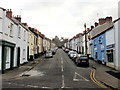
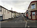
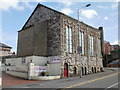
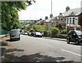


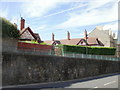
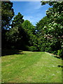
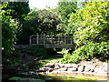
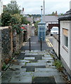
100 photos from this area
Area Information
Key information about the NP20 4JT including its size, population, and administrative classification.
- Area Type
- Postcode
- Area Size
- 9072 m²
- Population
- 1462
- Population Density
- 5251 people/km²
House Prices in NP20 4JT
28
Properties
£193,981
Average Sold Price
£48,000
Lowest Price
£360,000
Highest Price
Showing 28 properties
| Address | Type | Beds | Baths | Last Sale Price | Last Sale Date | |
|---|---|---|---|---|---|---|
| 70 Bryngwyn Road, Newport, NP20 4JT | Retail | 4 | 1 | £281,320 | May 2022 | |
| 42 Bryngwyn Road, Newport, NP20 4JT | house | - | - | £360,000 | Jan 2021 | |
| 74 Bryngwyn Road, Newport, NP20 4JT | Terraced | 4 | 2 | £269,950 | Aug 2018 | |
| 68 Bryngwyn Road, Newport, NP20 4JT | Terraced | 4 | 2 | £225,000 | Nov 2015 | |
| 72 Bryngwyn Road, Newport, NP20 4JT | house | - | - | £205,000 | Jun 2014 | |
| 58 Bryngwyn Road, Newport, NP20 4JT | Detached | 1 | - | £244,000 | Dec 2013 | |
| 56 Bryngwyn Road, Newport, NP20 4JT | Semi-detached | 4 | - | £250,000 | Dec 2012 | |
| 54 Bryngwyn Road, Newport, NP20 4JT | house | - | - | £190,000 | Nov 2008 | |
| 48 Bryngwyn Road, Newport, NP20 4JT | Semi-detached | - | - | £109,000 | May 2002 | |
| 40 Bryngwyn Road, Newport, NP20 4JT | Flat | - | - | £48,000 | Apr 2001 |
Page 1 of 3
Energy Efficiency in NP20 4JT
Amenities
Schools
| Rank | School | Type | Entry gender | Ages |
|---|
Explore more schools in this area
Go to Schools tabDemographics
Household Size
One person
most common
Accommodation Type
Houses
most common
Tenure
62
majority
Ethnic Group
White
most common
Religion
N/A
most common
Household Composition
N/A
most common
Age
47
median
Adults (30-64 years)
most common
Household Deprivation
N/A
with no deprivation
NS-SEC
33
in Lower managerial occupations
Explore more demographic insights in this area
Go to Demographics tabPlanning
Planning Constraints
- Flood RiskPremium
- Ramsar Wetland SitesPremium
- Area of Outstanding Natural BeautyPremium
- Protected Nature ReservePremium
- Protected WoodlandPremium
- Crime RiskPremium