Area Overview for NP20 3PZ
Photos of NP20 3PZ
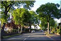
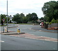
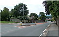
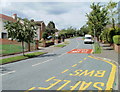

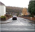
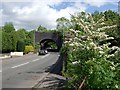
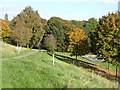
100 photos from this area
Area Information
Key information about the NP20 3PZ including its size, population, and administrative classification.
- Area Type
- Postcode
- Area Size
- 5.5 hectares
- Population
- 1407
- Population Density
- 1202 people/km²
House Prices in NP20 3PZ
24
Properties
£179,200
Average Sold Price
£80,000
Lowest Price
£295,000
Highest Price
Showing 24 properties
| Address | Type | Beds | Baths | Last Sale Price | Last Sale Date | |
|---|---|---|---|---|---|---|
| 211 Bassaleg Road, Newport, NP20 3PZ | Semi-detached | 3 | 1 | £265,000 | May 2025 | |
| 219 Bassaleg Road, Newport, NP20 3PZ | Semi-detached | 3 | 2 | £210,000 | May 2024 | |
| 193 Bassaleg Road, Newport, NP20 3PZ | Detached | 3 | 2 | £290,000 | Oct 2022 | |
| 207 Bassaleg Road, Newport, NP20 3PZ | Semi-detached | 3 | 1 | £295,000 | Mar 2022 | |
| 205 Bassaleg Road, Newport, NP20 3PZ | house | 3 | - | £247,500 | Nov 2020 | |
| 217 Bassaleg Road, Newport, NP20 3PZ | Detached | 3 | 1 | £215,000 | Feb 2020 | |
| 183 Bassaleg Road, Newport, NP20 3PZ | Semi-detached | 3 | 2 | £220,000 | Apr 2019 | |
| 215 Bassaleg Road, Newport, NP20 3PZ | Semi-detached | 3 | - | £183,000 | Nov 2017 | |
| 181 Bassaleg Road, Newport, NP20 3PZ | house | - | - | £139,000 | May 2016 | |
| 203 Bassaleg Road, Newport, NP20 3PZ | house | 3 | 1 | £225,000 | Mar 2016 |
Page 1 of 3
Energy Efficiency in NP20 3PZ
Amenities
Schools
| Rank | School | Type | Entry gender | Ages |
|---|
Explore more schools in this area
Go to Schools tabDemographics
Household Size
Family (3-5 people)
most common
Accommodation Type
Houses
most common
Tenure
64
majority
Ethnic Group
White
most common
Religion
N/A
most common
Household Composition
N/A
most common
Age
47
median
Adults (30-64 years)
most common
Household Deprivation
N/A
with no deprivation
NS-SEC
22
in Lower managerial occupations
Explore more demographic insights in this area
Go to Demographics tabPlanning
Planning Constraints
- Flood RiskPremium
- Ramsar Wetland SitesPremium
- Area of Outstanding Natural BeautyPremium
- Protected Nature ReservePremium
- Protected WoodlandPremium
- Crime RiskPremium