Area Overview for NP20 3JA
Photos of NP20 3JA
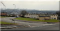
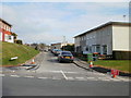
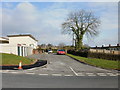
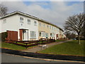
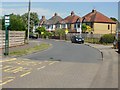
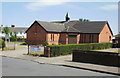
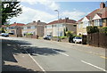
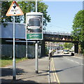
100 photos from this area
Area Information
Key information about the NP20 3JA including its size, population, and administrative classification.
- Area Type
- Postcode
- Area Size
- 1.5 hectares
- Population
- 1407
- Population Density
- 1202 people/km²
House Prices in NP20 3JA
33
Properties
£111,481
Average Sold Price
£41,500
Lowest Price
£201,000
Highest Price
Showing 33 properties
| Address | Type | Beds | Baths | Last Sale Price | Last Sale Date | |
|---|---|---|---|---|---|---|
| 135 Shakespeare Crescent, Newport, NP20 3JA | Flat | - | - | £110,000 | Sep 2023 | |
| 117 Shakespeare Crescent, Newport, NP20 3JA | Flat | 2 | 1 | £128,000 | Feb 2023 | |
| 91 Shakespeare Crescent, Newport, NP20 3JA | Semi-detached | 3 | 1 | £201,000 | Jun 2022 | |
| 95 Shakespeare Crescent, Newport, NP20 3JA | Retail | 3 | 2 | £201,000 | Jun 2022 | |
| 79 Shakespeare Crescent, Newport, NP20 3JA | house | - | - | £175,000 | Jun 2021 | |
| 63 Shakespeare Crescent, Newport, NP20 3JA | house | - | - | £140,000 | Mar 2020 | |
| 119 Shakespeare Crescent, Newport, NP20 3JA | Flat | - | - | £82,000 | Sep 2015 | |
| 125 Shakespeare Crescent, Newport, NP20 3JA | Flat | 2 | 1 | £85,000 | Apr 2006 | |
| 137 Shakespeare Crescent, Newport, NP20 3JA | Flat | 2 | 1 | £75,000 | Mar 2006 | |
| 129 Shakespeare Crescent, Newport, NP20 3JA | Flat | - | - | £88,250 | Dec 2004 |
Page 1 of 4
Energy Efficiency in NP20 3JA
Amenities
Schools
| Rank | School | Type | Entry gender | Ages |
|---|
Explore more schools in this area
Go to Schools tabDemographics
Household Size
Family (3-5 people)
most common
Accommodation Type
Houses
most common
Tenure
64
majority
Ethnic Group
White
most common
Religion
N/A
most common
Household Composition
N/A
most common
Age
47
median
Adults (30-64 years)
most common
Household Deprivation
N/A
with no deprivation
NS-SEC
22
in Lower managerial occupations
Explore more demographic insights in this area
Go to Demographics tabPlanning
Planning Constraints
- Flood RiskPremium
- Ramsar Wetland SitesPremium
- Area of Outstanding Natural BeautyPremium
- Protected Nature ReservePremium
- Protected WoodlandPremium
- Crime RiskPremium