Area Overview for NP20 3HT
Photos of NP20 3HT


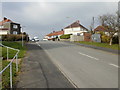


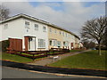
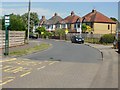

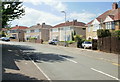

100 photos from this area
Area Information
Key information about the NP20 3HT including its size, population, and administrative classification.
- Area Type
- Postcode
- Area Size
- 2.5 hectares
- Population
- 1656
- Population Density
- 4613 people/km²
House Prices in NP20 3HT
46
Properties
£80,589
Average Sold Price
£32,000
Lowest Price
£124,000
Highest Price
Showing 46 properties
| Address | Type | Beds | Baths | Last Sale Price | Last Sale Date | |
|---|---|---|---|---|---|---|
| 141 Gaer Vale, Newport, NP20 3HT | house | - | - | £110,000 | Feb 2019 | |
| 123 Gaer Vale, Newport, NP20 3HT | Flat | - | - | £75,500 | May 2017 | |
| 118 Gaer Vale, Newport, NP20 3HT | Flat | 2 | 1 | £70,000 | Jul 2016 | |
| 121 Gaer Vale, Newport, NP20 3HT | Flat | - | - | £92,500 | May 2007 | |
| 109 Gaer Vale, Newport, NP20 3HT | Terraced | - | - | £86,300 | Jun 2006 | |
| 138 Gaer Vale, Newport, NP20 3HT | Terraced | - | - | £124,000 | May 2006 | |
| 139 Gaer Vale, Newport, NP20 3HT | house | - | - | £98,000 | Jun 2004 | |
| 122 Gaer Vale, Newport, NP20 3HT | Flat | - | - | £37,000 | Jun 2002 | |
| 140 Gaer Vale, Newport, NP20 3HT | house | - | - | £32,000 | Mar 1998 | |
| 129 Gaer Vale, Newport, NP20 3HT | Flat | 2 | 1 | - | - |
Page 1 of 5
Energy Efficiency in NP20 3HT
Amenities
Schools
| Rank | School | Type | Entry gender | Ages |
|---|
Explore more schools in this area
Go to Schools tabDemographics
Household Size
One person
most common
Accommodation Type
Houses
most common
Tenure
44
majority
Ethnic Group
White
most common
Religion
N/A
most common
Household Composition
N/A
most common
Age
47
median
Adults (30-64 years)
most common
Household Deprivation
N/A
with no deprivation
NS-SEC
23
in Lower managerial occupations
Explore more demographic insights in this area
Go to Demographics tabPlanning
Planning Constraints
- Flood RiskPremium
- Ramsar Wetland SitesPremium
- Area of Outstanding Natural BeautyPremium
- Protected Nature ReservePremium
- Protected WoodlandPremium
- Crime RiskPremium