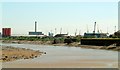
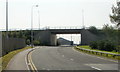
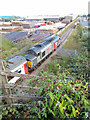
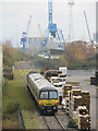
Area Overview for NP20 2WA
Photos of NP20 2WA


Area Information
NP20 2WA is a specific residential cluster located in Wales, covering an area of 3.5 hectares. The population stands at 2,724 people, creating a tightly knit community with a density of 624 people per square kilometre. This postcode defines a small, contained living space where residents experience a localized way of life. You will find that daily routines here revolve around immediate neighbours rather than the sprawling suburbs found in larger metropolitan zones. The area functions as a distinct residential unit, offering a sense of proximity that defines the local character. For those considering living in NP20 2WA, the environment presents a straightforward residential focus. The compact nature of the 3.5-hectare site means that destinations are often within a short walk or drive. You are looking at a defined neighbourhood where the boundaries of your postal code reflect the physical limits of the housing estate. This concentration allows for a shared sense of place among the 2,724 households. When you visit homes in NP20 2WA, the experience is of a settled, contained community. The area serves as a specific node for families and long-term residents who prefer a concentrated living environment over dispersed urban sprawl.
- Area Type
- Postcode
- Area Size
- 3.5 hectares
- Population
- 2724
- Population Density
- 624 people/km²
The property market in NP20 2WA is characterised by owner-occupation, with 73% of the 2,724 population owning their homes. This statistic suggests a stable market where residents tend to stay put rather than moving frequently. The accommodation type data confirms that houses predominate over flats, meaning the landscape consists of standalone or semi-detached properties typical of a suburb or village setting. When looking at homes in NP20 2WA, expect to find traditional housing stock designed for families rather than high-density apartment blocks. Because the vast majority of residents are owners, the pressure on the rental market from this specific postcode is likely low. Buyers entering this area will face a market driven by owners looking to stay or trade up, rather than landlords seeking short-term returns. The area size of 3.5 hectares limits the total volume of properties, which can sometimes limit competition but may also restrict availability. If you are considering buying in NP20 2WA, you are entering an owner-occupied environment where property values may reflect long-term investment rather than speculative building. The high percentage of owner-occupiers often implies that the local identity is tied deeply to specific properties, creating a stable and predictable market dynamic for serious buyers.
House Prices in NP20 2WA
Showing 1 properties
| Address | Type | Beds | Baths | Last Sale Price | Last Sale Date | |
|---|---|---|---|---|---|---|
| Finnforest, 9 North Dock Road, Alexandra Docks, Newport, NP20 2WA | office_workshop | - | - | - | - |
Energy Efficiency in NP20 2WA
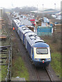
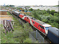
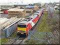
Residents of NP20 2WA benefit from a range of amenities within practical reach of their 3.5-hectare homes. Retail options include Iceland Newport, Tesco Newport, and Lidl Newport, which covers daily shopping needs from groceries to household essentials. With five shops in the immediate vicinity, you have quick access to supermarkets without needing to travel long distances. For travel planning, four rail stations including Newport Railway Station, Pye Corner Railway Station, and Rogerstone Railway Station are nearby, offering flexible commuting choices if you do not own a car. Water transport is also an option, with the Newport Ferry Terminal located close by for those needing ferry services. This diversity in transport and retail ensures that lifestyle choices in NP20 2WA are well-supported by local infrastructure. The presence of Iceland, Tesco, and Lidl means you can complete weekly shop runs conveniently. Combined with the rail network, the area houses the practical necessities for a self-sufficient household. When you consider living in NP20 2WA, you are choosing an area where the nearest amenities are not just abstract data points but tangible services you can use today. The specific inclusion of named stations and supermarkets grounds the lifestyle in reality, confirming that your daily needs are met by established venues like Newport Railway Station and the local retail parks.
Amenities
Schools
| Rank | School | Type | Entry gender | Ages |
|---|
Explore more schools in this area
Go to Schools tabDemographics
The community within NP20 2WA reflects a mature, stable population. The median age is 47 years, and adults between 30 and 64 years represent the most common age range. This demographic profile indicates a neighbourhood dominated by established families and those in the middle stages of their careers. You will find that the social fabric is built largely on this central adult cohort. Housing tenure shows a clear pattern of long-term settlement, with 73% of residents owning their homes. Such a high ownership rate typically correlates with higher stability and lower turnover compared to rental-heavy districts. The accommodation type is overwhelmingly dominated by houses, which aligns with the family-oriented age profile. Regarding diversity, the predominant ethnic group is White, meaning the area shares cultural characteristics common across much of rural and suburban Wales. While the population is homogenous in broad terms, the specific mix within the 2724 households forms a traditional community structure. A median age of 47 suggests that you will encounter neighbours who have likely raised children locally and are now focusing on later life or retirement planning in this specific postcode. The demographic data confirms that NP20 2WA is a place for established living rather than student housing or transient rentals.
Household Size
Accommodation Type
Tenure
Ethnic Group
Religion
Household Composition
Age
Household Deprivation
NS-SEC
Explore more demographic insights in this area
Go to Demographics tabPlanning
Planning Constraints
- Flood RiskPremium
- Ramsar Wetland SitesPremium
- Area of Outstanding Natural BeautyPremium
- Protected Nature ReservePremium
- Protected WoodlandPremium
- Crime RiskPremium