Area Overview for NP19 9TA
Photos of NP19 9TA
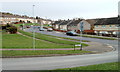
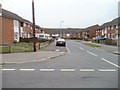

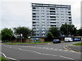
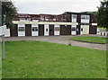

50 photos from this area
Area Information
Key information about the NP19 9TA including its size, population, and administrative classification.
- Area Type
- Postcode
- Area Size
- 2.2 hectares
- Population
- Not available
- Population Density
- Not available
House Prices in NP19 9TA
80
Properties
£152,222
Average Sold Price
£28,000
Lowest Price
£282,500
Highest Price
Showing 80 properties
| Address | Type | Beds | Baths | Last Sale Price | Last Sale Date | |
|---|---|---|---|---|---|---|
| 27 Treberth Avenue, Newport, NP19 9TA | Bungalow | 2 | 1 | £240,000 | Apr 2025 | |
| 25 Treberth Avenue, Newport, NP19 9TA | Bungalow | 2 | 1 | £282,500 | Dec 2024 | |
| 33 Treberth Avenue, Newport, NP19 9TA | Bungalow | 2 | 1 | £220,500 | Feb 2022 | |
| 39 Treberth Avenue, Newport, NP19 9TA | Bungalow | 2 | - | £195,000 | Feb 2020 | |
| 35 Treberth Avenue, Newport, NP19 9TA | Bungalow | 2 | 1 | £190,000 | Jan 2019 | |
| 19 Treberth Avenue, Newport, NP19 9TA | Bungalow | 2 | 1 | £150,000 | May 2017 | |
| 51 Treberth Avenue, Newport, NP19 9TA | Bungalow | - | - | £32,000 | Feb 2002 | |
| 170 Treberth Estate, Newport, NP19 9TA | Detached | - | - | £28,000 | Jun 2000 | |
| 52 Treberth Avenue, Newport, NP19 9TA | Bungalow | - | - | £32,000 | Jun 1997 | |
| 28 Treberth Estate, Newport, NP19 9TA | undefined | - | - | - | - |
Page 1 of 8
Energy Efficiency in NP19 9TA
Amenities
Schools
| Rank | School | Type | Entry gender | Ages |
|---|
Explore more schools in this area
Go to Schools tabDemographics
Household Size
One person
most common
Accommodation Type
Houses
most common
Tenure
51
majority
Ethnic Group
White
most common
Religion
N/A
most common
Household Composition
N/A
most common
Age
47
median
Adults (30-64 years)
most common
Household Deprivation
N/A
with no deprivation
NS-SEC
20
in Lower managerial occupations
Explore more demographic insights in this area
Go to Demographics tabPlanning
Planning Constraints
- Flood RiskPremium
- Ramsar Wetland SitesPremium
- Area of Outstanding Natural BeautyPremium
- Protected Nature ReservePremium
- Protected WoodlandPremium
- Crime RiskPremium