Area Overview for NP19 9SY
Photos of NP19 9SY
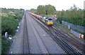
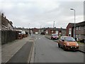
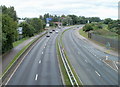


100 photos from this area
Area Information
Key information about the NP19 9SY including its size, population, and administrative classification.
- Area Type
- Postcode
- Area Size
- 1.7 hectares
- Population
- 1321
- Population Density
- 4024 people/km²
House Prices in NP19 9SY
30
Properties
£87,113
Average Sold Price
£18,900
Lowest Price
£200,000
Highest Price
Showing 30 properties
| Address | Type | Beds | Baths | Last Sale Price | Last Sale Date | |
|---|---|---|---|---|---|---|
| 3 Henry Wood Close, Newport, NP19 9SY | Semi-detached | 3 | 1 | £200,000 | Apr 2025 | |
| 4 Henry Wood Close, Newport, NP19 9SY | house | - | - | £155,000 | Jul 2022 | |
| 6 Henry Wood Close, Newport, NP19 9SY | Semi-detached | 3 | 1 | £148,000 | Apr 2022 | |
| 28 Henry Wood Close, Newport, NP19 9SY | house | - | - | £108,000 | Jun 2020 | |
| 17 Henry Wood Close, Newport, NP19 9SY | Semi-detached | 3 | 1 | £87,000 | Jul 2018 | |
| 5 Henry Wood Close, Newport, NP19 9SY | Detached | 3 | 1 | £95,000 | Oct 2015 | |
| 2 Henry Wood Close, Newport, NP19 9SY | Detached | 3 | 1 | £94,750 | Sep 2011 | |
| 14 Henry Wood Close, Newport, NP19 9SY | house | - | - | £97,000 | Sep 2009 | |
| 26 Henry Wood Close, Newport, NP19 9SY | house | - | - | £115,000 | Feb 2006 | |
| 11 Henry Wood Close, Newport, NP19 9SY | Semi-detached | - | - | £24,050 | Apr 2003 |
Page 1 of 3
Energy Efficiency in NP19 9SY
Amenities
Schools
| Rank | School | Type | Entry gender | Ages |
|---|
Explore more schools in this area
Go to Schools tabDemographics
Household Size
Family (3-5 people)
most common
Accommodation Type
Houses
most common
Tenure
64
majority
Ethnic Group
White
most common
Religion
N/A
most common
Household Composition
N/A
most common
Age
47
median
Adults (30-64 years)
most common
Household Deprivation
N/A
with no deprivation
NS-SEC
22
in Lower managerial occupations
Explore more demographic insights in this area
Go to Demographics tabPlanning
Planning Constraints
- Flood RiskPremium
- Ramsar Wetland SitesPremium
- Area of Outstanding Natural BeautyPremium
- Protected Nature ReservePremium
- Protected WoodlandPremium
- Crime RiskPremium