Area Overview for NP19 9RG
Photos of NP19 9RG
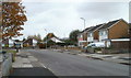
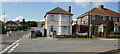
100 photos from this area
Area Information
Key information about the NP19 9RG including its size, population, and administrative classification.
- Area Type
- Postcode
- Area Size
- 8677 m²
- Population
- 1233
- Population Density
- 1987 people/km²
House Prices in NP19 9RG
28
Properties
£87,063
Average Sold Price
£40,000
Lowest Price
£165,000
Highest Price
Showing 28 properties
| Address | Type | Beds | Baths | Last Sale Price | Last Sale Date | |
|---|---|---|---|---|---|---|
| 53 Sullivan Circle, Newport, NP19 9RG | Retail | 3 | 1 | £165,000 | Oct 2022 | |
| 67 Sullivan Circle, Newport, NP19 9RG | Terraced | 3 | 1 | £106,000 | Mar 2018 | |
| 33 Sullivan Circle, Newport, NP19 9RG | Semi-detached | 3 | 1 | £77,000 | Apr 2017 | |
| 35 Sullivan Circle, Newport, NP19 9RG | Semi-detached | - | - | £74,000 | Dec 2009 | |
| 36 Sullivan Circle, Newport, NP19 9RG | house | - | - | £70,000 | Feb 2009 | |
| 71 Sullivan Circle, Newport, NP19 9RG | Terraced | - | - | £84,500 | Dec 2008 | |
| 49 Sullivan Circle, Newport, NP19 9RG | Semi-detached | 3 | 1 | £80,000 | Jun 2004 | |
| 59 Sullivan Circle, Newport, NP19 9RG | house | - | - | £40,000 | May 2003 | |
| 55 Sullivan Circle, Newport, NP19 9RG | house | - | - | - | - | |
| 43 Sullivan Circle, Newport, NP19 9RG | house | - | - | - | - |
Page 1 of 3
Energy Efficiency in NP19 9RG
Amenities
Schools
| Rank | School | Type | Entry gender | Ages |
|---|
Explore more schools in this area
Go to Schools tabDemographics
Household Size
Family (3-5 people)
most common
Accommodation Type
Houses
most common
Tenure
52
majority
Ethnic Group
White
most common
Religion
N/A
most common
Household Composition
N/A
most common
Age
47
median
Adults (30-64 years)
most common
Household Deprivation
N/A
with no deprivation
NS-SEC
15
in Lower managerial occupations
Explore more demographic insights in this area
Go to Demographics tabPlanning
Planning Constraints
- Flood RiskPremium
- Ramsar Wetland SitesPremium
- Area of Outstanding Natural BeautyPremium
- Protected Nature ReservePremium
- Protected WoodlandPremium
- Crime RiskPremium