Area Overview for NP19 9QN
Photos of NP19 9QN


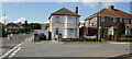
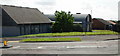
100 photos from this area
Area Information
Key information about the NP19 9QN including its size, population, and administrative classification.
- Area Type
- Postcode
- Area Size
- 8623 m²
- Population
- 1321
- Population Density
- 4024 people/km²
House Prices in NP19 9QN
20
Properties
£146,991
Average Sold Price
£56,950
Lowest Price
£250,000
Highest Price
Showing 20 properties
| Address | Type | Beds | Baths | Last Sale Price | Last Sale Date | |
|---|---|---|---|---|---|---|
| 124 Aberthaw Circle, Newport, NP19 9QN | Detached | 2 | 1 | £117,500 | Apr 2025 | |
| 5 Aberthaw Circle, Newport, NP19 9QN | Semi-detached | 2 | 1 | £175,000 | Oct 2024 | |
| 15 Aberthaw Circle, Newport, NP19 9QN | Semi-detached | 2 | 1 | £210,000 | Oct 2023 | |
| 31 Aberthaw Circle, Newport, NP19 9QN | Semi-detached | 3 | 1 | £250,000 | Dec 2022 | |
| 122 Aberthaw Circle, Newport, NP19 9QN | Semi-detached | 2 | 1 | £185,000 | Nov 2022 | |
| 27 Aberthaw Circle, Newport, NP19 9QN | Retail | 3 | 1 | £180,000 | Sep 2021 | |
| 17 Aberthaw Circle, Newport, NP19 9QN | Bungalow | - | - | £165,000 | Jan 2021 | |
| 9 Aberthaw Circle, Newport, NP19 9QN | Bungalow | 2 | 1 | £155,000 | Dec 2018 | |
| 13 Aberthaw Circle, Newport, NP19 9QN | Semi-detached | 2 | - | £164,950 | Sep 2018 | |
| 118 Aberthaw Circle, Newport, NP19 9QN | Bungalow | 2 | 1 | £120,000 | Mar 2018 |
Page 1 of 2
Energy Efficiency in NP19 9QN
Amenities
Schools
| Rank | School | Type | Entry gender | Ages |
|---|
Explore more schools in this area
Go to Schools tabDemographics
Household Size
Family (3-5 people)
most common
Accommodation Type
Houses
most common
Tenure
64
majority
Ethnic Group
White
most common
Religion
N/A
most common
Household Composition
N/A
most common
Age
47
median
Adults (30-64 years)
most common
Household Deprivation
N/A
with no deprivation
NS-SEC
22
in Lower managerial occupations
Explore more demographic insights in this area
Go to Demographics tabPlanning
Planning Constraints
- Flood RiskPremium
- Ramsar Wetland SitesPremium
- Area of Outstanding Natural BeautyPremium
- Protected Nature ReservePremium
- Protected WoodlandPremium
- Crime RiskPremium