Area Overview for NP19 9PW
Photos of NP19 9PW
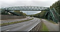

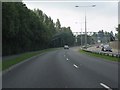
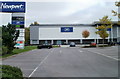
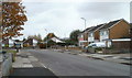
100 photos from this area
Area Information
Key information about the NP19 9PW including its size, population, and administrative classification.
- Area Type
- Postcode
- Area Size
- 3237 m²
- Population
- 1913
- Population Density
- 5625 people/km²
House Prices in NP19 9PW
25
Properties
£140,799
Average Sold Price
£101,000
Lowest Price
£195,000
Highest Price
Showing 25 properties
| Address | Type | Beds | Baths | Last Sale Price | Last Sale Date | |
|---|---|---|---|---|---|---|
| 201 Aberthaw Road, Newport, NP19 9PW | Terraced | 3 | 1 | £195,000 | Dec 2024 | |
| 181 Aberthaw Road, Newport, NP19 9PW | Semi-detached | 3 | 2 | £157,000 | Dec 2016 | |
| 185 Aberthaw Road, Newport, NP19 9PW | house | - | - | £159,995 | Dec 2015 | |
| 207 Aberthaw Road, Newport, NP19 9PW | house | - | - | £135,000 | Dec 2015 | |
| 193 Aberthaw Road, Newport, NP19 9PW | house | - | - | £150,000 | Sep 2015 | |
| 197 Aberthaw Road, Newport, NP19 9PW | house | - | - | £101,000 | Jul 2015 | |
| 199 Aberthaw Road, Newport, NP19 9PW | house | - | - | £139,000 | Jul 2015 | |
| 187 Aberthaw Road, Newport, NP19 9PW | house | - | - | £129,000 | Jul 2015 | |
| 191 Aberthaw Road, Newport, NP19 9PW | house | - | - | £129,000 | Jul 2015 | |
| 203 Aberthaw Road, Newport, NP19 9PW | house | - | - | £112,995 | Jul 2015 |
Page 1 of 3
Energy Efficiency in NP19 9PW
Amenities
Schools
| Rank | School | Type | Entry gender | Ages |
|---|
Explore more schools in this area
Go to Schools tabDemographics
Household Size
Family (3-5 people)
most common
Accommodation Type
Houses
most common
Tenure
40
majority
Ethnic Group
White
most common
Religion
N/A
most common
Household Composition
N/A
most common
Age
47
median
Adults (30-64 years)
most common
Household Deprivation
N/A
with no deprivation
NS-SEC
16
in Lower managerial occupations
Explore more demographic insights in this area
Go to Demographics tabPlanning
Planning Constraints
- Flood RiskPremium
- Ramsar Wetland SitesPremium
- Area of Outstanding Natural BeautyPremium
- Protected Nature ReservePremium
- Protected WoodlandPremium
- Crime RiskPremium