Area Overview for NP19 9PQ
Photos of NP19 9PQ
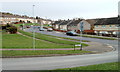
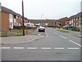
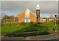
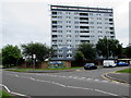
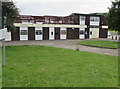
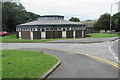
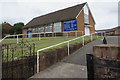
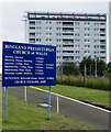
50 photos from this area
Area Information
Key information about the NP19 9PQ including its size, population, and administrative classification.
- Area Type
- Postcode
- Area Size
- 6.7 hectares
- Population
- 1233
- Population Density
- 1987 people/km²
House Prices in NP19 9PQ
79
Properties
£98,279
Average Sold Price
£49,950
Lowest Price
£127,000
Highest Price
Showing 79 properties
| Address | Type | Beds | Baths | Last Sale Price | Last Sale Date | |
|---|---|---|---|---|---|---|
| 186 Ringland Circle, Newport, NP19 9PQ | house | - | - | £125,000 | Apr 2021 | |
| 202 Ringland Circle, Newport, NP19 9PQ | Semi-detached | 3 | 1 | £120,000 | Feb 2020 | |
| 187 Ringland Circle, Newport, NP19 9PQ | Terraced | 3 | 1 | £125,000 | Oct 2019 | |
| 200 Ringland Circle, Newport, NP19 9PQ | Semi-detached | - | - | £127,000 | Sep 2018 | |
| 208 Ringland Circle, Newport, NP19 9PQ | Semi-detached | 3 | - | £116,000 | May 2018 | |
| 196 Ringland Circle, Newport, NP19 9PQ | Maisonette | - | - | £64,950 | Oct 2017 | |
| 204 Ringland Circle, Newport, NP19 9PQ | house | - | - | £86,500 | Jun 2009 | |
| 180 Ringland Circle, Newport, NP19 9PQ | Terraced | - | - | £95,000 | Sep 2007 | |
| 210 Ringland Circle, Newport, NP19 9PQ | house | - | - | £112,000 | Oct 2006 | |
| 181 Ringland Circle, Newport, NP19 9PQ | Terraced | - | - | £80,000 | Apr 2005 |
Page 1 of 8
Energy Efficiency in NP19 9PQ
Amenities
Schools
| Rank | School | Type | Entry gender | Ages |
|---|
Explore more schools in this area
Go to Schools tabDemographics
Household Size
Family (3-5 people)
most common
Accommodation Type
Houses
most common
Tenure
52
majority
Ethnic Group
White
most common
Religion
N/A
most common
Household Composition
N/A
most common
Age
47
median
Adults (30-64 years)
most common
Household Deprivation
N/A
with no deprivation
NS-SEC
15
in Lower managerial occupations
Explore more demographic insights in this area
Go to Demographics tabPlanning
Planning Constraints
- Flood RiskPremium
- Ramsar Wetland SitesPremium
- Area of Outstanding Natural BeautyPremium
- Protected Nature ReservePremium
- Protected WoodlandPremium
- Crime RiskPremium