Area Overview for NP19 9JT
Photos of NP19 9JT
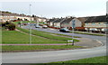
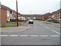

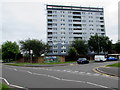
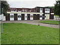
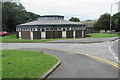

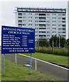
50 photos from this area
Area Information
Key information about the NP19 9JT including its size, population, and administrative classification.
- Area Type
- Postcode
- Area Size
- 1.6 hectares
- Population
- 1230
- Population Density
- 2945 people/km²
House Prices in NP19 9JT
38
Properties
£73,800
Average Sold Price
£38,000
Lowest Price
£166,000
Highest Price
Showing 38 properties
| Address | Type | Beds | Baths | Last Sale Price | Last Sale Date | |
|---|---|---|---|---|---|---|
| 3 Cot Farm Walk, Newport, NP19 9JT | Terraced | 3 | 1 | £166,000 | Apr 2025 | |
| 5 Cot Farm Walk, Newport, NP19 9JT | house | - | - | £60,000 | Apr 2018 | |
| 13 Cot Farm Walk, Newport, NP19 9JT | Semi-detached | - | - | £61,000 | May 2003 | |
| 9 Cot Farm Walk, Newport, NP19 9JT | Flat | 1 | 1 | £38,000 | Sep 2002 | |
| 7 Cot Farm Walk, Newport, NP19 9JT | Terraced | - | - | £44,000 | Jul 2002 | |
| Plot 56, Land South Of And Adjacent To, Cot Farm Walk, Newport, NP19 9JT | undefined | - | - | - | - | |
| 295 Hendre Farm Drive, Newport, NP19 9JT | Flat | - | - | - | - | |
| 283 Hendre Farm Drive, Newport, NP19 9JT | Flat | - | - | - | - | |
| 291 Hendre Farm Drive, Newport, NP19 9JT | Flat | - | - | - | - | |
| 281 Hendre Farm Drive, Newport, NP19 9JT | Flat | - | - | - | - |
Page 1 of 4
Energy Efficiency in NP19 9JT
Amenities
Schools
| Rank | School | Type | Entry gender | Ages |
|---|
Explore more schools in this area
Go to Schools tabDemographics
Household Size
One person
most common
Accommodation Type
Houses
most common
Tenure
47
majority
Ethnic Group
White
most common
Religion
N/A
most common
Household Composition
N/A
most common
Age
47
median
Adults (30-64 years)
most common
Household Deprivation
N/A
with no deprivation
NS-SEC
16
in Lower managerial occupations
Explore more demographic insights in this area
Go to Demographics tabPlanning
Planning Constraints
- Flood RiskPremium
- Ramsar Wetland SitesPremium
- Area of Outstanding Natural BeautyPremium
- Protected Nature ReservePremium
- Protected WoodlandPremium
- Crime RiskPremium