Area Overview for NP19 9DT
Photos of NP19 9DT
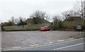
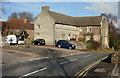
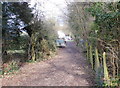
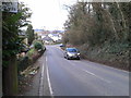
81 photos from this area
Area Information
Key information about the NP19 9DT including its size, population, and administrative classification.
- Area Type
- Postcode
- Area Size
- 5153 m²
- Population
- Not available
- Population Density
- Not available
House Prices in NP19 9DT
19
Properties
£73,363
Average Sold Price
£25,000
Lowest Price
£145,000
Highest Price
Showing 19 properties
| Address | Type | Beds | Baths | Last Sale Price | Last Sale Date | |
|---|---|---|---|---|---|---|
| 5 Will Paynter Walk, Newport, NP19 9DT | Bungalow | 1 | 1 | £97,000 | Jan 2025 | |
| 20 Will Paynter Walk, Newport, NP19 9DT | Terraced | 1 | 1 | £145,000 | Nov 2024 | |
| 6 Will Paynter Walk, Newport, NP19 9DT | Bungalow | - | - | £107,000 | Mar 2021 | |
| 15 Will Paynter Walk, Newport, NP19 9DT | house | - | - | £105,000 | Sep 2019 | |
| 7 Will Paynter Walk, Newport, NP19 9DT | Bungalow | 1 | 1 | £58,000 | Jul 2012 | |
| 2 Will Paynter Walk, Newport, NP19 9DT | house | - | - | £84,950 | May 2012 | |
| 3 Will Paynter Walk, Newport, NP19 9DT | house | - | - | £94,000 | Jun 2007 | |
| 4 Will Paynter Walk, Newport, NP19 9DT | house | - | - | £79,950 | Feb 2006 | |
| 10 Will Paynter Walk, Newport, NP19 9DT | house | 1 | 1 | £68,000 | Dec 2003 | |
| 17 Will Paynter Walk, Newport, NP19 9DT | house | - | - | £57,950 | Jun 2003 |
Page 1 of 2
Energy Efficiency in NP19 9DT
Amenities
Schools
| Rank | School | Type | Entry gender | Ages |
|---|
Explore more schools in this area
Go to Schools tabDemographics
Household Size
One person
most common
Accommodation Type
Houses
most common
Tenure
51
majority
Ethnic Group
White
most common
Religion
N/A
most common
Household Composition
N/A
most common
Age
47
median
Adults (30-64 years)
most common
Household Deprivation
N/A
with no deprivation
NS-SEC
20
in Lower managerial occupations
Explore more demographic insights in this area
Go to Demographics tabPlanning
Planning Constraints
- Flood RiskPremium
- Ramsar Wetland SitesPremium
- Area of Outstanding Natural BeautyPremium
- Protected Nature ReservePremium
- Protected WoodlandPremium
- Crime RiskPremium