Area Overview for NP19 8FJ
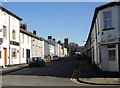
Photos of NP19 8FJ


Area Information
The postcode NP19 8FJ defines a specific residential cluster spread across 1.2 hectares in Newport, Wales. This compact area accommodates 2,349 residents, resulting in a population density that reaches 197,226 people per square kilometre. While the high density suggests significant housing concentration within this small footprint, the area functions as a established residential zone rather than a sprawling suburb. Life here is characterised by proximity, with residents surrounded by neighbours within a very limited geographical boundary. The postcode serves as a gateway into Newport's wider housing network, offering a mix of accommodation types suited to various household sizes. Living in NP19 8FJ means enjoying immediate access to the city's infrastructure while residing in a tightly defined locality. The area maintains a practical scale suitable for those who prioritise short commutes and walkability over expansive gardens or large plots of land. Properties here are likely close to one another, fostering a neighbourhood dynamic where community interactions occur frequently. Despite the small size, the location provides a foothold into Newport's broader commercial and educational offerings without the need for extensive travel.
- Area Type
- Postcode
- Area Size
- 1.2 hectares
- Population
- 2349
- Population Density
- 11985 people/km²
The housing stock in NP19 8FJ is dominated by houses, distinguishing it from areas reliant on flats or terraced rows. With 51 per cent of residents being homeowners, this postcode operates as a significant buyer's market rather than a rental-dominated zone. This high level of ownership suggests that the local housing loop circulates wealth and stability among existing residents. Homebuyers looking at this area should expect a robust selection of properties listed by current owners seeking to upgrade or downsize. The prevalence of houses indicates that land usage prioritises detached or semi-detached living over high-density urban blocks. For investors, the owner-occupation rate signals a community with deep local roots, potentially influencing long-term property values. Recent transactions likely reflect a market where families compete for suitable house layouts within the 1.2-hectare boundary. The mix of tenure ensures that the area maintains a steady pipeline of properties entering the market annually. Buyers focusing on permanent settlement will find the stock more aligned with their needs compared to transient rental markets.
House Prices in NP19 8FJ
Showing 59 properties
| Address | Type | Beds | Baths | Last Sale Price | Last Sale Date | |
|---|---|---|---|---|---|---|
| 11 Maindee Parade, Newport, NP19 8FJ | Terraced | 2 | 1 | £106,500 | Oct 2024 | |
| 36 Maindee Parade, Newport, NP19 8FJ | Terraced | 2 | 1 | £185,000 | Feb 2024 | |
| 7 Maindee Parade, Newport, NP19 8FJ | house | - | - | £163,000 | Nov 2023 | |
| 28 Maindee Parade, Newport, NP19 8FJ | house | - | - | £168,000 | Oct 2023 | |
| 44 Maindee Parade, Newport, NP19 8FJ | house | - | - | £292,500 | Dec 2021 | |
| 20 Maindee Parade, Newport, NP19 8FJ | house | - | - | £110,000 | Dec 2021 | |
| 45 Maindee Parade, Newport, NP19 8FJ | Terraced | 3 | 1 | £80,000 | Jul 2021 | |
| 3 Maindee Parade, Newport, NP19 8FJ | Terraced | 2 | 1 | £125,000 | Feb 2021 | |
| 27 Maindee Parade, Newport, NP19 8FJ | house | 2 | - | £105,000 | Oct 2019 | |
| 10 Maindee Parade, Newport, NP19 8FJ | Terraced | 2 | 1 | £115,000 | Jul 2019 |
Energy Efficiency in NP19 8FJ
Residents of NP19 8FJ enjoy immediate access to a variety of retail and transport hubs within practical reach. Local shopping includes venues such as Tesco Caerleon, Asda Casnewydd, and Spar, offering comprehensive grocery and daily needs coverage. These supermarkets provide the convenience of stocking up on essentials without leaving the immediate region. Transport links are equally robust, with five nearby rail stations connecting residents to Newport and beyond. Key stations include Newport Railway Station, Pye Corner Railway Station, and Rogerstone Railway Station, facilitating efficient daily commutes. Additionally, one ferry terminal, Newport Ferry Terminal, provides alternative water transport options for coastal travel or leisure. This transportation network ensures that moving around the city or the country requires minimal planning. The concentration of retail and rail services within the list highlights the area's logistical advantage. Daily chores and work commutes are streamlined by the presence of these major facilities nearby. Living in this postcode means balancing convenience with the ability to explore wider areas effortlessly.
Amenities
Schools
Families living in NP19 8FJ have access to educational facilities including Fairoak Nursery School. This nursery provides early years care and foundation for children entering the primary school system. As a private or independent institution, it offers alternative educational options to the state sector, catering to specific parenting philosophies. The presence of a nursery indicates that the area supports families with young children who require early education before starting primary school elsewhere. While the primary and secondary education options are not listed in the immediate vicinity of this specific postcode, the nursery serves as the first educational node for local households. Parents often utilise on-site nurseries to facilitate flexible working arrangements during early childhood development years. The proximity to Fairoak Nursery School ensures that parents do not need to travel far for the initial stages of their child's education. This facility complements other schools in the wider Newport area, creating a continuum of care for growing families.
| Rank | School | Type | Entry gender | Ages |
|---|
Explore more schools in this area
Go to Schools tabDemographics
The community within NP19 8FJ is defined by a mature population, with a median age of 47 years. Adults between the ages of 30 and 64 form the most common age range, indicating a neighbourhood dwelt by families in their prime working years and older households. Fifty-one per cent of residents own their homes, suggesting a stability that often comes with growing neighbourhood roots. The remaining households likely comprise long-term renters or shared ownership schemes typical of urban residential clusters. Housing in this postcode consists primarily of houses, which aligns with the demographic preference for space often sought by families and downsizers alike. The predominant ethnic group is White, reflecting the broader demographic composition found across much of Wales. Given the typical age profile and home ownership rate, the area supports a range of activities from school runs to retirement planning. Residents in their 40s and 50s may find the community well-suited to their life stage, balancing career demands with domestic responsibilities. The accommodation mix ensures that the area does not cater exclusively to young professionals or retirees, creating a stable demographic environment.
Household Size
Accommodation Type
Tenure
Ethnic Group
Religion
Household Composition
Age
Household Deprivation
NS-SEC
Explore more demographic insights in this area
Go to Demographics tabPlanning
Planning Constraints
- Flood RiskPremium
- Ramsar Wetland SitesPremium
- Area of Outstanding Natural BeautyPremium
- Protected Nature ReservePremium
- Protected WoodlandPremium
- Crime RiskPremium