Area Overview for NP19 8AU
Photos of NP19 8AU
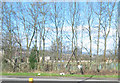
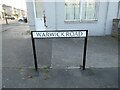
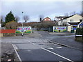
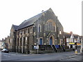
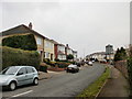


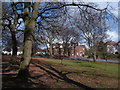
100 photos from this area
Area Information
Key information about the NP19 8AU including its size, population, and administrative classification.
- Area Type
- Postcode
- Area Size
- 8886 m²
- Population
- 1490
- Population Density
- 5297 people/km²
House Prices in NP19 8AU
24
Properties
£140,993
Average Sold Price
£35,000
Lowest Price
£267,500
Highest Price
Showing 24 properties
| Address | Type | Beds | Baths | Last Sale Price | Last Sale Date | |
|---|---|---|---|---|---|---|
| 54 Gibbs Road, Newport, NP19 8AU | house | 3 | 1 | £267,500 | May 2025 | |
| 80-82 Gibbs Road, Newport, NP19 8AU | Detached | 4 | 2 | £255,000 | Feb 2025 | |
| 76 Gibbs Road, Newport, NP19 8AU | Terraced | 3 | 1 | £233,000 | Feb 2022 | |
| 87 Gibbs Road, Newport, NP19 8AU | Semi-detached | 3 | 1 | £133,500 | Jul 2017 | |
| 79 Gibbs Road, Newport, NP19 8AU | Semi-detached | 3 | 1 | £157,000 | Jan 2017 | |
| 72 Gibbs Road, Newport, NP19 8AU | house | - | - | £137,500 | Jan 2015 | |
| 64 Gibbs Road, Newport, NP19 8AU | house | - | - | £140,000 | Nov 2012 | |
| 85 Gibbs Road, Newport, NP19 8AU | house | - | - | £112,500 | Sep 2009 | |
| 48 Gibbs Road, Newport, NP19 8AU | Semi-detached | - | - | £170,000 | Jan 2007 | |
| 78 Gibbs Road, Newport, NP19 8AU | Detached | 3 | 1 | £155,000 | Jan 2007 |
Page 1 of 3
Energy Efficiency in NP19 8AU
Amenities
Schools
| Rank | School | Type | Entry gender | Ages |
|---|
Explore more schools in this area
Go to Schools tabDemographics
Household Size
Family (3-5 people)
most common
Accommodation Type
Houses
most common
Tenure
79
majority
Ethnic Group
White
most common
Religion
N/A
most common
Household Composition
N/A
most common
Age
47
median
Adults (30-64 years)
most common
Household Deprivation
N/A
with no deprivation
NS-SEC
34
in Lower managerial occupations
Explore more demographic insights in this area
Go to Demographics tabPlanning
Planning Constraints
- Flood RiskPremium
- Ramsar Wetland SitesPremium
- Area of Outstanding Natural BeautyPremium
- Protected Nature ReservePremium
- Protected WoodlandPremium
- Crime RiskPremium