Area Overview for NP19 7UB
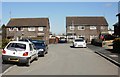
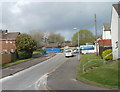
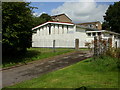
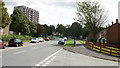
Photos of NP19 7UB


Area Information
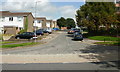
Living in NP19 7UB means residing in a compact residential cluster situated within Wales. This specific postcode covers a small area of just 3.1 hectares, creating a dense and intimate environment. The population stands at 1,601 people, resulting in a population density of 51,884 people per square kilometre. Such high density is typical for this cluster size, ensuring that services and neighbours are close at hand. Daily life here is characterised by immediate proximity to essentials rather than sprawling distances. You will find yourself in a setting where the residential nature of the postcode is maintained despite the tight concentration of homes. The area functions as a distinct pocket within the wider region, offering a straightforward community experience. There are no grand landscapes or vast open spaces defining this land; instead, the character comes from its concentration of population within a very limited geographic footprint. This setup suits those who value direct access to facilities over the privacy of a low-density stretch. For anyone considering moving here, the sheer size of the area emphasises that this is a neighbourhood-first location with a defined, boundary-conscious existence. ### The community in NP19 7UB reflects a mature demographic profile. The median age is 47 years, indicating that the neighbourhood is primarily inhabited by adults in the 30 to 64 years age range. This age structure suggests a population established in careers and families rather than a transient student community. Houses are the predominant form of accommodation, solidifying the residential character of the zone. Home ownership accounts for 42% of households, meaning nearly half of the residents have purchased their property, while the remainder likely rent. The predominant ethnic group in the area is white, shaping the cultural fabric of the locality. With 51,884 people per square kilometre, the sense of community is intense, defined by shared streets and immediate neighbours. This density often fosters stronger local connections compared to larger cities. The age mix implies a stability in the area, with a focus on long-term living arrangements. You will find a population that has settled, contributing to a consistent community atmosphere without rapid turnover. Understanding these figures helps you gauge the typical lifestyles found within the 3.1-hectare bounds of this postcode. ### The property market in NP19 7UB is defined by a predominantly house-built stock and a significant owner-occupier presence. Only 42% of homes are owned, meaning almost 60% of residents rent, which points to a mixed market with strong rental elements. The accommodation type data confirms that houses form the bulk of the housing supply rather than flats or other dwellings. This construction type aligns with the area's capacity for whole-family households and those seeking ground-floor connections. Buying homes here requires navigating a market where rental demand remains robust, likely due to the area's accessibility. The 3.1 hectares of land holding 1,601 residents means properties are likely in close proximity to one another. You will find a market driven by practical living rather than luxury or large-scale developments. The high population density influences property values and availability, creating a competitive environment for those seeking to buy. Investors should note the 42% ownership figure as an indicator of market behaviour and liquidity. Whether you buy or rent, the housing stock is uniform in type, catering to established families and professionals. The性格 of the market is straightforward, governed by the physical limits of the small residential cluster. ### Families living in NP19 7UB benefit from two specific educational institutions located nearby. St Julians Infant School and St Julians Junior School provide local education options for children in the catchment. These schools operate under an "other" classification type in the available records, offering a consistent educational path from early years through primary levels. For parents in the area, having both infant and junior sections of the school locally means children can often progress without changing schools as they age. This configuration reduces the disruption of moving between different institutions during primary education. The presence of these named schools suggests a community focused on childcare and early development within close reach. You would need to verify specific Ofsted ratings and curriculum details through official channels that are not included in this dataset. However, the existence of dedicated named schools like St Julians indicates a commitment to local education infrastructure. This setup supports families who value proximity to schooling and the stability of attending the same institution throughout early childhood. The schematic data confirms the names and types, providing a factual basis for school planning. ### Digital connectivity for residents of NP19 7UB is excellent, supporting a modern lifestyle with reliable online access. Your fixed broadband score is 100 out of 100, indicating the highest possible quality for home internet connections. This rating ensures smooth performance for working from home, video conferencing, and large data transfers without interruption. Mobile coverage also performs well, with a score of 85 out of 100. This provides dependable signal strength for most activities on the go. The combination of perfect broadband and strong mobile signals makes this postcode well-suited for remote workers and those who rely heavily on digital tools. You can expect a connection quality that matches the needs of heavy internet users. Physical transport links are equally accessible, with five railway stations within practical reach, including Newport, Pye Corner, and Rogerstone stations. A ferry terminal is also available at Newport for calais and travel connections. These amenities mean you can commute easily by rail or use online services with confidence. The infrastructure supports a balanced life where connectivity is not a secondary concern but a primary utility. ### Your daily life in NP19 7UB is enriched by a cluster of nearby amenities that are within easy walking or short driving distance. Retail options are plentiful, with five notable shops servicing the area. You can choose from Spar, Sainsburys Caerleon, and Tesco Caerleon for your weekly grocery and retail needs. These five retail locations ensure that you have access to a full range of products without travelling far. For commuters, transport links are extensive, featuring five rail stations nearby: Newport Railway Station, Pye Corner Railway Station, and Rogerstone Railway Station. Additionally, Newport Ferry Terminal offers one ferry option for broader regional connectivity. This mix of rail and ferry access provides flexibility for both daily commutes and leisure travel. The convenience of having these five distinctive amenities close by defines the local lifestyle. You do not need to travel great distances for essentials, as the practical reach of these venues covers most daily expenses. The presence of Sainsburys, Tesco, and Spar anchors the local high street, creating a familiar shopping environment. This density of services complements the small size of the residential cluster, ensuring a self-sufficient living experience. ### Residents of NP19 7UB face low environmental and planning risks, providing a secure foundation for daily life. The area passes all major safety and constraint assessments with reassuring results. Flood risk is rated as pass with a score of 1.17 out of 100, indicating a very low level of flood risk coverage. This means the land is largely safe from water-related hazards. There is no Ramsar wetland site coverage, no Area of Outstanding Natural Beauty coverage, and no protected nature reserve or protected woodland coverage within the limits of the footprint. Each of these constraints receives a pass level, ensuring no significant planning overlays restrict development or pose environmental threats. The crime risk assessment note states that data is currently only available for areas in England, so specific local crime statistics for this Welsh postcode are not available in the current records. However, the passing environmental grades suggest a stable physical setting. You can live here without concern for flooding or major conservation constraints that might impact property usage. The safety profile is clear and favourable, removing common anxieties about living in low-lying or restricted zones. The area stands as a low-risk environment for both owners and renters. ### What is the main demographic living in NP19 7UB?The community is dominated by adults between 30 and 64 years old, with a median age of 47. The population consists mainly of house owners and renters, with 42% owning their homes. The white ethnic group is predominant in this area. Which schools are close to NP19 7UB for my children?St Julians Infant School and St Julians Junior School are the nearest educational facilities. Both are classified as 'other' types of schools, providing a combined educational path for young residents without the need to move institutions very often. How good is the internet connection in this postcode?Your fixed broadband score is 100 out of 100, which is the maximum possible rating for quality. Mobile coverage is also excellent at 85 out of 100. This guarantees reliable connectivity for working from home or streaming services. What retail options are available nearby?There are five retail venues within practical reach, including Spar, Sainsburys Caerleon, and Tesco Caerleon. This range provides full access to grocery shopping and general retail needs without requiring a long journey. Is the area safe from environmental risks like flooding?The area passes the flood risk assessment with a score of 1.17, indicating very low flood risk. There are no protected woodlands, nature reserves, or AONB designations present. This creates a stable living environment free from significant environmental planning constraints.
- Area Type
- Postcode
- Area Size
- 3.1 hectares
- Population
- 1601
- Population Density
- 4609 people/km²
The property market in NP19 7UB is defined by a predominantly house-built stock and a significant owner-occupier presence. Only 42% of homes are owned, meaning almost 60% of residents rent, which points to a mixed market with strong rental elements. The accommodation type data confirms that houses form the bulk of the housing supply rather than flats or other dwellings. This construction type aligns with the area's capacity for whole-family households and those seeking ground-floor connections. Buying homes here requires navigating a market where rental demand remains robust, likely due to the area's accessibility. The 3.1 hectares of land holding 1,601 residents means properties are likely in close proximity to one another. You will find a market driven by practical living rather than luxury or large-scale developments. The high population density influences property values and availability, creating a competitive environment for those seeking to buy. Investors should note the 42% ownership figure as an indicator of market behaviour and liquidity. Whether you buy or rent, the housing stock is uniform in type, catering to established families and professionals. The性格 of the market is straightforward, governed by the physical limits of the small residential cluster. ### Families living in NP19 7UB benefit from two specific educational institutions located nearby. St Julians Infant School and St Julians Junior School provide local education options for children in the catchment. These schools operate under an "other" classification type in the available records, offering a consistent educational path from early years through primary levels. For parents in the area, having both infant and junior sections of the school locally means children can often progress without changing schools as they age. This configuration reduces the disruption of moving between different institutions during primary education. The presence of these named schools suggests a community focused on childcare and early development within close reach. You would need to verify specific Ofsted ratings and curriculum details through official channels that are not included in this dataset. However, the existence of dedicated named schools like St Julians indicates a commitment to local education infrastructure. This setup supports families who value proximity to schooling and the stability of attending the same institution throughout early childhood. The schematic data confirms the names and types, providing a factual basis for school planning. ### Digital connectivity for residents of NP19 7UB is excellent, supporting a modern lifestyle with reliable online access. Your fixed broadband score is 100 out of 100, indicating the highest possible quality for home internet connections. This rating ensures smooth performance for working from home, video conferencing, and large data transfers without interruption. Mobile coverage also performs well, with a score of 85 out of 100. This provides dependable signal strength for most activities on the go. The combination of perfect broadband and strong mobile signals makes this postcode well-suited for remote workers and those who rely heavily on digital tools. You can expect a connection quality that matches the needs of heavy internet users. Physical transport links are equally accessible, with five railway stations within practical reach, including Newport, Pye Corner, and Rogerstone stations. A ferry terminal is also available at Newport for calais and travel connections. These amenities mean you can commute easily by rail or use online services with confidence. The infrastructure supports a balanced life where connectivity is not a secondary concern but a primary utility. ### Your daily life in NP19 7UB is enriched by a cluster of nearby amenities that are within easy walking or short driving distance. Retail options are plentiful, with five notable shops servicing the area. You can choose from Spar, Sainsburys Caerleon, and Tesco Caerleon for your weekly grocery and retail needs. These five retail locations ensure that you have access to a full range of products without travelling far. For commuters, transport links are extensive, featuring five rail stations nearby: Newport Railway Station, Pye Corner Railway Station, and Rogerstone Railway Station. Additionally, Newport Ferry Terminal offers one ferry option for broader regional connectivity. This mix of rail and ferry access provides flexibility for both daily commutes and leisure travel. The convenience of having these five distinctive amenities close by defines the local lifestyle. You do not need to travel great distances for essentials, as the practical reach of these venues covers most daily expenses. The presence of Sainsburys, Tesco, and Spar anchors the local high street, creating a familiar shopping environment. This density of services complements the small size of the residential cluster, ensuring a self-sufficient living experience. ### Residents of NP19 7UB face low environmental and planning risks, providing a secure foundation for daily life. The area passes all major safety and constraint assessments with reassuring results. Flood risk is rated as pass with a score of 1.17 out of 100, indicating a very low level of flood risk coverage. This means the land is largely safe from water-related hazards. There is no Ramsar wetland site coverage, no Area of Outstanding Natural Beauty coverage, and no protected nature reserve or protected woodland coverage within the limits of the footprint. Each of these constraints receives a pass level, ensuring no significant planning overlays restrict development or pose environmental threats. The crime risk assessment note states that data is currently only available for areas in England, so specific local crime statistics for this Welsh postcode are not available in the current records. However, the passing environmental grades suggest a stable physical setting. You can live here without concern for flooding or major conservation constraints that might impact property usage. The safety profile is clear and favourable, removing common anxieties about living in low-lying or restricted zones. The area stands as a low-risk environment for both owners and renters. ### What is the main demographic living in NP19 7UB?The community is dominated by adults between 30 and 64 years old, with a median age of 47. The population consists mainly of house owners and renters, with 42% owning their homes. The white ethnic group is predominant in this area. Which schools are close to NP19 7UB for my children?St Julians Infant School and St Julians Junior School are the nearest educational facilities. Both are classified as 'other' types of schools, providing a combined educational path for young residents without the need to move institutions very often. How good is the internet connection in this postcode?Your fixed broadband score is 100 out of 100, which is the maximum possible rating for quality. Mobile coverage is also excellent at 85 out of 100. This guarantees reliable connectivity for working from home or streaming services. What retail options are available nearby?There are five retail venues within practical reach, including Spar, Sainsburys Caerleon, and Tesco Caerleon. This range provides full access to grocery shopping and general retail needs without requiring a long journey. Is the area safe from environmental risks like flooding?The area passes the flood risk assessment with a score of 1.17, indicating very low flood risk. There are no protected woodlands, nature reserves, or AONB designations present. This creates a stable living environment free from significant environmental planning constraints.
House Prices in NP19 7UB
Showing 6 properties
| Address | Type | Beds | Baths | Last Sale Price | Last Sale Date | |
|---|---|---|---|---|---|---|
| 75 Beaufort Road, Newport, NP19 7UB | Bungalow | - | - | - | - | |
| 71 Beaufort Road, Newport, NP19 7UB | Bungalow | - | - | - | - | |
| 69 Beaufort Road, Newport, NP19 7UB | Bungalow | - | - | - | - | |
| 73 Beaufort Road, Newport, NP19 7UB | Bungalow | - | - | - | - | |
| 67 Beaufort Road, Newport, NP19 7UB | Bungalow | - | - | - | - | |
| Egni Co-op, Photovoltaic Installation At St Julians Junior And Infants School, Beaufort Road, Newport, NP19 7UB | Industrial | - | - | - | - |
Energy Efficiency in NP19 7UB
Your daily life in NP19 7UB is enriched by a cluster of nearby amenities that are within easy walking or short driving distance. Retail options are plentiful, with five notable shops servicing the area. You can choose from Spar, Sainsburys Caerleon, and Tesco Caerleon for your weekly grocery and retail needs. These five retail locations ensure that you have access to a full range of products without travelling far. For commuters, transport links are extensive, featuring five rail stations nearby: Newport Railway Station, Pye Corner Railway Station, and Rogerstone Railway Station. Additionally, Newport Ferry Terminal offers one ferry option for broader regional connectivity. This mix of rail and ferry access provides flexibility for both daily commutes and leisure travel. The convenience of having these five distinctive amenities close by defines the local lifestyle. You do not need to travel great distances for essentials, as the practical reach of these venues covers most daily expenses. The presence of Sainsburys, Tesco, and Spar anchors the local high street, creating a familiar shopping environment. This density of services complements the small size of the residential cluster, ensuring a self-sufficient living experience. ### Residents of NP19 7UB face low environmental and planning risks, providing a secure foundation for daily life. The area passes all major safety and constraint assessments with reassuring results. Flood risk is rated as pass with a score of 1.17 out of 100, indicating a very low level of flood risk coverage. This means the land is largely safe from water-related hazards. There is no Ramsar wetland site coverage, no Area of Outstanding Natural Beauty coverage, and no protected nature reserve or protected woodland coverage within the limits of the footprint. Each of these constraints receives a pass level, ensuring no significant planning overlays restrict development or pose environmental threats. The crime risk assessment note states that data is currently only available for areas in England, so specific local crime statistics for this Welsh postcode are not available in the current records. However, the passing environmental grades suggest a stable physical setting. You can live here without concern for flooding or major conservation constraints that might impact property usage. The safety profile is clear and favourable, removing common anxieties about living in low-lying or restricted zones. The area stands as a low-risk environment for both owners and renters. ### What is the main demographic living in NP19 7UB?The community is dominated by adults between 30 and 64 years old, with a median age of 47. The population consists mainly of house owners and renters, with 42% owning their homes. The white ethnic group is predominant in this area. Which schools are close to NP19 7UB for my children?St Julians Infant School and St Julians Junior School are the nearest educational facilities. Both are classified as 'other' types of schools, providing a combined educational path for young residents without the need to move institutions very often. How good is the internet connection in this postcode?Your fixed broadband score is 100 out of 100, which is the maximum possible rating for quality. Mobile coverage is also excellent at 85 out of 100. This guarantees reliable connectivity for working from home or streaming services. What retail options are available nearby?There are five retail venues within practical reach, including Spar, Sainsburys Caerleon, and Tesco Caerleon. This range provides full access to grocery shopping and general retail needs without requiring a long journey. Is the area safe from environmental risks like flooding?The area passes the flood risk assessment with a score of 1.17, indicating very low flood risk. There are no protected woodlands, nature reserves, or AONB designations present. This creates a stable living environment free from significant environmental planning constraints.
Amenities
Schools
Families living in NP19 7UB benefit from two specific educational institutions located nearby. St Julians Infant School and St Julians Junior School provide local education options for children in the catchment. These schools operate under an "other" classification type in the available records, offering a consistent educational path from early years through primary levels. For parents in the area, having both infant and junior sections of the school locally means children can often progress without changing schools as they age. This configuration reduces the disruption of moving between different institutions during primary education. The presence of these named schools suggests a community focused on childcare and early development within close reach. You would need to verify specific Ofsted ratings and curriculum details through official channels that are not included in this dataset. However, the existence of dedicated named schools like St Julians indicates a commitment to local education infrastructure. This setup supports families who value proximity to schooling and the stability of attending the same institution throughout early childhood. The schematic data confirms the names and types, providing a factual basis for school planning. ### Digital connectivity for residents of NP19 7UB is excellent, supporting a modern lifestyle with reliable online access. Your fixed broadband score is 100 out of 100, indicating the highest possible quality for home internet connections. This rating ensures smooth performance for working from home, video conferencing, and large data transfers without interruption. Mobile coverage also performs well, with a score of 85 out of 100. This provides dependable signal strength for most activities on the go. The combination of perfect broadband and strong mobile signals makes this postcode well-suited for remote workers and those who rely heavily on digital tools. You can expect a connection quality that matches the needs of heavy internet users. Physical transport links are equally accessible, with five railway stations within practical reach, including Newport, Pye Corner, and Rogerstone stations. A ferry terminal is also available at Newport for calais and travel connections. These amenities mean you can commute easily by rail or use online services with confidence. The infrastructure supports a balanced life where connectivity is not a secondary concern but a primary utility. ### Your daily life in NP19 7UB is enriched by a cluster of nearby amenities that are within easy walking or short driving distance. Retail options are plentiful, with five notable shops servicing the area. You can choose from Spar, Sainsburys Caerleon, and Tesco Caerleon for your weekly grocery and retail needs. These five retail locations ensure that you have access to a full range of products without travelling far. For commuters, transport links are extensive, featuring five rail stations nearby: Newport Railway Station, Pye Corner Railway Station, and Rogerstone Railway Station. Additionally, Newport Ferry Terminal offers one ferry option for broader regional connectivity. This mix of rail and ferry access provides flexibility for both daily commutes and leisure travel. The convenience of having these five distinctive amenities close by defines the local lifestyle. You do not need to travel great distances for essentials, as the practical reach of these venues covers most daily expenses. The presence of Sainsburys, Tesco, and Spar anchors the local high street, creating a familiar shopping environment. This density of services complements the small size of the residential cluster, ensuring a self-sufficient living experience. ### Residents of NP19 7UB face low environmental and planning risks, providing a secure foundation for daily life. The area passes all major safety and constraint assessments with reassuring results. Flood risk is rated as pass with a score of 1.17 out of 100, indicating a very low level of flood risk coverage. This means the land is largely safe from water-related hazards. There is no Ramsar wetland site coverage, no Area of Outstanding Natural Beauty coverage, and no protected nature reserve or protected woodland coverage within the limits of the footprint. Each of these constraints receives a pass level, ensuring no significant planning overlays restrict development or pose environmental threats. The crime risk assessment note states that data is currently only available for areas in England, so specific local crime statistics for this Welsh postcode are not available in the current records. However, the passing environmental grades suggest a stable physical setting. You can live here without concern for flooding or major conservation constraints that might impact property usage. The safety profile is clear and favourable, removing common anxieties about living in low-lying or restricted zones. The area stands as a low-risk environment for both owners and renters. ### What is the main demographic living in NP19 7UB?The community is dominated by adults between 30 and 64 years old, with a median age of 47. The population consists mainly of house owners and renters, with 42% owning their homes. The white ethnic group is predominant in this area. Which schools are close to NP19 7UB for my children?St Julians Infant School and St Julians Junior School are the nearest educational facilities. Both are classified as 'other' types of schools, providing a combined educational path for young residents without the need to move institutions very often. How good is the internet connection in this postcode?Your fixed broadband score is 100 out of 100, which is the maximum possible rating for quality. Mobile coverage is also excellent at 85 out of 100. This guarantees reliable connectivity for working from home or streaming services. What retail options are available nearby?There are five retail venues within practical reach, including Spar, Sainsburys Caerleon, and Tesco Caerleon. This range provides full access to grocery shopping and general retail needs without requiring a long journey. Is the area safe from environmental risks like flooding?The area passes the flood risk assessment with a score of 1.17, indicating very low flood risk. There are no protected woodlands, nature reserves, or AONB designations present. This creates a stable living environment free from significant environmental planning constraints.
| Rank | School | Type | Entry gender | Ages |
|---|
Explore more schools in this area
Go to Schools tabDemographics
The community in NP19 7UB reflects a mature demographic profile. The median age is 47 years, indicating that the neighbourhood is primarily inhabited by adults in the 30 to 64 years age range. This age structure suggests a population established in careers and families rather than a transient student community. Houses are the predominant form of accommodation, solidifying the residential character of the zone. Home ownership accounts for 42% of households, meaning nearly half of the residents have purchased their property, while the remainder likely rent. The predominant ethnic group in the area is white, shaping the cultural fabric of the locality. With 51,884 people per square kilometre, the sense of community is intense, defined by shared streets and immediate neighbours. This density often fosters stronger local connections compared to larger cities. The age mix implies a stability in the area, with a focus on long-term living arrangements. You will find a population that has settled, contributing to a consistent community atmosphere without rapid turnover. Understanding these figures helps you gauge the typical lifestyles found within the 3.1-hectare bounds of this postcode. ### The property market in NP19 7UB is defined by a predominantly house-built stock and a significant owner-occupier presence. Only 42% of homes are owned, meaning almost 60% of residents rent, which points to a mixed market with strong rental elements. The accommodation type data confirms that houses form the bulk of the housing supply rather than flats or other dwellings. This construction type aligns with the area's capacity for whole-family households and those seeking ground-floor connections. Buying homes here requires navigating a market where rental demand remains robust, likely due to the area's accessibility. The 3.1 hectares of land holding 1,601 residents means properties are likely in close proximity to one another. You will find a market driven by practical living rather than luxury or large-scale developments. The high population density influences property values and availability, creating a competitive environment for those seeking to buy. Investors should note the 42% ownership figure as an indicator of market behaviour and liquidity. Whether you buy or rent, the housing stock is uniform in type, catering to established families and professionals. The性格 of the market is straightforward, governed by the physical limits of the small residential cluster. ### Families living in NP19 7UB benefit from two specific educational institutions located nearby. St Julians Infant School and St Julians Junior School provide local education options for children in the catchment. These schools operate under an "other" classification type in the available records, offering a consistent educational path from early years through primary levels. For parents in the area, having both infant and junior sections of the school locally means children can often progress without changing schools as they age. This configuration reduces the disruption of moving between different institutions during primary education. The presence of these named schools suggests a community focused on childcare and early development within close reach. You would need to verify specific Ofsted ratings and curriculum details through official channels that are not included in this dataset. However, the existence of dedicated named schools like St Julians indicates a commitment to local education infrastructure. This setup supports families who value proximity to schooling and the stability of attending the same institution throughout early childhood. The schematic data confirms the names and types, providing a factual basis for school planning. ### Digital connectivity for residents of NP19 7UB is excellent, supporting a modern lifestyle with reliable online access. Your fixed broadband score is 100 out of 100, indicating the highest possible quality for home internet connections. This rating ensures smooth performance for working from home, video conferencing, and large data transfers without interruption. Mobile coverage also performs well, with a score of 85 out of 100. This provides dependable signal strength for most activities on the go. The combination of perfect broadband and strong mobile signals makes this postcode well-suited for remote workers and those who rely heavily on digital tools. You can expect a connection quality that matches the needs of heavy internet users. Physical transport links are equally accessible, with five railway stations within practical reach, including Newport, Pye Corner, and Rogerstone stations. A ferry terminal is also available at Newport for calais and travel connections. These amenities mean you can commute easily by rail or use online services with confidence. The infrastructure supports a balanced life where connectivity is not a secondary concern but a primary utility. ### Your daily life in NP19 7UB is enriched by a cluster of nearby amenities that are within easy walking or short driving distance. Retail options are plentiful, with five notable shops servicing the area. You can choose from Spar, Sainsburys Caerleon, and Tesco Caerleon for your weekly grocery and retail needs. These five retail locations ensure that you have access to a full range of products without travelling far. For commuters, transport links are extensive, featuring five rail stations nearby: Newport Railway Station, Pye Corner Railway Station, and Rogerstone Railway Station. Additionally, Newport Ferry Terminal offers one ferry option for broader regional connectivity. This mix of rail and ferry access provides flexibility for both daily commutes and leisure travel. The convenience of having these five distinctive amenities close by defines the local lifestyle. You do not need to travel great distances for essentials, as the practical reach of these venues covers most daily expenses. The presence of Sainsburys, Tesco, and Spar anchors the local high street, creating a familiar shopping environment. This density of services complements the small size of the residential cluster, ensuring a self-sufficient living experience. ### Residents of NP19 7UB face low environmental and planning risks, providing a secure foundation for daily life. The area passes all major safety and constraint assessments with reassuring results. Flood risk is rated as pass with a score of 1.17 out of 100, indicating a very low level of flood risk coverage. This means the land is largely safe from water-related hazards. There is no Ramsar wetland site coverage, no Area of Outstanding Natural Beauty coverage, and no protected nature reserve or protected woodland coverage within the limits of the footprint. Each of these constraints receives a pass level, ensuring no significant planning overlays restrict development or pose environmental threats. The crime risk assessment note states that data is currently only available for areas in England, so specific local crime statistics for this Welsh postcode are not available in the current records. However, the passing environmental grades suggest a stable physical setting. You can live here without concern for flooding or major conservation constraints that might impact property usage. The safety profile is clear and favourable, removing common anxieties about living in low-lying or restricted zones. The area stands as a low-risk environment for both owners and renters. ### What is the main demographic living in NP19 7UB?The community is dominated by adults between 30 and 64 years old, with a median age of 47. The population consists mainly of house owners and renters, with 42% owning their homes. The white ethnic group is predominant in this area. Which schools are close to NP19 7UB for my children?St Julians Infant School and St Julians Junior School are the nearest educational facilities. Both are classified as 'other' types of schools, providing a combined educational path for young residents without the need to move institutions very often. How good is the internet connection in this postcode?Your fixed broadband score is 100 out of 100, which is the maximum possible rating for quality. Mobile coverage is also excellent at 85 out of 100. This guarantees reliable connectivity for working from home or streaming services. What retail options are available nearby?There are five retail venues within practical reach, including Spar, Sainsburys Caerleon, and Tesco Caerleon. This range provides full access to grocery shopping and general retail needs without requiring a long journey. Is the area safe from environmental risks like flooding?The area passes the flood risk assessment with a score of 1.17, indicating very low flood risk. There are no protected woodlands, nature reserves, or AONB designations present. This creates a stable living environment free from significant environmental planning constraints.
Household Size
Accommodation Type
Tenure
Ethnic Group
Religion
Household Composition
Age
Household Deprivation
NS-SEC
Explore more demographic insights in this area
Go to Demographics tabPlanning
Planning Constraints
- Flood RiskPremium
- Ramsar Wetland SitesPremium
- Area of Outstanding Natural BeautyPremium
- Protected Nature ReservePremium
- Protected WoodlandPremium
- Crime RiskPremium