Area Overview for NP19 7SQ
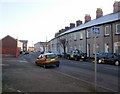
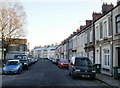
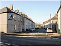
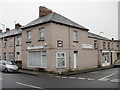
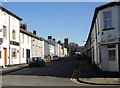
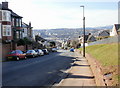
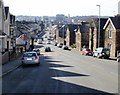
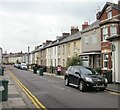
Photos of NP19 7SQ


Area Information
Living in NP19 7SQ means residing within a tightly knit residential cluster located in Wales. This specific postcode covers a tiny landmass of just 8,613 square metres, housing exactly 1,108 residents. Such a concentrated population density creates a neighbourhood where neighbours are inevitably close both physically and socially. The area functions as a defined residential pocket rather than a sprawling district. Prospective buyers looking for a specific, intimate setting will find this postcode delivers on that constraint. Daily life here is characterised by a sense of established permanence, given the vast majority of homes are occupied by their owners. The small physical footprint of the area suggests a community focused on internal networks and local coordination. For anyone considering homes in NP19 7SQ, the environment offers a clear, non-suburban scale. You live in a defined space where the immediate surroundings are known and accessible. This specificity provides a sense of order for those who prefer a contained living environment over sprawling developments. The area serves as a practical example of how dense, small-scale residential zones operate in the wider Welsh housing market.
- Area Type
- Postcode
- Area Size
- 8613 m²
- Population
- 1108
- Population Density
- 3343 people/km²
The property market in NP19 7SQ is defined by stability and ownership rather than speculation. With 84% of residents owning their homes, this is firmly an owner-occupied area. The predominant accommodation type consists of houses, which suggests a stock likely comprised of substantial residential properties rather than flats or terraced housing blocks. This high level of ownership typically correlates with long-term stability and a community vested in maintaining property values. Buyers looking at this small postcode will find that the local housing stock caters to those seeking to settle down or are already established homeowners. The market dynamics are influenced heavily by this entrenched ownership base. Unlike rental hubs where turnover is rapid, homes in NP19 7SQ tend to change hands less frequently. The fact that houses are the main accommodation type means you can expect traditional residential architecture. This market structure provides a predictable environment for buyers who prioritise tenure and continuity. The high concentration of owners indicates a location where residents have invested in their local environment for the long term.
House Prices in NP19 7SQ
Showing 10 properties
| Address | Type | Beds | Baths | Last Sale Price | Last Sale Date | |
|---|---|---|---|---|---|---|
| 5 Radnor Road, Newport, NP19 7SQ | Terraced | 3 | 2 | £141,950 | Jul 2020 | |
| 6 Radnor Road, Newport, NP19 7SQ | Terraced | 3 | 1 | £140,000 | Mar 2020 | |
| 4 Radnor Road, Newport, NP19 7SQ | house | - | - | £60,000 | Dec 2001 | |
| 1 Radnor Road, Newport, NP19 7SQ | Terraced | 3 | - | £42,000 | Dec 1996 | |
| 9 Radnor Road, Newport, NP19 7SQ | house | - | - | - | - | |
| 2 Radnor Road, Newport, NP19 7SQ | Semi-detached | - | - | - | - | |
| 3 Radnor Road, Newport, NP19 7SQ | house | - | - | - | - | |
| 10 Radnor Road, Newport, NP19 7SQ | house | - | - | - | - | |
| 8 Radnor Road, Newport, NP19 7SQ | house | - | - | - | - | |
| 7 Radnor Road, Newport, NP19 7SQ | house | - | - | - | - |
Energy Efficiency in NP19 7SQ
Daily life in NP19 7SQ is supported by a range of amenities within practical reach. Retail options include five specific outlets, with notable venues such as Spar, Tesco Caerleon, and Asda Casnewydd on hand for shopping needs. Your grocery and daily essential requirements are easily met by these specific supermarkets. Travel connectivity is strong, with five rail options available nearby. Newport Railway Station, Pye Corner Railway Station, and Rogerstone Railway Station provide access to the wider network. For those who live by the water or prefer short trips, the Newport Ferry Terminal serves as a single but functional ferry option. These five rail stations and one terminal ensure that residents are not isolated from the rest of Wales. The combination of national chain supermarkets and multiple railway stations creates a balanced lifestyle of local convenience and regional access. You can plan your week around clear transport routes without needing to rely on private vehicles for every journey.
Amenities
Schools
There is only one school listed in the immediate vicinity of NP19 7SQ. St Julian's School is the specific institution serving this local cluster. The data classifies this school as 'other' in terms of type, indicating it is neither a primary nor a secondary academy in the standard sense, or it serves a special educational need category. Prospective parents should verify the exact phase and Ofsted rating of St Julian's School directly with the establishment, as the current dataset does not specify an Ofsted grade. The presence of a single school option suggests that families in this postcode may rely on transport links to reach larger comprehensive schools outside the immediate matching range. This limited local provision is typical of very small zones where the population is insufficient to support a full range of educational facilities. You should plan your commute to education based on the location of St Julian's School and potential further afield options.
| Rank | School | Type | Entry gender | Ages |
|---|
Explore more schools in this area
Go to Schools tabDemographics
The community in NP19 7SQ reflects a mature demographic with a median age of 47 years. Most residents fall into the adult bracket between 30 and 64 years old, indicating a population past its prime child-rearing years but active in the workforce. Home ownership stands at 84%, which is a exceptionally high figure for any locality. This statistic confirms that the vast majority of people living here own their homes outright or have significant mortgages. The predominant accommodation type is houses, aligning with the mature age profile and high ownership rate. The predominant ethnic group is White, representing the primary demographic composition of the residents. With a population density of 128,639 people per square kilometre, the area is extraordinarily dense for its size, likely due to the small reported total area of the postcode boundary. This high density does not imply large urban sprawl but rather a compact arrangement of high ownership households. The area is distinct from younger, transient student zones or mixed rental hubs. You are likely to find long-term families and settled professionals among the neighbours in this section.
Household Size
Accommodation Type
Tenure
Ethnic Group
Religion
Household Composition
Age
Household Deprivation
NS-SEC
Explore more demographic insights in this area
Go to Demographics tabPlanning
Planning Constraints
- Flood RiskPremium
- Ramsar Wetland SitesPremium
- Area of Outstanding Natural BeautyPremium
- Protected Nature ReservePremium
- Protected WoodlandPremium
- Crime RiskPremium