Area Overview for NP19 7RY
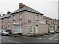
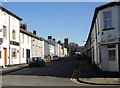
Photos of NP19 7RY


Area Information
NP19 7RY is a compact residential cluster covering just 1.1 hectares in Wales. You will find 1,415 people calling this small postcode home. The area represents a specific residential settlement within the broader Newport landscape. Density here is significant, with 125,021 people per square kilometre recorded for this cluster. This figure reflects a concentrated living environment typical of postcodes designating built-up residential zones. Life in this neighbourhood revolves around proximity, as a small physical footprint means most daily needs are within short walking distances. The layout supports a close community feel where neighbours naturally intersect with daily routines. Residents here navigate a defined space where the distinction between private and public areas can blur slightly due to the compact nature of the site. You are looking at a micro-community where every household is potentially just a street away from another. This postcode does not cover vast緑 spaces or sprawling estates; instead, it offers the intensity of urban living on a local scale. The environment is defined by its boundaries and its immediate relationship with surrounding infrastructure. For a buyer, this means understanding that NP19 7RY is a precise location rather than a broad district. The character is shaped by its size, creating an intimate setting where local histories and current demographics are easily observable.
- Area Type
- Postcode
- Area Size
- 1.1 hectares
- Population
- 1415
- Population Density
- 4333 people/km²
The property market in NP19 7RY is defined by established ownership and detached living. As 77% of homes are owner-occupied, the area prioritises buyers seeking to put down roots rather than landlords looking for high-yield rentals. The accommodation type is solely houses, which shapes the available housing stock significantly. You will find semi-detached or detached properties rather than apartments or maisonettes within this postcode. This housing pattern implies that buyers are looking for private gardens and usually two-storey layouts. The high ownership rate indicates a slower turnover market where prices reflect long-term investment values rather than quick resale opportunities. Prospective buyers should look at houses in NP19 7RY as a primary residence for themselves, not as a flip. The lack of alternative accommodation types means limited variety for those seeking modern conversions or vertical living spaces. The 1.1 hectare size of the area restricts the total number of properties available, creating a tight-knit property selection. To buy here, you join a market where stability and ownership history are key indicators of value. The presence of only houses suggests that maintenance expectations align with traditional domestic standards rather than the management complexities of blocks of flats.
House Prices in NP19 7RY
Showing 28 properties
| Address | Type | Beds | Baths | Last Sale Price | Last Sale Date | |
|---|---|---|---|---|---|---|
| 96 St Julians Road, Newport, NP19 7RY | Semi-detached | 3 | 1 | £287,000 | May 2025 | |
| 98 St Julians Road, Newport, NP19 7RY | Semi-detached | 3 | 1 | £269,000 | Apr 2025 | |
| 126 St Julians Road, Newport, NP19 7RY | Semi-detached | 3 | 1 | £235,000 | Apr 2024 | |
| 116 St Julians Road, Newport, NP19 7RY | house | - | - | £245,000 | Mar 2023 | |
| 148 St Julians Road, Newport, NP19 7RY | Retail | 3 | 2 | £245,000 | Oct 2022 | |
| 130 St Julians Road, Newport, NP19 7RY | Semi-detached | 3 | 1 | £235,000 | Jul 2022 | |
| 110 St Julians Road, Newport, NP19 7RY | Semi-detached | 3 | 1 | £176,000 | Mar 2021 | |
| 132 St Julians Road, Newport, NP19 7RY | Detached | 3 | 1 | £180,000 | Aug 2019 | |
| 156 St Julians Road, Newport, NP19 7RY | Semi-detached | 3 | - | £205,000 | May 2018 | |
| 138 St Julians Road, Newport, NP19 7RY | house | - | - | £172,000 | Feb 2017 |
Energy Efficiency in NP19 7RY
Your daily life in NP19 7RY benefits from a cluster of practical amenities within easy reach. You have access to five key retail options including Spar, Tesco Caerleon, and Asda Casnewydd. These supermarkets and convenience stores mean you do not need to drive far for groceries or household essentials. Five railway stations serve the area, providing connections to Newport Railway Station, Pye Corner Railway Station, and Rogerstone Railway Station. This rail network integration offers flexibility for commuters heading to Newport or beyond. Additionally, one ferry terminal is nearby at the Newport Ferry Terminal, expanding your travel options for holidays and regional trips. The proximity of these transport hubs and shops creates a lifestyle balanced between local convenience and broader connectivity. You can run errands at Tesco Caerleon before catching a train without needing a complex schedule. The availability of Spar ensures you have a catch-up shop for immediate needs. Living in this area gives you a self-sufficient lifestyle where the nearest amenities support a daily routine without excessive travel time. The combination of rail nodes and retail outlets defines the practical convenience of the neighbourhood.
Amenities
Schools
| Rank | School | Type | Entry gender | Ages |
|---|
Explore more schools in this area
Go to Schools tabDemographics
The community in NP19 7RY has a clear demographic profile centred on established adults. The median age is 47 years, placing the majority of residents in the 30 to 64 year age range. This statistic indicates a population that has likely stabilised in their careers and families. Home ownership stands at a robust 77%, suggesting that most households have a long-term stake in their residences. The accommodation type is exclusively houses, meaning you will not find flats or terraced properties within this specific postcode boundary. The predominant ethnic group is White, reflecting the general social composition of the region. These demographics suggest a stable environment where long-term residents form the backbone of the community. With over three-quarters of homes owned, the area lacks the transient nature often associated with high-rental zones. Adults in this bracket typically value quiet streets and established gardens over high-rise living. The age distribution means that schools near NP19 7RY cater primarily to teenage and young adult students rather than a mix of early-years and elderly residents. This concentration of middle-aged adults creates a demographic landscape suited to families in their latter child-rearing years or those seeking a settled domestic life away from the noise of city centres.
Household Size
Accommodation Type
Tenure
Ethnic Group
Religion
Household Composition
Age
Household Deprivation
NS-SEC
Explore more demographic insights in this area
Go to Demographics tabPlanning
Planning Constraints
- Flood RiskPremium
- Ramsar Wetland SitesPremium
- Area of Outstanding Natural BeautyPremium
- Protected Nature ReservePremium
- Protected WoodlandPremium
- Crime RiskPremium