Area Overview for NP19 7RF
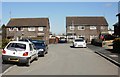
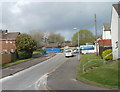
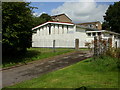
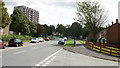
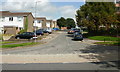
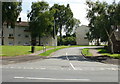
Photos of NP19 7RF


Area Information
Living in NP19 7RF offers a defined residential experience within a small, concentrated cluster covering just 1.5 hectares. This specific postcode area contains a population of 1,594 residents, creating a close-knit community feel that remains distinct from the wider Caerleon or Newport urban sprawl. The density here is notably high, recorded at 103,440 people per square kilometre, which suggests a tight grouping of properties despite the limited geographical footprint. Prospective buyers should understand that this is a well-established postcode rather than a generic address, situated firmly within Wales. The area caters primarily to individuals and families seeking stability, supported by a predominantly white demographic and a mature population profile. Daily life revolves around this compact nucleus, where neighbours are likely familiar with one another. The size of the area means that journeys to key destinations are short, yet the specific nature of NP19 7RF ensures you do not lose the sense of a local neighbourhood amidst the larger town. When considering homes in NP19 7RF, you are choosing a precise location with a rich history of residence. This postcode represents a solid, established part of the local fabric, ideal for those who value a clear sense of place and established community boundaries over rapid urban expansion.
- Area Type
- Postcode
- Area Size
- 1.5 hectares
- Population
- 1594
- Population Density
- 4915 people/km²
The property market in NP19 7RF is defined by established ownership and traditional housing stock. With 76% of residents owning their homes, this is clearly an owner-occupied borough rather than a rental hub. This statistic signals a stable market where properties change hands less frequently, which can protect values but may reduce immediate supply. The accommodation type throughout the postcode consists of houses. This means you will not find high-rise flats or semi-detached blocks for sale here; instead, the focus is on standalone or terraced houses suited for families or retirees. When looking for homes in NP19 7RF, expect a range of sizes within the house category, catering to different stages of adult life given the median age of 47. The high density of 103,440 people per square kilometre within the 1.5-hectare area indicates a compact built environment with limited green space between properties. Buyers looking at this specific postcode should focus on value and condition, as the market is driven by local demand for these specific house types. The predominance of ownership suggests that service prices and local improvements likely benefit from direct resident investment rather than speculative development.
House Prices in NP19 7RF
Showing 28 properties
| Address | Type | Beds | Baths | Last Sale Price | Last Sale Date | |
|---|---|---|---|---|---|---|
| 15 Kelly Road, Newport, NP19 7RF | Semi-detached | 3 | 1 | £160,000 | Nov 2024 | |
| 21 Kelly Road, Newport, NP19 7RF | Semi-detached | 3 | 1 | £135,000 | Sep 2023 | |
| 13 Kelly Road, Newport, NP19 7RF | Semi-detached | 3 | 1 | £180,000 | May 2023 | |
| 22 Kelly Road, Newport, NP19 7RF | house | - | - | £147,000 | Jan 2021 | |
| 17 Kelly Road, Newport, NP19 7RF | Semi-detached | 4 | - | £104,000 | Jul 2013 | |
| 30 Kelly Road, Newport, NP19 7RF | Terraced | 3 | 1 | £81,000 | Jul 2012 | |
| 38 Kelly Road, Newport, NP19 7RF | Terraced | - | - | £110,500 | Jul 2005 | |
| 4 Kelly Road, Newport, NP19 7RF | Terraced | - | - | £77,000 | Sep 2003 | |
| 6 Kelly Road, Newport, NP19 7RF | Terraced | 3 | 1 | £41,000 | Jun 1999 | |
| 7 Kelly Road, Newport, NP19 7RF | Semi-detached | - | - | £45,500 | Aug 1998 |
Energy Efficiency in NP19 7RF
Residents of NP19 7RF enjoy practical access to a variety of shops, trains, and ferry services within a short distance. Local shopping needs are met by five prominent retailers on your doorstep, including Spar, Tesco Caerleon, and Asda Casnewydd. These supermarkets provide everything from daily groceries to household essentials, eliminating the need for long travel to Cardiff town centre for routine purchases. Transport links are equally convenient, with five rail stations nearby to facilitate commuter travel. You can walk to or take a short drive to Newport Railway Station, Pye Corner Railway Station, and Rogerstone Railway Station to connect with networks across Wales and beyond. For those who prefer sea travel, the Newport Ferry Terminal is also within practical reach, offering additional routing options. Combining these amenities creates a lifestyle where daily errands and leisure trips are manageable without extensive planning. The proximity to these specific venues means you can spend your weekends shopping or commuting comfortably. Living in NP19 7RF places you in a position to utilise these facilities effortlessly, balancing the convenience of town life with the residential peace of your postcode.
Amenities
Schools
| Rank | School | Type | Entry gender | Ages |
|---|
Explore more schools in this area
Go to Schools tabDemographics
The community in NP19 7RF is characterised by a stable, mature demographic profile. The median age of residents is 47 years, indicating that the area is heavily populated by adults between the ages of 30 and 64. This age distribution suggests a neighbourhood where many residents are past their early career stages and likely have settled into long-term homes. Home ownership stands as a defining feature of this community, with 76% of households owning their property outright or with a mortgage. This high rate of ownership contrasts sharply with rental-heavy areas, pointing to residents who have made a permanent commitment to their local addresses. The accommodation type within NP19 7RF consists almost entirely of houses, reflecting the preferences of this older, established population. While the predominant ethnic group is white, the community benefits from this stable structure. The lack of young families or students as a major demographic means the area avoids the noise and transient nature often found in university zones. Instead, you find an environment where quiet and reliability are paramount. This demographic makeup shapes the local culture, favouring family-oriented activities and robust social networks built over decades of residency.
Household Size
Accommodation Type
Tenure
Ethnic Group
Religion
Household Composition
Age
Household Deprivation
NS-SEC
Explore more demographic insights in this area
Go to Demographics tabPlanning
Planning Constraints
- Flood RiskPremium
- Ramsar Wetland SitesPremium
- Area of Outstanding Natural BeautyPremium
- Protected Nature ReservePremium
- Protected WoodlandPremium
- Crime RiskPremium