Area Overview for NP19 7PL
Photos of NP19 7PL
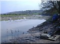
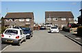

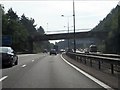
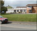
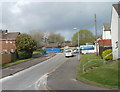
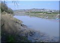

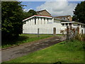
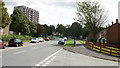
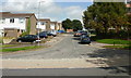
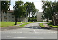
83 photos from this area
Area Information
Key information about the NP19 7PL including its size, population, and administrative classification.
- Area Type
- Postcode
- Area Size
- 7711 m²
- Population
- 1601
- Population Density
- 4609 people/km²
House Prices in NP19 7PL
22
Properties
£90,042
Average Sold Price
£17,760
Lowest Price
£180,000
Highest Price
Showing 22 properties
| Address | Type | Beds | Baths | Last Sale Price | Last Sale Date | |
|---|---|---|---|---|---|---|
| 4 Vermeer Crescent, Newport, NP19 7PL | Terraced | 3 | 2 | £180,000 | Jan 2025 | |
| 16 Vermeer Crescent, Newport, NP19 7PL | Terraced | 3 | 1 | £150,000 | Jun 2024 | |
| 34 Vermeer Crescent, Newport, NP19 7PL | Flat | - | - | £88,000 | Jan 2022 | |
| 8 Vermeer Crescent, Newport, NP19 7PL | Terraced | 3 | - | £130,000 | May 2018 | |
| 6 Vermeer Crescent, Newport, NP19 7PL | Terraced | 3 | 1 | £109,950 | Nov 2017 | |
| 32 Vermeer Crescent, Newport, NP19 7PL | Flat | - | - | £47,750 | Sep 2015 | |
| 20 Vermeer Crescent, Newport, NP19 7PL | Terraced | 3 | - | £98,000 | Mar 2015 | |
| 38 Vermeer Crescent, Newport, NP19 7PL | Flat | 2 | 1 | £56,000 | Jun 2012 | |
| 24 Vermeer Crescent, Newport, NP19 7PL | Maisonette | - | - | £85,000 | Sep 2007 | |
| 42 Vermeer Crescent, Newport, NP19 7PL | Flat | - | - | £28,000 | Mar 2001 |
Page 1 of 3
Energy Efficiency in NP19 7PL
Amenities
Schools
| Rank | School | Type | Entry gender | Ages |
|---|
Explore more schools in this area
Go to Schools tabDemographics
Household Size
One person
most common
Accommodation Type
Houses
most common
Tenure
42
majority
Ethnic Group
White
most common
Religion
N/A
most common
Household Composition
N/A
most common
Age
47
median
Adults (30-64 years)
most common
Household Deprivation
N/A
with no deprivation
NS-SEC
20
in Lower managerial occupations
Explore more demographic insights in this area
Go to Demographics tabPlanning
Planning Constraints
- Flood RiskPremium
- Ramsar Wetland SitesPremium
- Area of Outstanding Natural BeautyPremium
- Protected Nature ReservePremium
- Protected WoodlandPremium
- Crime RiskPremium