Area Overview for NP19 7LY
Photos of NP19 7LY
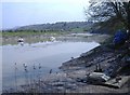
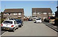


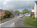
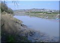

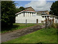
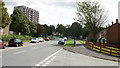
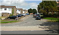
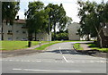
83 photos from this area
Area Information
Key information about the NP19 7LY including its size, population, and administrative classification.
- Area Type
- Postcode
- Area Size
- 1.9 hectares
- Population
- 1601
- Population Density
- 4609 people/km²
House Prices in NP19 7LY
39
Properties
£160,063
Average Sold Price
£500
Lowest Price
£386,000
Highest Price
Showing 39 properties
| Address | Type | Beds | Baths | Last Sale Price | Last Sale Date | |
|---|---|---|---|---|---|---|
| 571 Caerleon Road, Newport, NP19 7LY | Semi-detached | 3 | - | £150,000 | Mar 2025 | |
| 533 Caerleon Road, Newport, NP19 7LY | Semi-detached | 4 | 2 | £250,000 | Mar 2025 | |
| 569 Caerleon Road, Newport, NP19 7LY | Semi-detached | 3 | 1 | £218,000 | May 2024 | |
| 573 Caerleon Road, Newport, NP19 7LY | Semi-detached | 3 | - | £108,000 | Apr 2023 | |
| 555 Caerleon Road, Newport, NP19 7LY | house | - | - | £386,000 | Jan 2022 | |
| 535 Caerleon Road, Newport, NP19 7LY | house | - | - | £254,000 | Nov 2021 | |
| 557 Caerleon Road, Newport, NP19 7LY | Detached | 2 | - | £135,000 | Jul 2021 | |
| 529 Caerleon Road, Newport, NP19 7LY | Bungalow | 3 | 1 | £195,000 | Aug 2019 | |
| The Boathouse, 573A Caerleon Road, Newport, NP19 7LY | Detached | - | - | £500 | Oct 2017 | |
| 559 Caerleon Road, Newport, NP19 7LY | house | - | - | £135,000 | Dec 2011 |
Page 1 of 4
Energy Efficiency in NP19 7LY
Amenities
Schools
| Rank | School | Type | Entry gender | Ages |
|---|
Explore more schools in this area
Go to Schools tabDemographics
Household Size
One person
most common
Accommodation Type
Houses
most common
Tenure
42
majority
Ethnic Group
White
most common
Religion
N/A
most common
Household Composition
N/A
most common
Age
47
median
Adults (30-64 years)
most common
Household Deprivation
N/A
with no deprivation
NS-SEC
20
in Lower managerial occupations
Explore more demographic insights in this area
Go to Demographics tabPlanning
Planning Constraints
- Flood RiskPremium
- Ramsar Wetland SitesPremium
- Area of Outstanding Natural BeautyPremium
- Protected Nature ReservePremium
- Protected WoodlandPremium
- Crime RiskPremium