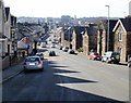
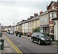
Area Overview for NP19 7GD
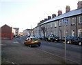
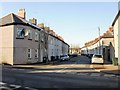
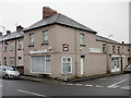
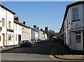
Photos of NP19 7GD


Area Information
NP19 7GD represents a specific postcode area covering a small residential cluster within Wales. This location spans just 3,449 square metres, creating a tight-knit community of 1,108 residents. The density here is extremely high, reaching 321,283 people per square kilometre, which indicates a very concentrated living environment. Despite the small geographical footprint, the area maintains a distinct identity separate from the broader valleys of New Port. Daily life for those choosing this postcode involves navigating a compact space where neighbours are inevitably close by. The sheer concentration of population within such a limited area suggests an urban nucleus rather than a sprawling suburban sprawl. Residents likely experience a sense of community intensity that is rare in other parts of the country. The area functions as a defined residential hub, offering the quiet containment of a small zone while benefiting from the wider network of services available in Caerleon and Casnewydd. Choosing to live in NP19 7GD means accepting a high-density environment where the boundaries between individual properties may feel less distinct than in typical country towns.
- Area Type
- Postcode
- Area Size
- 3449 m²
- Population
- 1108
- Population Density
- 3343 people/km²
The housing stock in NP19 7GD is defined by Houses, forming the primary accommodation type for the 1,108 residents. The market here is overwhelmingly owner-occupied, with 84% of households owning their homes. This figure suggests that the properties in this small cluster are largely established rather than speculative new builds intended for the rental market. For buyers considering homes in NP19 7GD, the high ownership rate implies a stable market where properties often stay with the same families for decades. The transition from renting to buying appears less common here compared to other seeking areas in Wales. If you are looking for rental properties, options may be scarce given the low percentage of privately owned homes retained for tenancy. The nature of this small residential cluster means that stock turnover is likely slow. Prospective owners should expect to compete with locals who have deep ties to the neighbourhood. The fact that houses dominate the landscape rather than apartments or flats is a crucial detail for those seeking specific property types.
House Prices in NP19 7GD
Showing 8 properties
| Address | Type | Beds | Baths | Last Sale Price | Last Sale Date | |
|---|---|---|---|---|---|---|
| 26 Leicester Road, Newport, NP19 7GD | house | - | - | £175,000 | Jul 2020 | |
| 30 Leicester Road, Newport, NP19 7GD | house | - | - | £146,000 | Oct 2016 | |
| 27 Leicester Road, Newport, NP19 7GD | Semi-detached | - | - | £135,000 | Feb 2006 | |
| 23 Leicester Road, Newport, NP19 7GD | house | 3 | - | £58,500 | Jul 2001 | |
| 24 Leicester Road, Newport, NP19 7GD | house | - | - | - | - | |
| 25 Leicester Road, Newport, NP19 7GD | house | - | - | - | - | |
| 28 Leicester Road, Newport, NP19 7GD | house | - | - | - | - | |
| 29 Leicester Road, Newport, NP19 7GD | Semi-detached | - | - | - | - |
Energy Efficiency in NP19 7GD
Daily life in NP19 7GD is supported by a practical range of amenities within easy reach. Retail options include Spar, Tesco Caerleon, and Asda Casnewydd, providing all necessary grocery and shopping needs. Five retail outlets are located within practical reach, ensuring you do not need to travel far for essentials. For commuting, five railway stations serve the area, including Newport Railway Station, Pye Corner Railway Station, and Rogerstone Railway Station. These connections offer flexibility for travelling to prominent cities across the UK. A ferry terminal is also nearby, which adds another layer of transport connectivity via Newport Ferry Terminal. Life here combines the convenience of multiple supermarket chains with excellent rail access. You can complete daily shopping at Tesco or Asda without a drive. The presence of three named railway stations suggests frequent travel opportunities for residents. This mix of retail and rail infrastructure makes the area highly functional for both workers and shoppers.
Amenities
Schools
Education options for families living near NP19 7GD are centred around a specific institution. The nearest school listed is St Julian's School, which falls under the category of other. This classification indicates that the facility may not be a standard primary or secondary academy but serves a specialised or alternative educational function. The data does not currently list any other specific schools with Ofsted ratings accessible from this postcode. Consequently, families must rely on transport arrangements to access broader school networks beyond the immediate vicinity. The presence of only one named educational facility suggests that NP19 7GD relies on external institutions for comprehensive schooling. You may find yourself driving further afield to reach comprehensive or primary schools with full Ofsted reporting. This limitation is a key factor for prospective parents. The single entry for St Julian's highlights a gap in the immediate local provision for standard age-group schooling within this tight cluster.
| Rank | School | Type | Entry gender | Ages |
|---|
Explore more schools in this area
Go to Schools tabDemographics
The community within NP19 7GD is dominated by adults, with the most common age range falling between 30 and 64 years. The median age for residents is 47, confirming that this is an older, established neighbourhood rather than a family-first zone with many young households. Home ownership stands at 84%, indicating that the vast majority of people occupying homes in this postcode own their property outright. This high rate of ownership contrasts sharply with areas where renting is the norm. The population is primarily White, reflecting a relatively homogenous demographic structure typical of established regions in Wales. The accommodation type is categorised as Houses, which aligns with the nature of established residential clusters in the area. With four-fifths of residents owning their homes, the social fabric is likely stable, with long-term inhabitants rather than transient renters. This profile suggests a neighbourhood where families and professionals who have settled over years remain true to the area. The lack of significant youth or grey-heads suggests a steady demographic without a massive population boom or decline.
Household Size
Accommodation Type
Tenure
Ethnic Group
Religion
Household Composition
Age
Household Deprivation
NS-SEC
Explore more demographic insights in this area
Go to Demographics tabPlanning
Planning Constraints
- Flood RiskPremium
- Ramsar Wetland SitesPremium
- Area of Outstanding Natural BeautyPremium
- Protected Nature ReservePremium
- Protected WoodlandPremium
- Crime RiskPremium