Area Overview for NP19 7BE
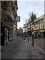
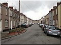
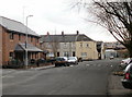
Photos of NP19 7BE


Area Information
Living in NP19 7BE means you settle into a very small residential cluster spread across just 7831 square metres. This compact postcode area accommodates a population of 1853 people, creating a tightly knit environment typical of urban residential pockets in Wales. The high population density of 236610 people per square kilometre indicates that every metre of this space is utilised for housing, suggesting a close-knit community where neighbours are rarely far away. You will find that daily life here revolves around proximity, with residents relying on walking distances to access the wider Newport region. This area represents a specific slice of South Wales living where space is at a premium. The sheer concentration of homes within such a tiny footprint creates a distinct character different from sprawling suburbs. You are part of a micro-community where local dynamics move quickly. The setting is entirely residential, offering a quiet residential atmosphere despite the high density due to the surrounding city context. For those seeking a location defined by immediate proximity to major urban centres while maintaining a defined postcode boundary, NP19 7BE delivers that precise configuration. It is a location where the distinction between home and the wider city plan begins immediately upon stepping outside your door.
- Area Type
- Postcode
- Area Size
- 7831 m²
- Population
- 1853
- Population Density
- 4504 people/km²
The housing stock within NP19 7BE is defined entirely by houses. This specific accommodation type dominates the landscape, offering detached or semi-detached living for the residents. With 56 per cent of the population owning their homes, the area functions primarily as a market for owner-occupiers rather than a rental hub. This high level of proprietorship suggests that buyers here are looking to settle permanently, not merely rent short-term accommodation. When you consider purchasing homes in NP19 7BE, you enter a market where the majority of stock has been purchased by previous owners. The concentration of houses aligns with the 56 per cent ownership figure, creating a consistent pattern of residence. Unlike postcodes dominated by flats or terraced housing which often cater to young professionals or students, this area showcases family-oriented or long-term individual housing. The small total area of 7831 square metres limits the volume of properties available, which can affect market liquidity. You are buying into a specific housing pattern where the architectural style is uniform and the tenure is predominantly owned outright. This stability is a clear feature of the local property landscape for those willing to navigate this tight geographic boundary.
House Prices in NP19 7BE
Showing 44 properties
| Address | Type | Beds | Baths | Last Sale Price | Last Sale Date | |
|---|---|---|---|---|---|---|
| 32 Usk Street, Newport, NP19 7BE | house | - | - | £155,000 | Feb 2024 | |
| 27 Usk Street, Newport, NP19 7BE | Terraced | 2 | 1 | £195,000 | Jul 2022 | |
| 7 Usk Street, Newport, NP19 7BE | Retail | 4 | 1 | £200,000 | Jun 2022 | |
| 24 Usk Street, Newport, NP19 7BE | house | - | - | £120,000 | May 2022 | |
| 5 Usk Street, Newport, NP19 7BE | house | 3 | 1 | £165,000 | Apr 2022 | |
| 6 Usk Street, Newport, NP19 7BE | house | 2 | 1 | £137,500 | Sep 2021 | |
| 3 Usk Street, Newport, NP19 7BE | Terraced | 2 | 1 | £118,900 | Jan 2020 | |
| 33 Usk Street, Newport, NP19 7BE | Terraced | 2 | 1 | £64,950 | Mar 2016 | |
| 8 Usk Street, Newport, NP19 7BE | house | - | - | £71,000 | Mar 2014 | |
| 10 Usk Street, Newport, NP19 7BE | house | - | - | £100,000 | Oct 2012 |
Energy Efficiency in NP19 7BE
Your daily lifestyle in NP19 7 BE benefits from a network of five retail outlets within practical reach. You can shop at Tesco Caerleon, Spar, and Asda Casnewydd, ensuring access to groceries, daily essentials, and larger shopping trips without needing a long drive. The presence of these three major supermarkets anchors the commercial vibrancy of the suburb. Five railway stations also serve as transit points, supporting your weekly travel needs. Newport Railway Station, Pye Corner Railway Station, and Rogerstone Railway Station offer comprehensive rail options just moments away from your doorstep. Beyond retail, the area connects to Newport Ferry Terminal, providing water-based transport links for leisure or specific crossings. This amenity adds a layer of connectivity you might not find in typical residential zones. The combination of major supermarkets and transit hubs means you can manage every aspect of your weekly routine locally. You do not need to travel far for basic needs or to catch a train to another city. The immediate availability of Asda Casnewydd and Tesco Caerleon makes the lifestyle convenient. The density of transport nodes suggests that life here is balanced between residential peace and urban accessibility. You have everything required for a self-sufficient weekly routine directly accessible from your postcode boundary.
Amenities
Schools
Families considering living in NP19 7BE have access to one specific educational institution within immediate reach: Newport Nursery School. This facility operates as a nursery school, providing early years education and childcare services for the youngest residents. The presence of a dedicated nursery supports working parents who require reliable childcare before their children enter primary education. Currently, the data lists no primary, secondary, or further education schools directly within the immediate cluster. The provision of a nursery school is the concrete educational amenity confirmed for this postcode. You will need to look to the wider Newport education network for primary and secondary schooling, as no larger schools are listed for this specific boundary. The inclusion of Newport Nursery School confirms that the area prioritises early childhood development. For parents moving into the neighbourhood, the nursery offers a starting point for educational engagement. While this is the only school type explicitly detailed for the area, it serves the foundational needs of the community. The lack of data on secondary schools in this specific small area means families plan their children's education routes to schools just beyond this immediate residential boundary.
| Rank | School | Type | Entry gender | Ages |
|---|
Explore more schools in this area
Go to Schools tabDemographics
The community within NP19 7BE reflects a mature demographic profile with a median age of 47 years. Adults aged between 30 and 64 years form the most common age range within this population. This suggests the area attracts a life-stage group likely to have stabilised careers and families. Home ownership stands at 56 per cent, meaning more than half of you will buy your home rather than rent it. This level of proprietorship indicates a stable community with long-term residents invested in the locality. Accommodation types are exclusively houses, which shapes the physical character of the street layout extensively. The predominance of single-family homes contrasts with the high density figure, likely due to the compact nature of the site combined with low-rise construction. The predominant ethnic group is White, reflecting the broader demographic composition often found in established Welsh urban clusters like Newport. With a median age nearing 50, you will likely encounter neighbours who value quiet and stability. The 56 per cent home ownership rate further reinforces this, as owners often tend to stay put longer than private tenants. This data paints a picture of an established residential zone rather than a transient commuter belt or student housing block.
Household Size
Accommodation Type
Tenure
Ethnic Group
Religion
Household Composition
Age
Household Deprivation
NS-SEC
Explore more demographic insights in this area
Go to Demographics tabPlanning
Planning Constraints
- Flood RiskPremium
- Ramsar Wetland SitesPremium
- Area of Outstanding Natural BeautyPremium
- Protected Nature ReservePremium
- Protected WoodlandPremium
- Crime RiskPremium