Area Overview for NP19 7AN
Photos of NP19 7AN


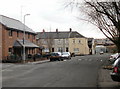
Area Information
NP19 7AN represents a specific postcode cluster within the wider New Port area of Wales. This residential zone covers just 4473 square metres and houses approximately 1853 residents. The location functions as a compact living hub where daily life revolves around established local infrastructure. Area size suggests a densely packed environment where neighbours are likely to know each other well. You will find this cluster situated near the economic and transport arteries of Newport. The small footprint means that accessing services requires short walks or modest drives rather than long commutes. This postcode captures the essence of living in a defined, manageable corner of the town. The community here operates with a sense of intimacy despite being part of the larger urban sprawl. Movement between homes is quick, and the area maintains a clear residential identity. Visitors will notice the settled nature of the settlement and the proximity to major thoroughfares. It is a place where space and access balance without the chaos of larger districts.
- Area Type
- Postcode
- Area Size
- 4473 m²
- Population
- 1853
- Population Density
- 4504 people/km²
When evaluating homes in NP19 7AN, you will encounter a market driven by owner-occupiers rather than transient tenants. Houses form the primary accommodation type, meaning detached and semi-detached properties dominate the stock in this 4473 square metre postcode. With 56% of homes owned outright, the area appeals to buyers seeking long-term security and the freedom to customise their living spaces. This ownership level typically results in a stable neighbourhood where residents invest in maintenance and improvements. The housing stock naturally predates high-rise developments, avoiding the challenges associated with blocks of flats or apartments. Families looking for surrounding gardens and private entrances will find the available properties align with these traditional expectations. The small geographical spread means house prices may fluctuate based on immediate proximity to local train stations or roads. Buyers should focus on inspecting physical condition, as the high ownership rate encourages individual care of each property. This market segment offers a straightforward path for purchasers who prefer conventional single-family dwellings over shared estates. The limited size of the postcode means supply remains low, potentially driving competition for suitable stock in the immediate vicinity.
House Prices in NP19 7AN
Showing 29 properties
| Address | Type | Beds | Baths | Last Sale Price | Last Sale Date | |
|---|---|---|---|---|---|---|
| 4 Rudry Street, Newport, NP19 7AN | house | 3 | 1 | £169,950 | Nov 2025 | |
| 8 Rudry Street, Newport, NP19 7AN | Terraced | 3 | 1 | £150,000 | Sep 2023 | |
| 10 Rudry Street, Newport, NP19 7AN | Terraced | 3 | 2 | £146,000 | Mar 2023 | |
| 14 Rudry Street, Newport, NP19 7AN | Terraced | 4 | 1 | £179,999 | Jun 2022 | |
| 11 Rudry Street, Newport, NP19 7AN | Terraced | 2 | 1 | £114,300 | Jan 2020 | |
| 12 Rudry Street, Newport, NP19 7AN | Terraced | 2 | 1 | £110,000 | Jan 2020 | |
| 20 Rudry Street, Newport, NP19 7AN | house | - | - | £61,000 | May 2018 | |
| 9 Rudry Street, Newport, NP19 7AN | Terraced | 3 | 1 | £92,000 | Apr 2018 | |
| 2 Rudry Street, Newport, NP19 7AN | Terraced | 4 | - | £91,000 | Sep 2017 | |
| 7 Rudry Street, Newport, NP19 7AN | house | - | - | £75,000 | Jun 2016 |
Energy Efficiency in NP19 7AN
Living in NP19 7AN places you within easy reach of essential retail and leisure venues that define daily convenience. Five major retail outlets operate nearby, slashed by Asda Casnewydd, Tesco Caerleon, and Farmfoods Newport for your grocery shopping needs. You can stock your kitchen with fresh produce and household essentials without undertaking a long journey. Transport links further enhance your lifestyle by bringing Newport Railway Station, Pye Corner Railway Station, and Rogerstone Railway Station within practical driving distance. These stations allow you to commute quickly to wider employment opportunities while returning to a residential heartland. Newport Ferry Terminal offers another leisure option for those interested in water-based travel or dining near the docks. Five railway stations in the immediate vicinity provide flexibility for weekend trips or business travel. The landscape includes parks and green spaces that are part of the local redboundaries for the postcode. This amenity density ensures that routine errands and recreational activities do not consume excessive time in your week.
Amenities
Schools
Education options for children living near NP19 7AN are limited to early years provision within the immediate catchment. Newport Nursery School sits close by and provides care and education for very young children. This institution serves as the primary educational name associated with the postcode area in the available records. Families with older children will need to look beyond this local option for primary or secondary schooling. The presence of a nursery indicates a community with young families who require regulated childcare close to home. However, the absence of older school data in this specific cluster suggests you may need to commute to larger towns for comprehensive education. The school mix is therefore narrow, focusing exclusively on foundational years of learning. Parents must verify Travel to School schemes for older children outside the immediate walking distance. This configuration supports parents working locally who need nursery support nearby. It also means older children often integrate into broader Newport school districts rather than attending facilities solely within the NP19 7AN boundaries.
| Rank | School | Type | Entry gender | Ages |
|---|
Explore more schools in this area
Go to Schools tabDemographics
The community within NP19 7AN reflects a mature residential profile centred on adults aged between 30 and 64 years. The median age stands at 47, indicating a population with significant life experience and stability. Home ownership accounts for 56% of households, suggesting a settled community where residents have strong ties to their properties. Houses form the predominant accommodation type throughout this postcode, offering standalone living within a compact area. White residents comprise the majority of the ethnic mix within this specific cluster. The demographic data points to a neighbourhood where families and empty nesters coexist in significant numbers. This age distribution supports local businesses that cater to established households rather than newcomers seeking their first home. The 56% ownership figure also implies fewer transient rentals compared to student-heavy university towns. Residents enjoy access to natural light and standard single-storey or two-storey living arrangements typical of Welsh housing. The population density of 414278 people per square kilometre highlights the intensity of land use in this small zone.
Household Size
Accommodation Type
Tenure
Ethnic Group
Religion
Household Composition
Age
Household Deprivation
NS-SEC
Explore more demographic insights in this area
Go to Demographics tabPlanning
Planning Constraints
- Flood RiskPremium
- Ramsar Wetland SitesPremium
- Area of Outstanding Natural BeautyPremium
- Protected Nature ReservePremium
- Protected WoodlandPremium
- Crime RiskPremium