Area Overview for NP19 4XF
Photos of NP19 4XF


Area Information
Living in NP19 4XF offers a distinct experience within a small residential cluster located in Wales. This specific postcode covers an area of just 1.1 hectares, creating an intimate neighbourhood feel among its 1,405 residents. The compact size means communities here know one another, yet the location provides access to the wider regional network. You will find density remains modest at 126 people per square kilometre, which balances tranquillity with essential proximity. This neighbourhood sits away from large urban sprawl, offering a quieter lifestyle while maintaining links to wider transport hubs. The character of NP19 4XF is defined by its status as a tightly knit group of dwellings rather than a sprawling development. Prospective buyers looking for a home in this postcode seek a sheltered environment with established roots. Even though the area is small, it functions as a complete home for those who value seclusion without total isolation. The specific boundaries of NP19 4XF define a clear sense of place that differs from nearby, larger residential zones. Daily life here revolves around the immediate streets and reliable connections to services outside the immediate local cluster.
- Area Type
- Postcode
- Area Size
- 1.1 hectares
- Population
- 1405
- Population Density
- 126 people/km²
The property market in NP19 4XF is characterised by a decisive preference for private ownership over renting. Current data shows that 64% of homes in this postcode are owned by residents. This high percentage of home ownership creates a secure market where residents have invested deeply in their local properties. Accommodation types are almost exclusively houses, reflecting the desire for standalone living within this small cluster. When searching for properties near NP19 4XF, you will find a stock dominated by family homes rather than investment flats. This housing stock suits those seeking stability and control over their living environment rather than rental flexibility. The small area size of 1.1 hectares limits the total number of available properties, making specific listings particularly valuable. Buyers looking at homes in NP19 4XF should expect a market driven by local retention rather than high turnover. Unlike areas with significant student or young professional rentals, this postcode caters to those establishing long-term roots. The dominance of houses and ownership means transaction values often reflect historical investment rather than speculative market swings.
House Prices in NP19 4XF
No properties found in this postcode.
Energy Efficiency in NP19 4XF
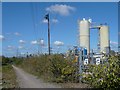
Daily life in NP19 4XF is supported by a network of five practical amenities nearby. You can reach Newport Ferry Terminal easily, providing direct water access for leisure journeys across the Bristol Channel. Shopping options are robust with five major retailers covering your essential needs. Morrisons Somerton, Aldi Liswerry, and Tesco Newport are among the notable stores within easy reach. These venues ensure you do not need to travel far for groceries or household goods. Rail connectivity is further enhanced by three stations close to the residential cluster. Newport Railway Station, Pye Corner Railway Station, and Rogerstone Railway Station form a convenient transport spine. Near these stations, you will find additional services that supplement the retail offerings. The combination of ferry access, large supermarkets, and rail hubs creates a self-sufficient lifestyle. Residents of NP19 4XF enjoy the convenience of major high streets just a short journey away. This practical arrangement means daily errands happen quickly without navigating complex city traffic. The mix of water and land transport options adds variety to how you travel for work or holidays.
Amenities
Schools
| Rank | School | Type | Entry gender | Ages |
|---|
Explore more schools in this area
Go to Schools tabDemographics
The community profile of NP19 4XF reflects a mature and stable population. The median age of residents stands at 47 years, indicating a largely established household demographic. Most commonly, the population falls within the 30 to 64 years age range, suggesting working adults and empty nesters form the core of the area. You will encounter a high level of stability with 64% of residents owning their homes outright. This significant home ownership rate distinguishes the area from many other regions where renting dominates the market. The prevailing accommodation type consists of houses, which aligns with the demographics and ownership figures. While the predominant ethnic group is White, the area supports a settled community with long-term residency. This lack of transient renting contributes to a consistent social fabric. Residents here have invested decades in building their lives within the local infrastructure. The age profile suggests you will meet neighbours who have watched the area evolve over time. Those considering homes in NP19 4XF will find a neighbourly environment where experiences span several generations of living locally.
Household Size
Accommodation Type
Tenure
Ethnic Group
Religion
Household Composition
Age
Household Deprivation
NS-SEC
Explore more demographic insights in this area
Go to Demographics tabPlanning
Planning Constraints
- Flood RiskPremium
- Ramsar Wetland SitesPremium
- Area of Outstanding Natural BeautyPremium
- Protected Nature ReservePremium
- Protected WoodlandPremium
- Crime RiskPremium